
| Birth | : | 18 May 1930 Wolbach, Greeley County, Nebraska, USA |
| Death | : | 9 Jul 2007 Port Townsend, Jefferson County, Washington, USA |
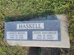
| Burial | : | Clark Family Cemetery, Beulah, Clayton County, USA |
| Coordinate | : | 42.9166505, -91.4751415 |
| Description | : | The Rev. Charles L. Kaldahl died of cancer at his Port Townsend home. He was 77. He was born to the Rev. Soren S. and Marie Christiana (Petersen) Kaldahl in Wolbach, Nebr. He attended elementary school in Green Bay, Wis., and graduated from Harlan High School in Harlan, Iowa. He graduated with a Bachelor of Science degree in education at Tallequah Oklahoma University and was a elementary school teacher. He worked as a high design florist while attending Pacific Lutheran Theological Seminary in Berkeley, Calif., where he received a Master of Divinity and was ordained May 7, 1972. He married Jean... Read More |
frequently asked questions (FAQ):
-
Where is Rev Charles L Kaldahl's memorial?
Rev Charles L Kaldahl's memorial is located at: Clark Family Cemetery, Beulah, Clayton County, USA.
-
When did Rev Charles L Kaldahl death?
Rev Charles L Kaldahl death on 9 Jul 2007 in Port Townsend, Jefferson County, Washington, USA
-
Where are the coordinates of the Rev Charles L Kaldahl's memorial?
Latitude: 42.9166505
Longitude: -91.4751415
Family Members:
Parent
Siblings


Nearby Cemetories:
1. Clark Family Cemetery
Beulah, Clayton County, USA
Coordinate: 42.9166505, -91.4751415
2. Weymouth Cemetery
Saint Olaf, Clayton County, USA
Coordinate: 42.9278799, -91.4583559
3. Patterson Pioneer Cemetery
Saint Olaf, Clayton County, USA
Coordinate: 42.9216000, -91.4489000
4. Cook Family Cemetery
Elkader, Clayton County, USA
Coordinate: 42.9209880, -91.5091230
5. Norway Lutheran Church Cemetery
Saint Olaf, Clayton County, USA
Coordinate: 42.9352798, -91.4302826
6. Wagner Township Cemetery
Saint Olaf, Clayton County, USA
Coordinate: 42.9519386, -91.4513931
7. Highland Lutheran Cemetery
Highland Township, Clayton County, USA
Coordinate: 42.8987000, -91.5330000
8. Marion Lutheran Cemetery
Gunder, Clayton County, USA
Coordinate: 42.9708290, -91.5127792
9. Houg Cemetery
Gunder, Clayton County, USA
Coordinate: 42.9444008, -91.5675964
10. Eno Cemetery
Wagner Township, Clayton County, USA
Coordinate: 42.9930992, -91.4693985
11. Apostolic Cemetery
Marion Township, Clayton County, USA
Coordinate: 42.9347000, -91.5821991
12. Gooding Cemetery
Wagner Township, Clayton County, USA
Coordinate: 42.9869490, -91.4191570
13. Farmersburg-Wagner Cemetery
Farmersburg, Clayton County, USA
Coordinate: 42.9481010, -91.3700027
14. Elkader Cemetery
Elkader, Clayton County, USA
Coordinate: 42.8541718, -91.4000015
15. Saint Josephs Cemetery
Elkader, Clayton County, USA
Coordinate: 42.8488998, -91.4021988
16. Colony Catholic Cemetery (Defunct)
Read Township, Clayton County, USA
Coordinate: 42.8830000, -91.3580000
17. County Home Cemetery
Clayton Center, Clayton County, USA
Coordinate: 42.8916702, -91.3499985
18. Fry Family Cemetery
Farmersburg, Clayton County, USA
Coordinate: 43.0152530, -91.5182350
19. Pioneer Cemetery
Monona, Clayton County, USA
Coordinate: 43.0149994, -91.4274979
20. Dohrer Cemetery
Osborne, Clayton County, USA
Coordinate: 42.8124846, -91.4584734
21. Bismark Cemetery
Farmersburg, Clayton County, USA
Coordinate: 42.9790000, -91.3500000
22. Zion Lutheran Cemetery
Clayton Center, Clayton County, USA
Coordinate: 42.8841705, -91.3249969
23. Clayton Center Cemetery
Clayton Center, Clayton County, USA
Coordinate: 42.8841705, -91.3225021
24. East Clermont Lutheran Church Cemetery
Grand Meadow Township, Clayton County, USA
Coordinate: 42.9969406, -91.5916672