

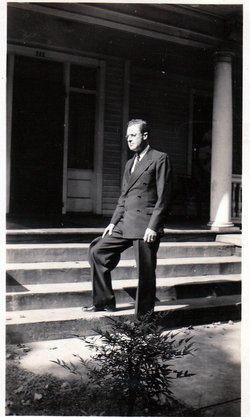

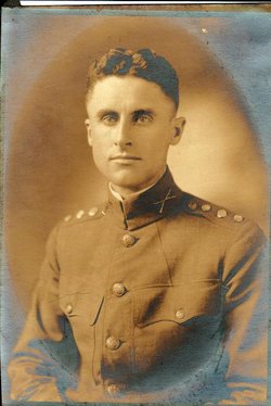
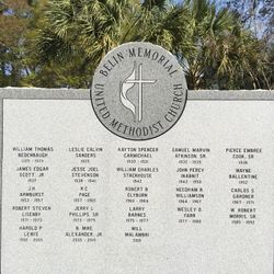
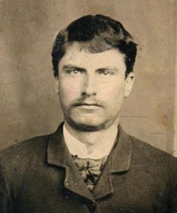
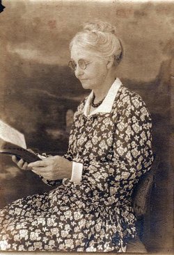
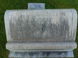
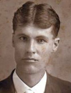
Rev Leslie Calvin Sanders
| Birth | : | 25 Apr 1895 Pinckney, Union County, South Carolina, USA |
| Death | : | 17 Nov 1949 Spartanburg, Spartanburg County, South Carolina, USA |
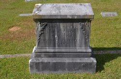
| Burial | : | Rose Hill Cemetery, Carrier, Garfield County, USA |
| Coordinate | : | 36.4782753, -98.0322952 |
frequently asked questions (FAQ):
-
Where is Rev Leslie Calvin Sanders's memorial?
Rev Leslie Calvin Sanders's memorial is located at: Rose Hill Cemetery, Carrier, Garfield County, USA.
-
When did Rev Leslie Calvin Sanders death?
Rev Leslie Calvin Sanders death on 17 Nov 1949 in Spartanburg, Spartanburg County, South Carolina, USA
-
Where are the coordinates of the Rev Leslie Calvin Sanders's memorial?
Latitude: 36.4782753
Longitude: -98.0322952
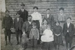
Family Members:
Parent
Spouse
Siblings

Flowers:


Nearby Cemetories:
1. Rose Hill Cemetery
Carrier, Garfield County, USA
Coordinate: 36.4782753, -98.0322952
2. Trinity Lutheran Cemetery
Enid, Garfield County, USA
Coordinate: 36.4195300, -98.0342500
3. Lahoma Mennonite Cemetery
Lahoma, Garfield County, USA
Coordinate: 36.4256400, -98.0864800
4. Zion Lutheran Cemetery
Lahoma, Garfield County, USA
Coordinate: 36.4258600, -98.0873000
5. Baumagartner Cemetery
Lahoma, Garfield County, USA
Coordinate: 36.4194700, -98.0779100
6. Banner Hill Cemetery
Garfield County, USA
Coordinate: 36.4627500, -97.9425300
7. Saint Michael Cemetery
Goltry, Alfalfa County, USA
Coordinate: 36.4785995, -98.1399994
8. Karoma Cemetery
Goltry, Alfalfa County, USA
Coordinate: 36.5278015, -98.1389008
9. Hillsdale Cemetery
Hillsdale, Garfield County, USA
Coordinate: 36.5652800, -97.9701700
10. Coldwater Cemetery
Hillsdale, Garfield County, USA
Coordinate: 36.5781700, -98.0514400
11. Sunnyside Cemetery
Lahoma, Garfield County, USA
Coordinate: 36.3692017, -98.0500031
12. Boyer Family Cemetery
Goltry, Alfalfa County, USA
Coordinate: 36.5033440, -98.1758660
13. Union Cemetery
Meno, Major County, USA
Coordinate: 36.4452400, -98.1756100
14. Memorial Park Cemetery
Enid, Garfield County, USA
Coordinate: 36.4585991, -97.8685989
15. Enid Cemetery
Enid, Garfield County, USA
Coordinate: 36.4199295, -97.8803329
16. Calvary Catholic Cemetery
Enid, Garfield County, USA
Coordinate: 36.4200900, -97.8789800
17. Mennonite Brethren Cemetery
Enid, Garfield County, USA
Coordinate: 36.4637900, -97.8605300
18. New Hopedale Mennonite Memorial Cemetery
Meno, Major County, USA
Coordinate: 36.3932600, -98.1756500
19. Saint Matthews Episcopal Church Columbarium
Enid, Garfield County, USA
Coordinate: 36.3980590, -97.8847090
20. First United Methodist Church Columbarium
Enid, Garfield County, USA
Coordinate: 36.3976370, -97.8837560
21. Imo Cemetery
Drummond, Garfield County, USA
Coordinate: 36.3293991, -98.0156021
22. Pleasant Hill Cemetery
Meno, Major County, USA
Coordinate: 36.3916800, -98.2027300
23. Enid State School Cemetery
Enid, Garfield County, USA
Coordinate: 36.4326900, -97.8370800
24. New Home Cemetery
Nash, Grant County, USA
Coordinate: 36.6436005, -98.0736008