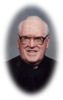
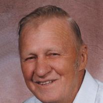
Rev Michael William Schwarte
| Birth | : | 12 Jun 1912 Westphalia, Shelby County, Iowa, USA |
| Death | : | 31 May 2006 Earling, Shelby County, Iowa, USA |
| Burial | : | Quann-Chambers Cemetery, Rhoadesville, Orange County, USA |
| Coordinate | : | 38.3074493, -77.8535843 |
| Description | : | Michael William Schwarte, the son of William and Mary Ann Schiltz Schwarte, was born on June 25, 1912, at Westphalia, Iowa. He attended schools at St. Boniface Catholic School in Westphalia, Des Moines Catholic College in Des Moines, Iowa, St. Paul Seminary in Minnesota, and Harvard University in Cambridge, Massachusetts. He was ordained by Bishop Gerald T. Bergan on June 11, 1938, given an interim appointment at St. Bernard's Catholic Church in Osceola, then to St. Patrick's in Perry, Iowa. At St. Francis Zavier, Rev. Michael was a Catholic Youth Director of the Deanery. In 1942, he went to... Read More |
frequently asked questions (FAQ):
-
Where is Rev Michael William Schwarte's memorial?
Rev Michael William Schwarte's memorial is located at: Quann-Chambers Cemetery, Rhoadesville, Orange County, USA.
-
When did Rev Michael William Schwarte death?
Rev Michael William Schwarte death on 31 May 2006 in Earling, Shelby County, Iowa, USA
-
Where are the coordinates of the Rev Michael William Schwarte's memorial?
Latitude: 38.3074493
Longitude: -77.8535843
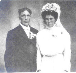
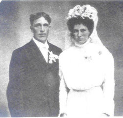
Family Members:
Parent
Siblings
Flowers:
Nearby Cemetories:
1. Quann-Chambers Cemetery
Rhoadesville, Orange County, USA
Coordinate: 38.3074493, -77.8535843
2. Kube Family Cemetery
Rhoadesville, Orange County, USA
Coordinate: 38.3067640, -77.8576390
3. Zoar Cemetery
Burr Hill, Orange County, USA
Coordinate: 38.3319016, -77.8296967
4. Rhoades Family Farm Cemetery
Burr Hill, Orange County, USA
Coordinate: 38.3380400, -77.8616560
5. Coleman Cemetery
Rhoadesville, Orange County, USA
Coordinate: 38.3371450, -77.8692970
6. Salem Cemetery
Rhoadesville, Orange County, USA
Coordinate: 38.2769012, -77.8871994
7. Mount Pisgah Baptist Church Cemetery
True Blue, Orange County, USA
Coordinate: 38.3480988, -77.8886032
8. New Hope Cemetery
Locust Grove, Orange County, USA
Coordinate: 38.2635020, -77.8118950
9. Lewistown Cemetery
Locust Grove, Orange County, USA
Coordinate: 38.3602040, -77.8273730
10. Mount Zion Baptist Church Cemetery
Locust Grove, Orange County, USA
Coordinate: 38.3440710, -77.7981470
11. Mount Sinai Cemetery
Rhoadesville, Orange County, USA
Coordinate: 38.2713190, -77.9118550
12. Rhoadesville Baptist Church Cemetery
Rhoadesville, Orange County, USA
Coordinate: 38.2705994, -77.9244003
13. Kube Family Cemetery
Rhoadesville, Orange County, USA
Coordinate: 38.2727547, -77.9350357
14. Willis Cemetery
Locust Grove, Orange County, USA
Coordinate: 38.3493040, -77.7769730
15. City of Refuge Bible Baptist Church Cemetery
Rhoadesville, Orange County, USA
Coordinate: 38.3430530, -77.9402740
16. Wallace Cemetery
Mine Run, Orange County, USA
Coordinate: 38.2313820, -77.8345900
17. Mount Olive Cemetery
Unionville, Orange County, USA
Coordinate: 38.2491989, -77.9188995
18. Pannill Cemetery
True Blue, Orange County, USA
Coordinate: 38.3549450, -77.9331730
19. Mount Olive Memorial Park
Rhoadesville, Orange County, USA
Coordinate: 38.2481910, -77.9194160
20. Davis Family Cemetery
Unionville, Orange County, USA
Coordinate: 38.3479030, -77.9424840
21. Dempsey Family Cemetery
Flat Run, Orange County, USA
Coordinate: 38.3452910, -77.7595140
22. Mt. Holy Baptist Church Cemetery
Unionville, Orange County, USA
Coordinate: 38.3241997, -77.9580994
23. Antioch Baptist Church Cemetery
Unionville, Orange County, USA
Coordinate: 38.2442017, -77.9263992
24. Urquhart Family Cemetery
Locust Grove, Orange County, USA
Coordinate: 38.3766670, -77.7844440

