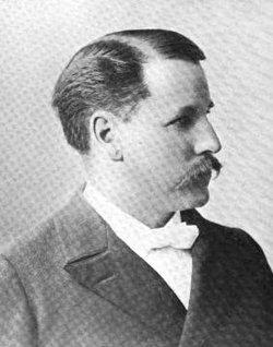
Rev William Slade Jr.
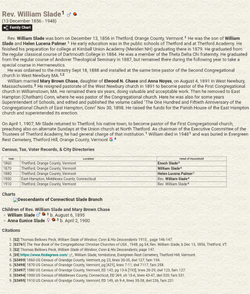
| Birth | : | 13 Dec 1856 Thetford, Orange County, Vermont, USA |
| Death | : | 17 Jul 1948 Hanover, Grafton County, New Hampshire, USA |
| Burial | : | St. James the Less Churchyard, Hambridge, South Somerset District, England |
| Coordinate | : | 50.9849380, -2.8669180 |
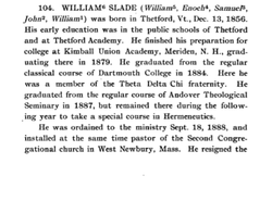
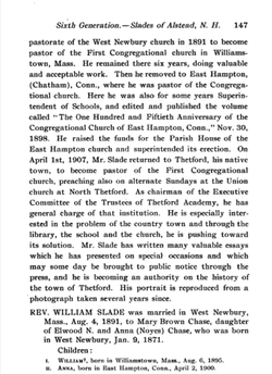
| Description | : | early education was in the public schools of Thetford and at Thetford Academy. He finished his preparation for college at Kimball Union Academy (Meriden NH) graduating there in 1879. He graduated from the regular classical course of Dartmouth College in 1884. He was a member of the Theta Delta Chi fraternity. He graduated from the regular course of Andover Theological Seminary in 1887, but remained there during the following year to take a special course in Hermeneutics. He was ordained to the ministry Sept 18, 1888 and installed at the same time pastor of the Second Congregational church in West Newbury... Read More |
frequently asked questions (FAQ):
-
Where is Rev William Slade Jr.'s memorial?
Rev William Slade Jr.'s memorial is located at: St. James the Less Churchyard, Hambridge, South Somerset District, England.
-
When did Rev William Slade Jr. death?
Rev William Slade Jr. death on 17 Jul 1948 in Hanover, Grafton County, New Hampshire, USA
-
Where are the coordinates of the Rev William Slade Jr.'s memorial?
Latitude: 50.9849380
Longitude: -2.8669180
Family Members:
Parent
Spouse
Siblings
Flowers:
Nearby Cemetories:
1. St. James the Less Churchyard
Hambridge, South Somerset District, England
Coordinate: 50.9849380, -2.8669180
2. All Saints Churchyard
Isle Brewers, South Somerset District, England
Coordinate: 50.9854450, -2.9000040
3. St Mary the Virgin Churchyard
Barrington, South Somerset District, England
Coordinate: 50.9591210, -2.8713310
4. All Saints Church Original Location
Isle Brewers, South Somerset District, England
Coordinate: 50.9879000, -2.9081000
5. St. Andrew's Churchyard
Puckington, South Somerset District, England
Coordinate: 50.9606190, -2.8884930
6. St. Catherine's Churchyard
Fivehead, South Somerset District, England
Coordinate: 51.0083009, -2.9000973
7. St Mary the Virgin Churchyard
Isle Abbotts, South Somerset District, England
Coordinate: 50.9842010, -2.9240160
8. St. Catherine's Churchyard
Drayton, South Somerset District, England
Coordinate: 51.0191860, -2.8494960
9. Fivehead Cemetery
Fivehead, South Somerset District, England
Coordinate: 50.9969923, -2.9231360
10. Baptist Chapel
Isle Abbotts, South Somerset District, England
Coordinate: 50.9820340, -2.9282940
11. St. Martin's Churchyard
Kingsbury Episcopi, South Somerset District, England
Coordinate: 50.9863950, -2.8043130
12. St. Martin's Churchyard
Fivehead, South Somerset District, England
Coordinate: 51.0017010, -2.9239810
13. St. Andrew's Churchyard
Curry Rivel, South Somerset District, England
Coordinate: 51.0246570, -2.8687410
14. Curry Rivel Cemetery
Curry Rivel, South Somerset District, England
Coordinate: 51.0257667, -2.8676226
15. St James Churchyard
Kingsbury Episcopi, South Somerset District, England
Coordinate: 50.9646420, -2.8106370
16. St. Peter and St. Paul's Churchyard
Muchelney, South Somerset District, England
Coordinate: 51.0207389, -2.8154595
17. St. Peter Churchyard
Ilton, South Somerset District, England
Coordinate: 50.9524910, -2.9239420
18. Ilton Cemetery
Ilton, South Somerset District, England
Coordinate: 50.9552744, -2.9281412
19. All Saints Churchyard
Curry Mallet, South Somerset District, England
Coordinate: 50.9836110, -2.9497220
20. Ilminster Cemetery
Ilminster, South Somerset District, England
Coordinate: 50.9364800, -2.9130200
21. All Saints Churchyard
Langport, South Somerset District, England
Coordinate: 51.0369970, -2.8254530
22. Blessed Virgin Mary Churchyard
Huish Episcopi, South Somerset District, England
Coordinate: 51.0362250, -2.8182410
23. St. James' Churchyard
Beercrocombe, South Somerset District, England
Coordinate: 50.9791730, -2.9619190
24. United Reform Churchyard
Martock, South Somerset District, England
Coordinate: 50.9609320, -2.7735020

