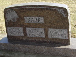
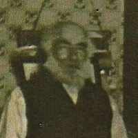
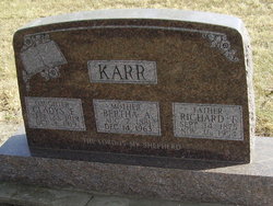
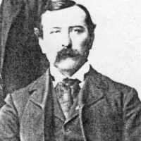
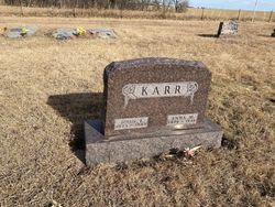
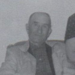
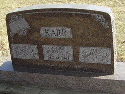
Richard Franklin “Frank” Karr
| Birth | : | 14 Sep 1875 Wallingford, Will County, Illinois, USA |
| Death | : | 16 Nov 1954 Hastings, Adams County, Nebraska, USA |
| Burial | : | Brights Chapel Cemetery, Elk, Tucker County, USA |
| Coordinate | : | 39.0201000, -79.5312400 |
| Plot | : | SW section Lot 92 |
| Description | : | Rites Held Friday For Frank Karr Funeral services were held at the Merten-Butler Funeral Chapel in Blue Hill on Friday afternoon, Nov. 19 at two o'clock for Frank Karr, long time resident of this community who passed away at his home in Hastings on Wednesday of last week. Rev. White of the Hastings Presbyterian church was in charge of the services. Mrs. Naomi McConkey and Mrs. Naomi McConkey and Mrs. William Vaughan sang two hymns accompanied by Mrs. Byron Vaughan at the organ. Burial was in the Blue Hill cemetery. Pallbearers were Elmer Schulz, Jotham... Read More |
frequently asked questions (FAQ):
-
Where is Richard Franklin “Frank” Karr's memorial?
Richard Franklin “Frank” Karr's memorial is located at: Brights Chapel Cemetery, Elk, Tucker County, USA.
-
When did Richard Franklin “Frank” Karr death?
Richard Franklin “Frank” Karr death on 16 Nov 1954 in Hastings, Adams County, Nebraska, USA
-
Where are the coordinates of the Richard Franklin “Frank” Karr's memorial?
Latitude: 39.0201000
Longitude: -79.5312400
Family Members:
Parent
Spouse
Siblings
Children
Flowers:
Nearby Cemetories:
1. Brights Chapel Cemetery
Elk, Tucker County, USA
Coordinate: 39.0201000, -79.5312400
2. Carr-White Cemetery
Tucker County, USA
Coordinate: 39.0234100, -79.5201220
3. Clark-Carr Cemetery
Red Creek, Tucker County, USA
Coordinate: 39.0240580, -79.5434710
4. Teter Cemetery
Gladwin, Tucker County, USA
Coordinate: 39.0018997, -79.5432968
5. Andrew Shirk Cemetery
Gladwin, Tucker County, USA
Coordinate: 38.9987970, -79.5581280
6. Old Ault Family Cemetery
Red Creek, Tucker County, USA
Coordinate: 38.9962140, -79.5075670
7. Flanagan Hill Cemetery
Red Creek, Tucker County, USA
Coordinate: 39.0013400, -79.4964020
8. Bonner-Johnson Cemetery
Tucker County, USA
Coordinate: 38.9839800, -79.5087700
9. Nelson Cemetery
Dryfork, Randolph County, USA
Coordinate: 38.9756260, -79.4959780
10. Nine Cemetery
Tucker County, USA
Coordinate: 39.0254500, -79.4642930
11. Wolford-Rohrbaugh Cemetery
Tucker County, USA
Coordinate: 38.9859580, -79.4784080
12. Turner Cemetery
Dryfork, Randolph County, USA
Coordinate: 38.9687195, -79.5028305
13. Hedrick Cemetery
Red Creek, Tucker County, USA
Coordinate: 38.9894850, -79.4693680
14. D. B. Harper Cemetery
Randolph County, USA
Coordinate: 38.9679380, -79.4931890
15. Laban Smith Family Cemetery
Randolph County, USA
Coordinate: 38.9587080, -79.5259120
16. Flanagan Memorial Cemetery
Laneville, Tucker County, USA
Coordinate: 38.9858017, -79.4591980
17. Huffman Cemetery
Tucker County, USA
Coordinate: 38.9905210, -79.4525900
18. Judy Cemetery
Laneville, Tucker County, USA
Coordinate: 38.9904950, -79.4526050
19. Buena Chapel Cemetery
Canaan Heights, Tucker County, USA
Coordinate: 39.0223200, -79.4438200
20. Lanesville Bethel Church Cemetery
Laneville, Tucker County, USA
Coordinate: 38.9835020, -79.4541530
21. Bonner Mountain Cemetery
Dryfork, Randolph County, USA
Coordinate: 38.9600754, -79.4767303
22. Mick Family Cemetery
Harman, Randolph County, USA
Coordinate: 38.9463470, -79.5053720
23. Pennington Cemetery
Harman, Randolph County, USA
Coordinate: 38.9463760, -79.5049300
24. Cortland Cemetery
Cortland, Tucker County, USA
Coordinate: 39.0581017, -79.4360962

