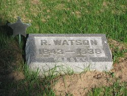
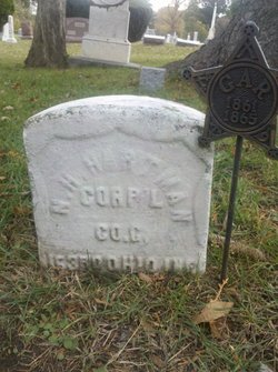
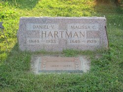
Richard Watson Hartman
| Birth | : | 23 Feb 1843 |
| Death | : | 4 Aug 1938 |
| Burial | : | Saint Mary Magdalene Cemetery, Omaha, Douglas County, USA |
| Coordinate | : | 41.2039420, -95.9850610 |
| Description | : | Richard Watson Hartman; From Obit: Final taps were sounded for Richard Watson Hartman, 95, Thursday when he passed on after a short illness at the home of his daughter, Mrs. Kate Fahringer. Uncle Wat, as he was affectionately called, was Napoleon's last survivor of the great Civil War. He was born February 23, 1843, son of Mr. and Mrs. Samuel Hartman. He attended country schools and as he reached manhood the great war of the states broke out and he enlisted in Co. F of the 68th regiment, serving four years with the Union army, seeing service at Fort Henry, Fort... Read More |
frequently asked questions (FAQ):
-
Where is Richard Watson Hartman's memorial?
Richard Watson Hartman's memorial is located at: Saint Mary Magdalene Cemetery, Omaha, Douglas County, USA.
-
When did Richard Watson Hartman death?
Richard Watson Hartman death on 4 Aug 1938 in
-
Where are the coordinates of the Richard Watson Hartman's memorial?
Latitude: 41.2039420
Longitude: -95.9850610
Family Members:
Parent
Spouse
Siblings
Children
Flowers:
Nearby Cemetories:
1. Saint Mary Magdalene Cemetery
Omaha, Douglas County, USA
Coordinate: 41.2039420, -95.9850610
2. Graceland Park Cemetery
Omaha, Douglas County, USA
Coordinate: 41.2113991, -95.9785995
3. Saint Mary's Cemetery
Omaha, Douglas County, USA
Coordinate: 41.2042007, -95.9646988
4. Saint Johns Cemetery
Bellevue, Sarpy County, USA
Coordinate: 41.1864014, -95.9682999
5. Fisher Farm Cemetery
Bellevue, Sarpy County, USA
Coordinate: 41.1727982, -95.9760971
6. Hrabik Cemetery
Bellevue, Sarpy County, USA
Coordinate: 41.1726540, -95.9768200
7. Westlawn-Hillcrest Memorial Park
Omaha, Douglas County, USA
Coordinate: 41.2346992, -95.9966965
8. Laurel Hill Cemetery
Omaha, Douglas County, USA
Coordinate: 41.1918983, -95.9417038
9. Bohemian Cemetery
Omaha, Douglas County, USA
Coordinate: 41.2388992, -95.9955978
10. Douglas County Poor Farm Cemetery
Omaha, Douglas County, USA
Coordinate: 41.2437240, -95.9723480
11. Beth El Cemetery
Ralston, Douglas County, USA
Coordinate: 41.2117004, -96.0428009
12. Ak-Sar-Ben Racetrack Grounds
Omaha, Douglas County, USA
Coordinate: 41.2414703, -96.0159607
13. Calvary Cemetery
Omaha, Douglas County, USA
Coordinate: 41.2364006, -96.0294037
14. Resurrection Cemetery
Omaha, Douglas County, USA
Coordinate: 41.2344208, -96.0365448
15. Holy Sepulchre Cemetery
Omaha, Douglas County, USA
Coordinate: 41.2543983, -95.9875031
16. Papillion Cemetery
Papillion, Sarpy County, USA
Coordinate: 41.1758003, -96.0410995
17. Evergreen Memorial Park Cemetery
Omaha, Douglas County, USA
Coordinate: 41.2393990, -96.0355988
18. First Central Congregational Columbarium
Omaha, Douglas County, USA
Coordinate: 41.2563456, -95.9658365
19. Saint Andrews Episcopal Church Columbarium
Omaha, Douglas County, USA
Coordinate: 41.2492500, -96.0427500
20. Nash Chapel Crypt
Omaha, Douglas County, USA
Coordinate: 41.2665090, -95.9721790
21. Immanuel Lutheran Church Columbarium
Bellevue, Sarpy County, USA
Coordinate: 41.1602700, -95.9218900
22. Countryside Community Church Columbarium
Omaha, Douglas County, USA
Coordinate: 41.2483660, -96.0500270
23. Trinity Cathedral Columbarium
Omaha, Douglas County, USA
Coordinate: 41.2603900, -95.9393660
24. Cedar Dale Cemetery
Papillion, Sarpy County, USA
Coordinate: 41.1418304, -96.0338745

