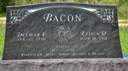
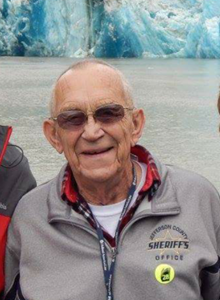
Rita Mae Bacon Carothers
| Birth | : | 20 Nov 1936 Topeka, Shawnee County, Kansas, USA |
| Death | : | 21 Aug 2020 Topeka, Shawnee County, Kansas, USA |
| Burial | : | Bethel Cemetery, Topeka, Shawnee County, USA |
| Coordinate | : | 39.0085983, -95.5864029 |
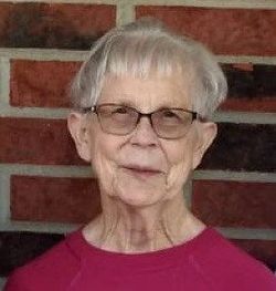
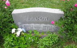
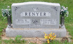
| Description | : | Rita Mae Carothers, 83, Topeka, passed away Friday, August 21, 2020 at Midland Hospice House. Rita was born November 20, 1936 in Topeka, the daughter of Wendell and Amelia (Iwig) Bacon. She graduated from Highland Park High School in 1954. She was a member of St. David’s Episcopal Church. She enjoyed jigsaw puzzles, cross stitch and camping. Rita married Leonard L. Renyer on September 8, 1956. He died October 7, 1999. She married Carothers on January 18, 2014. He survives. Other survivors include children, step-children, CO; grandchildren, step-grandchildren, 9 great-grandchildren; and brothers,. |
frequently asked questions (FAQ):
-
Where is Rita Mae Bacon Carothers's memorial?
Rita Mae Bacon Carothers's memorial is located at: Bethel Cemetery, Topeka, Shawnee County, USA.
-
When did Rita Mae Bacon Carothers death?
Rita Mae Bacon Carothers death on 21 Aug 2020 in Topeka, Shawnee County, Kansas, USA
-
Where are the coordinates of the Rita Mae Bacon Carothers's memorial?
Latitude: 39.0085983
Longitude: -95.5864029
Family Members:
Parent
Spouse
Siblings
Flowers:
Nearby Cemetories:
1. Bethel Cemetery
Topeka, Shawnee County, USA
Coordinate: 39.0085983, -95.5864029
2. Bauer Cemetery
Topeka, Shawnee County, USA
Coordinate: 38.9864006, -95.5764008
3. Zion Cemetery
Watson, Shawnee County, USA
Coordinate: 38.9861984, -95.5481033
4. Emmanuel Cemetery
Watson, Shawnee County, USA
Coordinate: 38.9719009, -95.5744019
5. Mount Auburn Cemetery
Topeka, Shawnee County, USA
Coordinate: 39.0393982, -95.6500015
6. Topeka Cemetery
Topeka, Shawnee County, USA
Coordinate: 39.0388985, -95.6528015
7. Lynn Creek Cemetery
Berryton, Shawnee County, USA
Coordinate: 38.9575005, -95.6408005
8. Saint Peters Cemetery
Lecompton, Douglas County, USA
Coordinate: 39.0139885, -95.4941635
9. Eastview Cemetery
Big Springs, Douglas County, USA
Coordinate: 39.0222015, -95.4858475
10. Old Grantville Cemetery
Grantville, Jefferson County, USA
Coordinate: 39.0949500, -95.5771300
11. Grace Episcopal Cathedral Sanctuary
Topeka, Shawnee County, USA
Coordinate: 39.0506925, -95.6839273
12. Grace Episcopal Cathedral Columbarium
Topeka, Shawnee County, USA
Coordinate: 39.0511284, -95.6843719
13. Grantville Cemetery
Grantville, Jefferson County, USA
Coordinate: 39.0957400, -95.5745800
14. Ritchie Cemetery
Topeka, Shawnee County, USA
Coordinate: 39.0228010, -95.7027530
15. Carnegie Hall
Topeka, Shawnee County, USA
Coordinate: 39.0350600, -95.6999100
16. Foster Cemetery
Topeka, Shawnee County, USA
Coordinate: 38.9942017, -95.7061005
17. Curtis Family Cemetery
North Topeka, Shawnee County, USA
Coordinate: 39.0792870, -95.6702270
18. Westminster Presbyterian Church Memorial Garden
Topeka, Shawnee County, USA
Coordinate: 39.0430400, -95.7021700
19. Pleasant Hill Cemetery
Berryton, Shawnee County, USA
Coordinate: 38.9103012, -95.5763016
20. Stull Cemetery
Stull, Douglas County, USA
Coordinate: 38.9714203, -95.4546204
21. Topeka State Hospital Cemetery
Topeka, Shawnee County, USA
Coordinate: 39.0671005, -95.7080994
22. Saint Davids Episcopal Church Columbarium
Topeka, Shawnee County, USA
Coordinate: 39.0369860, -95.7259480
23. Mount Calvary and Rose Hill Cemetery
Newman, Jefferson County, USA
Coordinate: 39.0872536, -95.4827042
24. Memorial Park Cemetery
Topeka, Shawnee County, USA
Coordinate: 39.0619011, -95.7221985

