
| Memorials | : | 315 |
| Location | : | Topeka, Shawnee County, USA |
| Coordinate | : | 39.0228010, -95.7027530 |
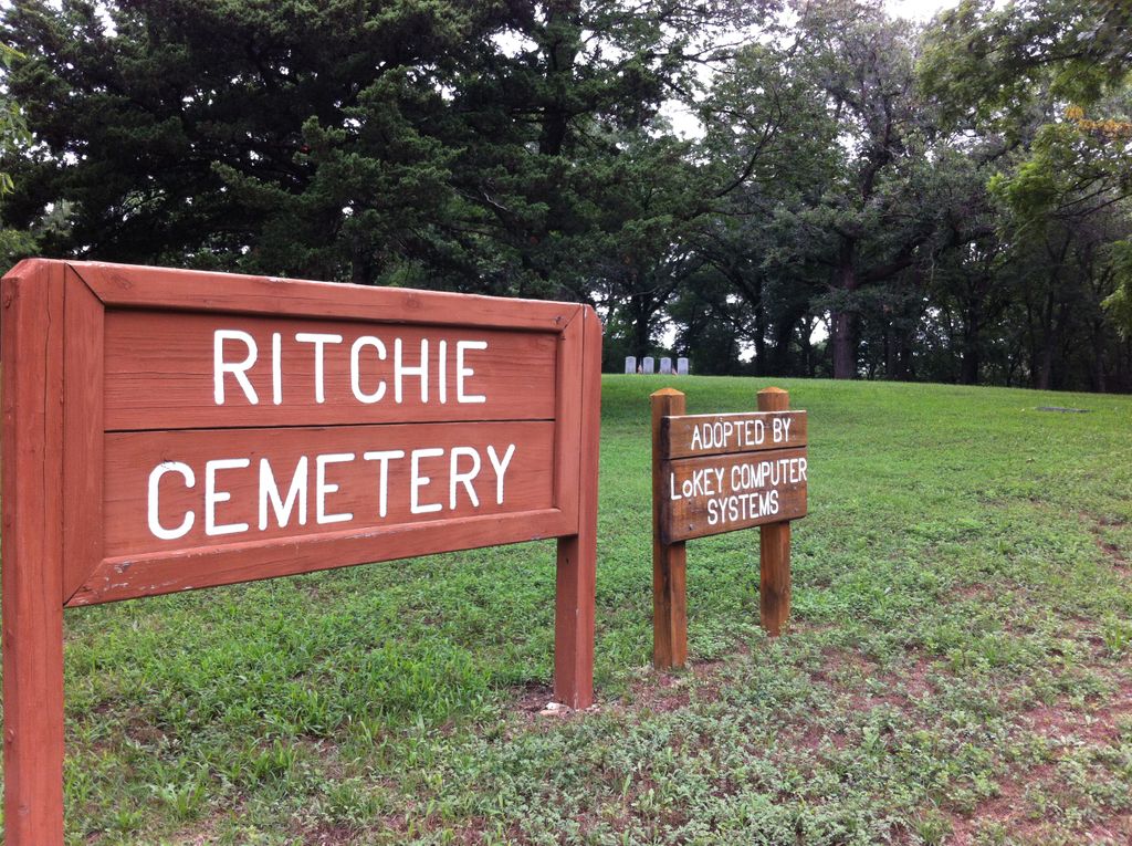
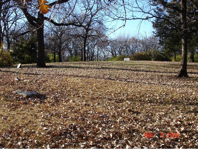
| Description | : | The Ritchie cemetery is a historic cemetery in Topeka Kansas. Most burials took place from the 1880s to the 1920s. There are less than 10 headstones but there are hundreds of people buried there. Most were black citizens of Topeka, many came to Topeka after slavery ended. The cemetery is no longer active and was decommissioned as a cemetery in 1962. |
frequently asked questions (FAQ):
-
Where is Ritchie Cemetery?
Ritchie Cemetery is located at SW 27th Street & Boswell Ave Topeka, Shawnee County ,Kansas , 66611USA.
-
Ritchie Cemetery cemetery's updated grave count on graveviews.com?
23 memorials
-
Where are the coordinates of the Ritchie Cemetery?
Latitude: 39.0228010
Longitude: -95.7027530
Nearby Cemetories:
1. Carnegie Hall
Topeka, Shawnee County, USA
Coordinate: 39.0350600, -95.6999100
2. Westminster Presbyterian Church Memorial Garden
Topeka, Shawnee County, USA
Coordinate: 39.0430400, -95.7021700
3. Saint Davids Episcopal Church Columbarium
Topeka, Shawnee County, USA
Coordinate: 39.0369860, -95.7259480
4. Foster Cemetery
Topeka, Shawnee County, USA
Coordinate: 38.9942017, -95.7061005
5. Mount Hope Cemetery
Topeka, Shawnee County, USA
Coordinate: 39.0367393, -95.7386703
6. Grace Episcopal Cathedral Sanctuary
Topeka, Shawnee County, USA
Coordinate: 39.0506925, -95.6839273
7. Grace Episcopal Cathedral Columbarium
Topeka, Shawnee County, USA
Coordinate: 39.0511284, -95.6843719
8. Mount Calvary Cemetery
Topeka, Shawnee County, USA
Coordinate: 39.0532990, -95.7360992
9. Memorial Park Cemetery
Topeka, Shawnee County, USA
Coordinate: 39.0619011, -95.7221985
10. Topeka Cemetery
Topeka, Shawnee County, USA
Coordinate: 39.0388985, -95.6528015
11. Mount Auburn Cemetery
Topeka, Shawnee County, USA
Coordinate: 39.0393982, -95.6500015
12. Topeka State Hospital Cemetery
Topeka, Shawnee County, USA
Coordinate: 39.0671005, -95.7080994
13. Abram Burnett Burial Site
Topeka, Shawnee County, USA
Coordinate: 39.0102997, -95.7685776
14. Elevation Cemetery
Shawnee County, USA
Coordinate: 38.9832993, -95.7613983
15. Security Benefit Association Cemetery
Topeka, Shawnee County, USA
Coordinate: 39.0630989, -95.7606583
16. Curtis Family Cemetery
North Topeka, Shawnee County, USA
Coordinate: 39.0792870, -95.6702270
17. Mission Center Cemetery
Topeka, Shawnee County, USA
Coordinate: 39.0145493, -95.7819290
18. Bennie Lee Graham Memorial Cemetery
Shawnee County, USA
Coordinate: 39.1020584, -95.6836472
19. Lynn Creek Cemetery
Berryton, Shawnee County, USA
Coordinate: 38.9575005, -95.6408005
20. Rochester Cemetery
Topeka, Shawnee County, USA
Coordinate: 39.1044006, -95.6800003
21. Bethel Cemetery
Topeka, Shawnee County, USA
Coordinate: 39.0085983, -95.5864029
22. Prairie Home Cemetery
Topeka, Shawnee County, USA
Coordinate: 39.1077118, -95.7482910
23. West Lawn Memorial Gardens
Topeka, Shawnee County, USA
Coordinate: 39.0518112, -95.8167419
24. Bauer Cemetery
Topeka, Shawnee County, USA
Coordinate: 38.9864006, -95.5764008