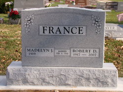
Robert DeWitt France
| Birth | : | 25 Sep 1917 Columbia City, Whitley County, Indiana, USA |
| Death | : | 1 Apr 2007 Akron, Summit County, Ohio, USA |
| Burial | : | St Nicholas Churchyard, Bradwell, Great Yarmouth Borough, England |
| Coordinate | : | 52.5748650, 1.6928610 |
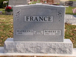
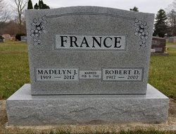
| Inscription | : | MARRIED FEB 8, 1941 |
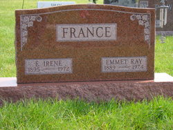
| Description | : | Robert D. France, age 89, formerly of Columbia City, IN died at 12:10 a.m. on Sunday April 1, 2007 in Akron, OH. He was born in Columbia City on September 25, 1917 to Emmet Ray and E. Irene (Shoda) France. He graduated from Columbia City High School with the Class of 1935 where he was a varsity squad cheerleader. As a young man, he played in the Columbia City Softball League. On February 8, 1941 he was united in marriage to Madelyn J. Stidham at their newly purchased home on North Walnut Street in Columbia City. He and his wife later... Read More |
frequently asked questions (FAQ):
-
Where is Robert DeWitt France's memorial?
Robert DeWitt France's memorial is located at: St Nicholas Churchyard, Bradwell, Great Yarmouth Borough, England.
-
When did Robert DeWitt France death?
Robert DeWitt France death on 1 Apr 2007 in Akron, Summit County, Ohio, USA
-
Where are the coordinates of the Robert DeWitt France's memorial?
Latitude: 52.5748650
Longitude: 1.6928610
Family Members:
Parent
Spouse
Siblings
Children
Flowers:
Nearby Cemetories:
1. St Nicholas Churchyard
Bradwell, Great Yarmouth Borough, England
Coordinate: 52.5748650, 1.6928610
2. Gorleston Crematorium
Gorleston-on-Sea, Great Yarmouth Borough, England
Coordinate: 52.5718100, 1.7044000
3. Magdalen Lawn Cemetery
Great Yarmouth, Great Yarmouth Borough, England
Coordinate: 52.5719600, 1.7073100
4. Gorleston Cemetery
Gorleston-on-Sea, Great Yarmouth Borough, England
Coordinate: 52.5786850, 1.7171760
5. All Saints Churchyard
Belton, Great Yarmouth Borough, England
Coordinate: 52.5674970, 1.6662540
6. Saint Andrew Churchyard
Gorleston-on-Sea, Great Yarmouth Borough, England
Coordinate: 52.5788550, 1.7249070
7. St Peter and St Paul Churchyard
Burgh Castle, Great Yarmouth Borough, England
Coordinate: 52.5861230, 1.6542990
8. Black Friars Priory
Great Yarmouth, Great Yarmouth Borough, England
Coordinate: 52.6003760, 1.7285340
9. Colby Gate Jewish Burial Ground
Great Yarmouth, Great Yarmouth Borough, England
Coordinate: 52.6014625, 1.7310622
10. White Friars Carmelite Priory
Great Yarmouth, Great Yarmouth Borough, England
Coordinate: 52.6079960, 1.7233900
11. St Margaret Churchyard
Hopton-on-Sea, Great Yarmouth Borough, England
Coordinate: 52.5395717, 1.7211316
12. Dissenters' Grave Yard
Great Yarmouth, Great Yarmouth Borough, England
Coordinate: 52.6088420, 1.7279481
13. St Nicholas Churchyard
Great Yarmouth, Great Yarmouth Borough, England
Coordinate: 52.6109500, 1.7269100
14. Saint Margaret Old Churchyard
Hopton-on-Sea, Great Yarmouth Borough, England
Coordinate: 52.5387720, 1.7296733
15. St Edmund's Churchyard
Fritton, Great Yarmouth Borough, England
Coordinate: 52.5430920, 1.6460460
16. St John the Baptist Churchyard
Lound, Waveney District, England
Coordinate: 52.5310680, 1.6937750
17. St Mary's Parish Churchyard
Ashby, Waveney District, England
Coordinate: 52.5322480, 1.6693690
18. Kitchener Road Cemetery
Great Yarmouth, Great Yarmouth Borough, England
Coordinate: 52.6125100, 1.7333200
19. Great Yarmouth New Cemetery
Great Yarmouth, Great Yarmouth Borough, England
Coordinate: 52.6151000, 1.7335100
20. St Olave's Priory
Herringfleet, Waveney District, England
Coordinate: 52.5381200, 1.6240290
21. St Margaret's Churchyard
Herringfleet, Waveney District, England
Coordinate: 52.5218820, 1.6493630
22. St Mary The Virgin Churchyard
Blundeston, Waveney District, England
Coordinate: 52.5151100, 1.7029600
23. St Mary Churchyard
Somerleyton, Waveney District, England
Coordinate: 52.5157800, 1.6730900
24. St Bartholomew Churchyard
Corton, Waveney District, England
Coordinate: 52.5213100, 1.7404800

