
| Birth | : | 26 Jul 1903 Lee, Goochland County, Virginia, USA |
| Death | : | 26 Sep 1972 Silver Spring, Montgomery County, Maryland, USA |
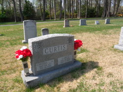
| Burial | : | Monocacy Cemetery, Beallsville, Montgomery County, USA |
| Coordinate | : | 39.1800003, -77.4163971 |
| Plot | : | Row E, Lot 30, Site 12 |
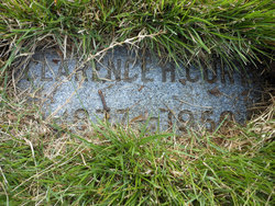
| Description | : | Parents: {of Lee, Gouchland, Virginia} - Clarence H. Curtis [ 1877-1958] - Florence Bertie [1877-1937] Married Annie Pauline (Cooley) Curtis Children: - Annie (Polly) Curtis Obituary The Washington Post - September 28, 1972 On Tuesday, September 26, 1972, Robert Elmer Curtis of 2128 Henderons Ave., Wheaton, Md., beloved husband of Annie P. Curtis; father of Mrs. Edward (Polly) Schrider; brother of Mrs. Della Miller, Everett, Irvin, Alton, Espie, Richard, Chester, and Upton Curtis; grandfather of Lynda M., Joseph E. and Regina A. Schrider. The family requests that memorial contributions be made to the... Read More |
frequently asked questions (FAQ):
-
Where is Robert Elmer Curtis's memorial?
Robert Elmer Curtis's memorial is located at: Monocacy Cemetery, Beallsville, Montgomery County, USA.
-
When did Robert Elmer Curtis death?
Robert Elmer Curtis death on 26 Sep 1972 in Silver Spring, Montgomery County, Maryland, USA
-
Where are the coordinates of the Robert Elmer Curtis's memorial?
Latitude: 39.1800003
Longitude: -77.4163971
Family Members:
Parent
Spouse

Siblings
Flowers:


Nearby Cemetories:
1. Monocacy Cemetery
Beallsville, Montgomery County, USA
Coordinate: 39.1800003, -77.4163971
2. Jerusalem Baptist Church Cemetery Old
Montgomery County, USA
Coordinate: 39.1646300, -77.4043500
3. Jerusalem Baptist Church Cemetery New
Poolesville, Montgomery County, USA
Coordinate: 39.1631500, -77.4028300
4. Brewer Family Cemetery
Beallsville, Montgomery County, USA
Coordinate: 39.1658380, -77.3954871
5. Chiswell Family Cemetery
Poolesville, Montgomery County, USA
Coordinate: 39.1542500, -77.4197400
6. Poole Family Cemetery
Poolesville, Montgomery County, USA
Coordinate: 39.1527010, -77.4123580
7. Elijah United Methodist Church Cemetery
Poolesville, Montgomery County, USA
Coordinate: 39.1516500, -77.4159800
8. Mount Zion Cemetery
Dickerson, Montgomery County, USA
Coordinate: 39.2058210, -77.3975230
9. Poolesville Methodist Episcopal Church Cemetery
Poolesville, Montgomery County, USA
Coordinate: 39.1453100, -77.4183100
10. David Trundle Cemetery
Dickerson, Montgomery County, USA
Coordinate: 39.2004590, -77.4585700
11. Hoskinson Family Cemetery
Poolesville, Montgomery County, USA
Coordinate: 39.1497300, -77.4556700
12. Sugarloaf Pet Gardens
Dickerson, Montgomery County, USA
Coordinate: 39.2070600, -77.3696300
13. Mount Pleasant Methodist Church Cemetery
Dickerson, Montgomery County, USA
Coordinate: 39.2268982, -77.4169006
14. Saint Marys Catholic Cemetery
Barnesville, Montgomery County, USA
Coordinate: 39.2200012, -77.3811035
15. Barnesville Methodist Episcopal Church Cemetery
Barnesville, Montgomery County, USA
Coordinate: 39.2220500, -77.3829500
16. Hays Family Cemetery
Montgomery County, USA
Coordinate: 39.2225700, -77.3803500
17. Chilton - Dyer Family Cemetery
Dickerson, Montgomery County, USA
Coordinate: 39.1653300, -77.4883400
18. Gott Family Farm - The Fertile Plains
Bucklodge, Montgomery County, USA
Coordinate: 39.1614100, -77.3408300
19. Aud Family Cemetery
Poolesville, Montgomery County, USA
Coordinate: 39.1183700, -77.4311000
20. Wood Family Cemetery
Poolesville, Montgomery County, USA
Coordinate: 39.1211540, -77.3844750
21. Darnall Family Cemetery
Poolesville, Montgomery County, USA
Coordinate: 39.1275300, -77.3682300
22. Open Door MCC Memorial Garden
Boyds, Montgomery County, USA
Coordinate: 39.1991425, -77.3277588
23. Saint Marks United Methodist Church Cemetery
Boyds, Montgomery County, USA
Coordinate: 39.1776200, -77.3203200
24. Bells Chapel Cemetery
Stronghold, Frederick County, USA
Coordinate: 39.2561600, -77.4033900