
| Memorials | : | 0 |
| Location | : | Poolesville, Montgomery County, USA |
| Coordinate | : | 39.1211540, -77.3844750 |
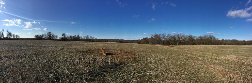
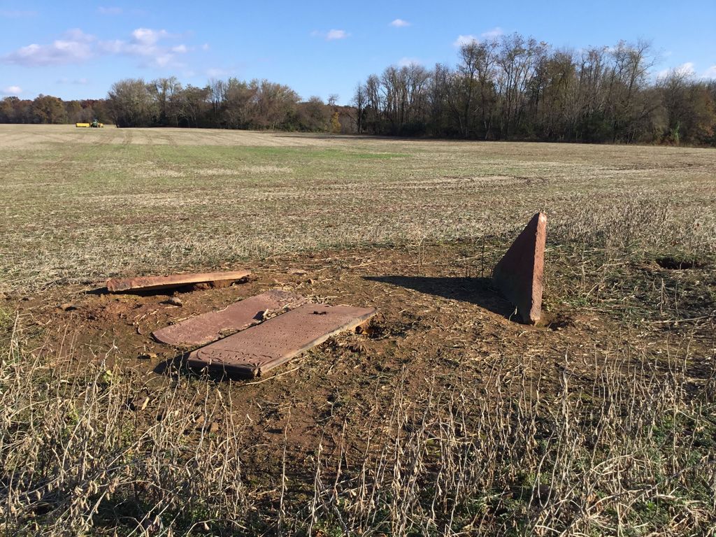
| Description | : | Small, unprotected family cemetery in the middle of a farm field. Three Seneca sandstone grave markers plus one Seneca sandstone hand-hewn slab, possibly a vault cover. Montgomery County Cemetery Inventory ID# 220 |
frequently asked questions (FAQ):
-
Where is Wood Family Cemetery?
Wood Family Cemetery is located at Opposite from 16039 Partnership Road Poolesville, Montgomery County ,Maryland ,USA.
-
Wood Family Cemetery cemetery's updated grave count on graveviews.com?
0 memorials
-
Where are the coordinates of the Wood Family Cemetery?
Latitude: 39.1211540
Longitude: -77.3844750
Nearby Cemetories:
1. Darnall Family Cemetery
Poolesville, Montgomery County, USA
Coordinate: 39.1275300, -77.3682300
2. Saint Paul Community Church Cemetery
Poolesville, Montgomery County, USA
Coordinate: 39.0976100, -77.3832900
3. Poolesville Methodist Episcopal Church Cemetery
Poolesville, Montgomery County, USA
Coordinate: 39.1453100, -77.4183100
4. Aud Family Cemetery
Poolesville, Montgomery County, USA
Coordinate: 39.1183700, -77.4311000
5. Poole Family Cemetery
Poolesville, Montgomery County, USA
Coordinate: 39.1527010, -77.4123580
6. Elijah United Methodist Church Cemetery
Poolesville, Montgomery County, USA
Coordinate: 39.1516500, -77.4159800
7. Montevideo Cemetery
Seneca, Montgomery County, USA
Coordinate: 39.0872900, -77.3507500
8. Chiswell Family Cemetery
Poolesville, Montgomery County, USA
Coordinate: 39.1542500, -77.4197400
9. Jerusalem Baptist Church Cemetery New
Poolesville, Montgomery County, USA
Coordinate: 39.1631500, -77.4028300
10. Dawson Family Cemetery
Dawsonville, Montgomery County, USA
Coordinate: 39.1376330, -77.3307140
11. Brewer Family Cemetery
Beallsville, Montgomery County, USA
Coordinate: 39.1658380, -77.3954871
12. Jerusalem Baptist Church Cemetery Old
Montgomery County, USA
Coordinate: 39.1646300, -77.4043500
13. Gott Family Farm - The Fertile Plains
Bucklodge, Montgomery County, USA
Coordinate: 39.1614100, -77.3408300
14. Clipper Family Cemetery
Seneca, Montgomery County, USA
Coordinate: 39.0694770, -77.3641010
15. Button Farm Slavery Burials
Germantown, Montgomery County, USA
Coordinate: 39.1283456, -77.3118924
16. Hoskinson Family Cemetery
Poolesville, Montgomery County, USA
Coordinate: 39.1497300, -77.4556700
17. Monocacy Cemetery
Beallsville, Montgomery County, USA
Coordinate: 39.1800003, -77.4163971
18. Pleasant Hills Cemetery
Darnestown, Montgomery County, USA
Coordinate: 39.1098340, -77.3033990
19. Seneca Community Church Cemetery
Darnestown, Montgomery County, USA
Coordinate: 39.0725000, -77.3276100
20. Jenkins Family Cemetery
Sterling, Loudoun County, USA
Coordinate: 39.0584290, -77.4212600
21. Offutt Family Cemetery
Darnestown, Montgomery County, USA
Coordinate: 39.0865700, -77.3071900
22. Asbury United Methodist Cemetery
Germantown, Montgomery County, USA
Coordinate: 39.1418991, -77.2975006
23. Hickman Family Cemetery
Poolesville, Montgomery County, USA
Coordinate: 39.1104630, -77.4750000
24. Darne Family Cemetery (Defunct)
Darnestown, Montgomery County, USA
Coordinate: 39.1033520, -77.2909020