
| Memorials | : | 8 |
| Location | : | Bucklodge, Montgomery County, USA |
| Coordinate | : | 39.1614100, -77.3408300 |
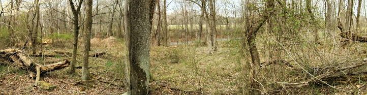
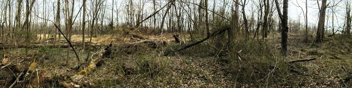
| Description | : | Richard Gott, his family, and his slaves came to Montgomery County in 1792 from tidewater Anne Arundel County in 1792. He put up his slaves as collateral and purchased seven hundred acres on the Bucklodge River near the present site of Boyds. His mansion was built in 1792 and he named it "Buck Lodge". His plantation included one of the largest tobacco farms in the area, with more than 850 acres of land and numerous outbuildings, a blacksmith shop, slave quarters, a carriage house and barns. Benjamin Gott, son of the original owner, was a Union sympathizer, but like many other... Read More |
frequently asked questions (FAQ):
-
Where is Gott Family Farm - The Fertile Plains?
Gott Family Farm - The Fertile Plains is located at White Ground Road Bucklodge, Montgomery County ,Maryland ,USA.
-
Gott Family Farm - The Fertile Plains cemetery's updated grave count on graveviews.com?
8 memorials
-
Where are the coordinates of the Gott Family Farm - The Fertile Plains?
Latitude: 39.1614100
Longitude: -77.3408300
Nearby Cemetories:
1. Saint Marks United Methodist Church Cemetery
Boyds, Montgomery County, USA
Coordinate: 39.1776200, -77.3203200
2. Dawson Family Cemetery
Dawsonville, Montgomery County, USA
Coordinate: 39.1376330, -77.3307140
3. Boyds Presbyterian Church Cemetery
Boyds, Montgomery County, USA
Coordinate: 39.1819000, -77.3155975
4. Asbury United Methodist Cemetery
Germantown, Montgomery County, USA
Coordinate: 39.1418991, -77.2975006
5. Open Door MCC Memorial Garden
Boyds, Montgomery County, USA
Coordinate: 39.1991425, -77.3277588
6. Button Farm Slavery Burials
Germantown, Montgomery County, USA
Coordinate: 39.1283456, -77.3118924
7. Darnall Family Cemetery
Poolesville, Montgomery County, USA
Coordinate: 39.1275300, -77.3682300
8. Germantown Baptist Church Cemetery
Germantown, Montgomery County, USA
Coordinate: 39.1456300, -77.2898800
9. Brewer Family Cemetery
Beallsville, Montgomery County, USA
Coordinate: 39.1658380, -77.3954871
10. Trinity United Methodist Church Historic Cemetery
Germantown, Montgomery County, USA
Coordinate: 39.1635010, -77.2833310
11. Jerusalem Baptist Church Cemetery New
Poolesville, Montgomery County, USA
Coordinate: 39.1631500, -77.4028300
12. Magers-Mobley-Arnold Cemetery
Germantown, Montgomery County, USA
Coordinate: 39.1620000, -77.2779500
13. Jerusalem Baptist Church Cemetery Old
Montgomery County, USA
Coordinate: 39.1646300, -77.4043500
14. Sugarloaf Pet Gardens
Dickerson, Montgomery County, USA
Coordinate: 39.2070600, -77.3696300
15. Wood Family Cemetery
Poolesville, Montgomery County, USA
Coordinate: 39.1211540, -77.3844750
16. Poole Family Cemetery
Poolesville, Montgomery County, USA
Coordinate: 39.1527010, -77.4123580
17. Musser Cemetery
Germantown, Montgomery County, USA
Coordinate: 39.1572200, -77.2660700
18. Elijah United Methodist Church Cemetery
Poolesville, Montgomery County, USA
Coordinate: 39.1516500, -77.4159800
19. Pleasant Hills Cemetery
Darnestown, Montgomery County, USA
Coordinate: 39.1098340, -77.3033990
20. Monocacy Cemetery
Beallsville, Montgomery County, USA
Coordinate: 39.1800003, -77.4163971
21. Chiswell Family Cemetery
Poolesville, Montgomery County, USA
Coordinate: 39.1542500, -77.4197400
22. Poolesville Methodist Episcopal Church Cemetery
Poolesville, Montgomery County, USA
Coordinate: 39.1453100, -77.4183100
23. Mount Zion Cemetery
Dickerson, Montgomery County, USA
Coordinate: 39.2058210, -77.3975230
24. Waters Family Cemetery
Germantown, Montgomery County, USA
Coordinate: 39.1939600, -77.2715400