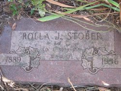
Rolla J Stober
| Birth | : | 26 Mar 1889 |
| Death | : | 4 Mar 1956 Alden, Hardin County, Iowa, USA |
| Burial | : | High Point Cemetery, High Point, Moniteau County, USA |
| Coordinate | : | 38.4817009, -92.5757980 |
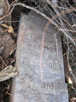
| Description | : | Moulton Weekly Tribune March 8, 1956 Rolla Stober Dies Funeral ServicesHeld Tuesday Rolla Stober, 67, who until a few months ago had made his home in Moulton, died at Alden, Iowa, Sunday. Mr. Stober had been ill for the past two years and had just recently been a patient in the Veterans Hospital at Des Moines. Death was due to a heart attack.Rolla Jette Stober, son of Philip and Harriet Atwell Stober, was born March 26, 1889, and departed this life March 4, 1956, at Alden, Iowa, at the home of his brother, Clarence, at the age of 66 years, 11 months, and 7... Read More |
frequently asked questions (FAQ):
-
Where is Rolla J Stober's memorial?
Rolla J Stober's memorial is located at: High Point Cemetery, High Point, Moniteau County, USA.
-
When did Rolla J Stober death?
Rolla J Stober death on 4 Mar 1956 in Alden, Hardin County, Iowa, USA
-
Where are the coordinates of the Rolla J Stober's memorial?
Latitude: 38.4817009
Longitude: -92.5757980
Family Members:
Parent
Siblings
Flowers:
Nearby Cemetories:
1. High Point Cemetery
High Point, Moniteau County, USA
Coordinate: 38.4817009, -92.5757980
2. Depp Cemetery
High Point, Moniteau County, USA
Coordinate: 38.4776400, -92.5818500
3. United Baptist Church Cemetery
High Point, Moniteau County, USA
Coordinate: 38.4962200, -92.5856800
4. Gray Cemetery
Moniteau County, USA
Coordinate: 38.4536018, -92.5456009
5. Yarnell Cemetery
California, Moniteau County, USA
Coordinate: 38.5189018, -92.5708008
6. Union Christian Church Cemetery
High Point, Moniteau County, USA
Coordinate: 38.5196390, -92.5994260
7. Phillips Cemetery
High Point, Moniteau County, USA
Coordinate: 38.4430300, -92.6125300
8. Bruce-Lewis-McGahan Cemetery
Enon, Moniteau County, USA
Coordinate: 38.4667500, -92.5172100
9. Rock Enon Cemetery
Miller County, USA
Coordinate: 38.4668400, -92.5170700
10. Karnes Cemetery
Corticelli, Moniteau County, USA
Coordinate: 38.5099700, -92.5247900
11. Walker Cemetery
Moniteau County, USA
Coordinate: 38.4338989, -92.5522003
12. Etter-Walker Cemetery
Burris Fork, Moniteau County, USA
Coordinate: 38.4333700, -92.5525400
13. Jackson Chapel Methodist Church Cemetery
California, Moniteau County, USA
Coordinate: 38.4447900, -92.5286500
14. Farris Cemetery
Moniteau County, USA
Coordinate: 38.4369900, -92.5380000
15. Marney Family Cemetery
High Point, Moniteau County, USA
Coordinate: 38.5357900, -92.5614500
16. Gamble Cemetery
California, Moniteau County, USA
Coordinate: 38.5393982, -92.5757980
17. Karnes-Carney-Henderson Cemetery
Burris Fork, Moniteau County, USA
Coordinate: 38.4992100, -92.5007510
18. Old Latham Cemetery
Latham, Moniteau County, USA
Coordinate: 38.5466400, -92.5891100
19. Elliott Cemetery
Moniteau County, USA
Coordinate: 38.5244500, -92.6408700
20. Colburn Cemetery
Eldon, Miller County, USA
Coordinate: 38.4246300, -92.6275500
21. Green Ridge Baptist Church Cemetery
Eldon, Miller County, USA
Coordinate: 38.4116200, -92.5645700
22. DeFoe Cemetery
California, Moniteau County, USA
Coordinate: 38.5416985, -92.5250015
23. Olean Cemetery
Olean, Miller County, USA
Coordinate: 38.4131012, -92.5413971
24. Phillips Cemetery
Barnett, Morgan County, USA
Coordinate: 38.4227982, -92.6367035


