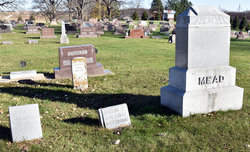
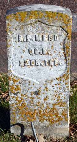
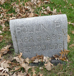
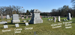
Rollin Plutard Mead
| Birth | : | 3 Apr 1837 Franklin County, Vermont, USA |
| Death | : | 29 Sep 1906 Parkersburg, Butler County, Iowa, USA |
| Burial | : | Spring Hill Cemetery, Fort Recovery, Mercer County, USA |
| Coordinate | : | 40.4129000, -84.7918700 |
| Description | : | Rollin P. Mead was born in Franklin county, Vermont, April 3, 1837, where he received his education in the district school. When nineteen years of age he visited Illinois, and there worked at farming one year, when he returned to Vermont. . In 1861 he came to Beaver Grove, Iowa. September 20, 1862, he enlisted in the Thirty-second Iowa, Company E, going to New Madrid, thence to Fort Pillow, then to Vicksburg, where they joined Shermans command, and was with him on his Meridian raid. They joined Smiths command at Columbus, and was with the Red River expedition, under Banks. Mr. Mead was wounded in the arm at... Read More |
frequently asked questions (FAQ):
-
Where is Rollin Plutard Mead's memorial?
Rollin Plutard Mead's memorial is located at: Spring Hill Cemetery, Fort Recovery, Mercer County, USA.
-
When did Rollin Plutard Mead death?
Rollin Plutard Mead death on 29 Sep 1906 in Parkersburg, Butler County, Iowa, USA
-
Where are the coordinates of the Rollin Plutard Mead's memorial?
Latitude: 40.4129000
Longitude: -84.7918700
Family Members:
Spouse
Children
Nearby Cemetories:
1. Green Mound Cemetery
Fort Recovery, Mercer County, USA
Coordinate: 40.4137600, -84.7983900
2. Old Pioneer Cemetery
Fort Recovery, Mercer County, USA
Coordinate: 40.4108009, -84.7814026
3. Saint Mary Cemetery
Fort Recovery, Mercer County, USA
Coordinate: 40.4071999, -84.7835999
4. Fort Recovery Monument Park
Fort Recovery, Mercer County, USA
Coordinate: 40.4131860, -84.7758080
5. Scott-Anderson Cemetery
Fort Recovery, Mercer County, USA
Coordinate: 40.4356003, -84.7908020
6. Pisgah Cemetery
Fort Recovery, Mercer County, USA
Coordinate: 40.3802986, -84.7814026
7. Money Cemetery
Fort Recovery, Mercer County, USA
Coordinate: 40.4534120, -84.7939800
8. Saint Joseph Cemetery
Saint Joseph, Mercer County, USA
Coordinate: 40.4275017, -84.7386017
9. Lotz Cemetery
Madison Township, Jay County, USA
Coordinate: 40.3703194, -84.8174667
10. Saint Peter Cemetery
Saint Peter, Mercer County, USA
Coordinate: 40.4511108, -84.7467957
11. Salamonia Cemetery
Salamonia, Jay County, USA
Coordinate: 40.3795800, -84.8641300
12. Morehouse Cemetery
Noble Township, Jay County, USA
Coordinate: 40.4262620, -84.8746230
13. Macedon Cemetery
Macedon, Mercer County, USA
Coordinate: 40.4794922, -84.7588501
14. Stevenson Cemetery
Wabash Township, Jay County, USA
Coordinate: 40.4848290, -84.8059130
15. Mount Zion Cemetery
Noble Township, Jay County, USA
Coordinate: 40.4685173, -84.8642960
16. Saint Wendelin Cemetery
Wendelin, Mercer County, USA
Coordinate: 40.3987236, -84.6901703
17. Lauber Cemetery
Wendelin, Mercer County, USA
Coordinate: 40.4074821, -84.6865616
18. Saint Pauls Catholic Cemetery
Sharpsburg, Mercer County, USA
Coordinate: 40.3658371, -84.7057877
19. Saint Anthony Cemetery
Fort Recovery, Mercer County, USA
Coordinate: 40.5087710, -84.7859470
20. Pleasant Ridge Cemetery
Darke County, USA
Coordinate: 40.3164350, -84.7749610
21. North Padua Cemetery
Padua, Mercer County, USA
Coordinate: 40.5129690, -84.7839460
22. Mount Zion Cemetery
Mississinawa Township, Darke County, USA
Coordinate: 40.3091800, -84.7874200
23. Pleasant Hill Cemetery
Madison Township, Jay County, USA
Coordinate: 40.3090477, -84.8247375
24. Dixon Cemetery
Erastus, Mercer County, USA
Coordinate: 40.5114620, -84.7319650

