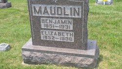
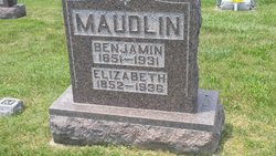
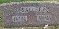
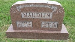
Rosella Estella Maudlin Sallee
| Birth | : | 25 Jan 1878 |
| Death | : | 1 Jan 1932 |
| Burial | : | Homeview Cemetery, Cheviot, Hurunui District, New Zealand |
| Coordinate | : | -42.7939600, 173.2701100 |
| Plot | : | Row 9 |
frequently asked questions (FAQ):
-
Where is Rosella Estella Maudlin Sallee's memorial?
Rosella Estella Maudlin Sallee's memorial is located at: Homeview Cemetery, Cheviot, Hurunui District, New Zealand.
-
When did Rosella Estella Maudlin Sallee death?
Rosella Estella Maudlin Sallee death on 1 Jan 1932 in
-
Where are the coordinates of the Rosella Estella Maudlin Sallee's memorial?
Latitude: -42.7939600
Longitude: 173.2701100
Family Members:
Parent
Spouse
Siblings
Children
Nearby Cemetories:
1. Homeview Cemetery
Cheviot, Hurunui District, New Zealand
Coordinate: -42.7939600, 173.2701100
2. Jed River Cemetery
Hurunui District, New Zealand
Coordinate: -42.8480000, 173.3133270
3. Waiau Cemetery
Waiau, Hurunui District, New Zealand
Coordinate: -42.6547350, 173.0465200
4. Rotherham Cemetery
Rotherham, Hurunui District, New Zealand
Coordinate: -42.6948170, 172.9572170
5. Whalers Grave
Oaro, Kaikoura District, New Zealand
Coordinate: -42.5340691, 173.5026990
6. Culverden Cemetery
Culverden, Hurunui District, New Zealand
Coordinate: -42.7704060, 172.8366990
7. Hanmer Springs Cemetery
Hanmer Springs, Hurunui District, New Zealand
Coordinate: -42.5175400, 172.8632300
8. Glenmark Cemetery
Waipara, Hurunui District, New Zealand
Coordinate: -43.0473440, 172.7693080
9. Waikari Cemetery
Waikari, Hurunui District, New Zealand
Coordinate: -42.9681550, 172.7101230
10. Horsley Down Cemetery
Medbury, Hurunui District, New Zealand
Coordinate: -42.8860400, 172.6487000
11. Kaikoura Public Cemetery
Kaikōura, Kaikoura District, New Zealand
Coordinate: -42.4105400, 173.6797300
12. St. James Anglican Churchyard
Kaikōura, Kaikoura District, New Zealand
Coordinate: -42.3791350, 173.6321660
13. St Paul's Churchyard
Leithfield, Hurunui District, New Zealand
Coordinate: -43.1912600, 172.7392000
14. Brackenbridge Catholic Cemetery
Balcairn, Hurunui District, New Zealand
Coordinate: -43.1675440, 172.6985610
15. Balcairn Public Cemetery
Balcairn, Hurunui District, New Zealand
Coordinate: -43.1991770, 172.7102070
16. Church of England Terrace Cemetery
Sefton, Waimakariri District, New Zealand
Coordinate: -43.2315300, 172.7139100
17. Hapuku Urupā
Hapuku, Kaikoura District, New Zealand
Coordinate: -42.3124300, 173.7506600
18. Rangi Gill's Gravesite
Molesworth, Marlborough District, New Zealand
Coordinate: -42.1379353, 173.1600656
19. St Barnabas Anglican Cemetery
Woodend, Waimakariri District, New Zealand
Coordinate: -43.3137800, 172.6702300
20. Red Gate Hut Graves
Molesworth, Marlborough District, New Zealand
Coordinate: -42.1325380, 173.0534620
21. Woodend Methodist Churchyard
Woodend, Waimakariri District, New Zealand
Coordinate: -43.3195400, 172.6672900
22. Rangiora Park Lawn Cemetery
Rangiora, Waimakariri District, New Zealand
Coordinate: -43.2908200, 172.5986500
23. Saint Brigid's Catholic Cemetery
Loburn, Waimakariri District, New Zealand
Coordinate: -43.2474800, 172.5388100
24. Rangiora Methodist Cemetery
Rangiora, Waimakariri District, New Zealand
Coordinate: -43.2909600, 172.5934900


