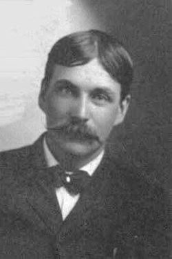
| Birth | : | 11 Jul 1913 Aneta, Nelson County, North Dakota, USA |
| Death | : | 20 Jul 1989 Daniels County, Montana, USA |
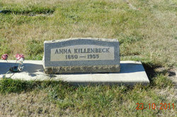
| Burial | : | Daniels County Cemetery, Scobey, Daniels County, USA |
| Coordinate | : | 48.7942009, -105.4421997 |
| Description | : | Moved with his family in 1914 to the West Ford community where he attended West Ford School. Married Delanor Beatrice Ryding July 7, 1932, in Wolf Point, MT. He was a partner in Citizens State Bank, part-owner of radio station KCGM in Scobey and a former State Senator. Served on the state ASCA Committee, the Fish & Game Commission and the Daniels Fair Board. He was a member of Masonic Temple, Scottish Rite Body, Algerian Temple, Shriners and Eastern Star. He enjoyed hunting, fishing, trapping, gambling and was a former pilot. He was a fur buyer and raised mink. |
frequently asked questions (FAQ):
-
Where is Roy Alfred Killenbeck's memorial?
Roy Alfred Killenbeck's memorial is located at: Daniels County Cemetery, Scobey, Daniels County, USA.
-
When did Roy Alfred Killenbeck death?
Roy Alfred Killenbeck death on 20 Jul 1989 in Daniels County, Montana, USA
-
Where are the coordinates of the Roy Alfred Killenbeck's memorial?
Latitude: 48.7942009
Longitude: -105.4421997
Family Members:
Parent
Spouse
Children
Flowers:
Nearby Cemetories:
1. Fairview Cemetery
Daniels County, USA
Coordinate: 48.6431007, -105.4972000
2. Saint Michaels Cemetery
Daniels County, USA
Coordinate: 48.9500008, -105.4244003
3. Orville Cemetery
Flaxville, Daniels County, USA
Coordinate: 48.7364006, -105.2016983
4. Flaxville Cemetery
Flaxville, Daniels County, USA
Coordinate: 48.8102989, -105.1697006
5. Whitetail Cemetery
Daniels County, USA
Coordinate: 48.8967018, -105.1477966
6. East Poplar Cemetery
Coronach, Assiniboia Census Division, Canada
Coordinate: 49.0649250, -105.3677700
7. West Fork Cemetery
Daniels County, USA
Coordinate: 48.6648000, -105.8567700
8. Buffalo Gap Cemetery
Buffalo Gap, Assiniboia Census Division, Canada
Coordinate: 49.0874100, -105.2777000
9. Coronach Cemetery
Coronach, Assiniboia Census Division, Canada
Coordinate: 49.1118600, -105.5017090
10. Pleasant Prairie Cemetery
Daniels County, USA
Coordinate: 48.5635986, -105.0871964
11. Mount Pleasant Cemetery
Coronach, Assiniboia Census Division, Canada
Coordinate: 49.1239380, -105.4126170
12. Valleyview Cemetery
Redstone, Sheridan County, USA
Coordinate: 48.8133011, -104.9356003
13. Saint John Lutheran Cemetery
Coronach, Assiniboia Census Division, Canada
Coordinate: 49.1308190, -105.6129560
14. Old Redstone Cemetery
Sheridan County, USA
Coordinate: 48.8306007, -104.9060974
15. Big Beaver Union Cemetery
Big Beaver, Weyburn Census Division, Canada
Coordinate: 49.0889460, -105.0563550
16. Berg Cemetery
Willow Bunch, Assiniboia Census Division, Canada
Coordinate: 49.1673810, -105.6112070
17. Faith Lutheran Cemetery
Sheridan County, USA
Coordinate: 48.6217003, -104.9039001
18. Archer Cemetery
Sheridan County, USA
Coordinate: 48.7811012, -104.8153000
19. Poplar Valley Cemetery
Rockglen, Assiniboia Census Division, Canada
Coordinate: 49.1012550, -105.8785270
20. Fife Lake Municipal Cemetery
Fife Lake, Assiniboia Census Division, Canada
Coordinate: 49.1742300, -105.7352760
21. Marshall Cemetery
Big Beaver, Weyburn Census Division, Canada
Coordinate: 49.0269260, -104.8803420
22. Highland Cemetery
Outlook, Sheridan County, USA
Coordinate: 48.8732986, -104.7755966
23. Christ the King Roman Catholic Cemetery
Fife Lake, Assiniboia Census Division, Canada
Coordinate: 49.2036630, -105.7281090
24. Volt Cemetery
Volt, Roosevelt County, USA
Coordinate: 48.3775000, -105.7160500


