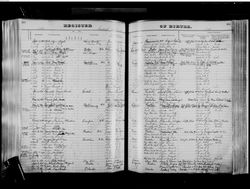
| Birth | : | 17 Aug 1884 Lewis County, West Virginia, USA |
| Death | : | 25 Jul 1962 Lewis County, West Virginia, USA |
| Burial | : | Pumphrey Cemetery, Orlando, Lewis County, USA |
| Coordinate | : | 38.9275880, -80.6216500 |
| Description | : | When Roy's mother (Mary) and father (Minter) divorced around 1891, Roy remained with his father. However, his sister Jessie and brother Edward stayed with their mother and adopted the surname of Heath after their mother married Elias Heath in 1893. Roy remained single and never married. |
frequently asked questions (FAQ):
-
Where is Roy Lee “Jake” Pumphrey's memorial?
Roy Lee “Jake” Pumphrey's memorial is located at: Pumphrey Cemetery, Orlando, Lewis County, USA.
-
When did Roy Lee “Jake” Pumphrey death?
Roy Lee “Jake” Pumphrey death on 25 Jul 1962 in Lewis County, West Virginia, USA
-
Where are the coordinates of the Roy Lee “Jake” Pumphrey's memorial?
Latitude: 38.9275880
Longitude: -80.6216500
Family Members:
Parent
Siblings
Flowers:
Nearby Cemetories:
1. Pumphrey Cemetery
Orlando, Lewis County, USA
Coordinate: 38.9275880, -80.6216500
2. Mick Cemetery
Gilmer County, USA
Coordinate: 38.9157200, -80.6316400
3. Finster Chapel Cemetery
Peterson, Lewis County, USA
Coordinate: 38.9300003, -80.5999985
4. Queen Family Cemetery
Copley, Lewis County, USA
Coordinate: 38.9499000, -80.6130000
5. Heater Cemetery
Burnsville, Braxton County, USA
Coordinate: 38.9024560, -80.6100370
6. Tumbling Cemetery
Gilmer County, USA
Coordinate: 38.9085999, -80.6594009
7. Tomblin Cemetery
Blackburn, Gilmer County, USA
Coordinate: 38.9076650, -80.6597330
8. Montgomery Cemetery
Bealls Mills, Lewis County, USA
Coordinate: 38.9648890, -80.6035400
9. Blackburn Cemetery
Blackburn, Gilmer County, USA
Coordinate: 38.9235700, -80.6743200
10. Boilon Cemetery
Gilmer County, USA
Coordinate: 38.9519005, -80.6718979
11. Saint Bridget's Church Cemetery
Weston, Lewis County, USA
Coordinate: 38.9319400, -80.5572970
12. Schoonover-Dawson Cemetery
Donlan, Gilmer County, USA
Coordinate: 38.9461770, -80.6854790
13. Barrett Cemetery
Burnsville, Braxton County, USA
Coordinate: 38.8778000, -80.6528015
14. Canfield Cemetery
Gilmer, Gilmer County, USA
Coordinate: 38.9071999, -80.6900024
15. Rogers Cemetery
Gilmer County, USA
Coordinate: 38.9406013, -80.6936035
16. Locust Knob Cemetery
Stouts Mills, Gilmer County, USA
Coordinate: 38.8990000, -80.6880000
17. Snyder Cemetery
Gilmer County, USA
Coordinate: 38.9006004, -80.6964035
18. Keith Cemetery
Gilmer County, USA
Coordinate: 38.9561005, -80.6986008
19. Old Field Fork Cemetery
Lewis County, USA
Coordinate: 38.9827995, -80.6710968
20. Saint Bernard Church Cemetery
Weston, Lewis County, USA
Coordinate: 38.9928000, -80.5926940
21. Dyer Cemetery
Gilmer County, USA
Coordinate: 38.9319000, -80.7110977
22. McHenry Cemetery
Gilmer County, USA
Coordinate: 38.9341870, -80.7130200
23. Peterson Village Cemetery
Peterson, Lewis County, USA
Coordinate: 38.8938270, -80.5400510
24. Hoover Cemetery
Burnsville, Braxton County, USA
Coordinate: 38.8619600, -80.6644170


