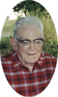
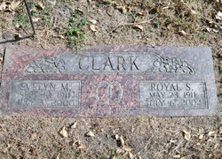
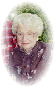
Royal S. Clark
| Birth | : | 23 May 1911 Davenport, Scott County, Iowa, USA |
| Death | : | 6 Jul 2002 Lincoln, Lancaster County, Nebraska, USA |
| Burial | : | St. Mary's Churchyard, Long Sutton, South Holland District, England |
| Coordinate | : | 52.7844700, 0.1221800 |
| Description | : | Son of Oliver G. & Mabell (Sanford) Clark. He graduated from Columbus High School and then attended Doane College in Crete, Nebraska. Royal then went to the University of Nebraska-Lincoln and graduated in 1937, with a degree in Civil Engineering. On August 8, 1936, he married Evelyn Moffitt in Lincoln, Nebraska. After graduation, Royal went to work for the Union Pacific Railroad in Omaha, Nebraska as a draftsman. In 1938 he moved to Columbus where he became the Platte County Highway Commissioner and County Surveyor until 1941. In 1941 Royal joined the Loup Power District Electrical Department as a draftsman.... Read More |
frequently asked questions (FAQ):
-
Where is Royal S. Clark's memorial?
Royal S. Clark's memorial is located at: St. Mary's Churchyard, Long Sutton, South Holland District, England.
-
When did Royal S. Clark death?
Royal S. Clark death on 6 Jul 2002 in Lincoln, Lancaster County, Nebraska, USA
-
Where are the coordinates of the Royal S. Clark's memorial?
Latitude: 52.7844700
Longitude: 0.1221800
Family Members:
Spouse
Flowers:
Nearby Cemetories:
1. St. Mary's Churchyard
Long Sutton, South Holland District, England
Coordinate: 52.7844700, 0.1221800
2. Long Sutton Baptist Churchyard
Long Sutton, South Holland District, England
Coordinate: 52.7837460, 0.1204960
3. Long Sutton Cemetery
Long Sutton, South Holland District, England
Coordinate: 52.7848300, 0.1272300
4. St Nicholas Churchyard
Lutton, South Holland District, England
Coordinate: 52.8085300, 0.1246500
5. St Mary Magdalene Churchyard
Gedney, South Holland District, England
Coordinate: 52.7984900, 0.0791600
6. St. Mary Magdalene Churchyard
Fleet, South Holland District, England
Coordinate: 52.7928490, 0.0582900
7. St. Mary Churchyard
Tydd St Mary, South Holland District, England
Coordinate: 52.7456600, 0.1404600
8. St. Matthew's Churchyard
Sutton Bridge, South Holland District, England
Coordinate: 52.7682100, 0.1903100
9. St. Luke's Churchyard
Holbeach Hurn, South Holland District, England
Coordinate: 52.8231700, 0.0653600
10. St. Giles' Churchyard
Tydd St Giles, Fenland District, England
Coordinate: 52.7269470, 0.1118120
11. Gedney Dawsmere Cemetery
Gedney, South Holland District, England
Coordinate: 52.8487200, 0.1428700
12. Christs Church Churchyard
Dawsmere, South Holland District, England
Coordinate: 52.8493100, 0.1398000
13. Gedney Drove End Churchyard
Gedney, South Holland District, England
Coordinate: 52.8493470, 0.1405420
14. Holbeach Cemetery
Holbeach, South Holland District, England
Coordinate: 52.8062100, 0.0171500
15. All Saints Churchyard
Holbeach, South Holland District, England
Coordinate: 52.8036140, 0.0142530
16. Walpole St Andrew - Extension
Walpole, Kings Lynn and West Norfolk Borough, England
Coordinate: 52.7314600, 0.2162800
17. Walpole St Andrew
Walpole, Kings Lynn and West Norfolk Borough, England
Coordinate: 52.7349520, 0.2227630
18. St. Peter's Churchyard
Walpole, Kings Lynn and West Norfolk Borough, England
Coordinate: 52.7284200, 0.2219100
19. St. John's Churchyard
Holbeach, South Holland District, England
Coordinate: 52.7457510, -0.0024000
20. Whaplode Cemetery
Whaplode, South Holland District, England
Coordinate: 52.8016190, -0.0281347
21. St. Mary's Churchyard
Whaplode, South Holland District, England
Coordinate: 52.7974840, -0.0385520
22. St Paul Churchyard
Gorefield, Fenland District, England
Coordinate: 52.6873400, 0.0944700
23. Gorefield Congregational Churchyard
Gorefield, Fenland District, England
Coordinate: 52.6865500, 0.0968700
24. Terrington Saint Clement Methodist Cemetery
Terrington St Clement, Kings Lynn and West Norfolk Borough, England
Coordinate: 52.7589440, 0.2899360


