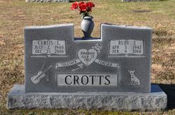
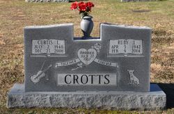
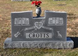
Ruby Jewell Simpson Crotts
| Birth | : | 5 Apr 1942 Surry County, North Carolina, USA |
| Death | : | 9 Feb 2014 Winston-Salem, Forsyth County, North Carolina, USA |
| Burial | : | Solid Rock Baptist Church Cemetery, Cana, Carroll County, USA |
| Coordinate | : | 36.5652400, -80.6357650 |
| Description | : | Mrs. Ruby Jewell Simpson Crotts age 71 of Cana, VA widow of Mr. Curtis Lee Crotts passed away Sunday, February 9, 2014 at Wake Forest University Baptist Medical Center. She was born April 5, 1942 in Surry County to the late Cecil Martin Simpson and Forest Eden Cook Simpson. She was retired from Spencer's Inc. and was a member of Solid Rock Baptist Church. Surviving are five sons Curtis Crotts, Jr. of Cana, VA, Tim Crotts, Bobby Lineback, Jimmy Lineback and Eddie Lineback all of Mt. Airy and a daughter, Fern Lineback Wall of Mt. Airy 11 grandchildren and six... Read More |
frequently asked questions (FAQ):
-
Where is Ruby Jewell Simpson Crotts's memorial?
Ruby Jewell Simpson Crotts's memorial is located at: Solid Rock Baptist Church Cemetery, Cana, Carroll County, USA.
-
When did Ruby Jewell Simpson Crotts death?
Ruby Jewell Simpson Crotts death on 9 Feb 2014 in Winston-Salem, Forsyth County, North Carolina, USA
-
Where are the coordinates of the Ruby Jewell Simpson Crotts's memorial?
Latitude: 36.5652400
Longitude: -80.6357650
Family Members:
Parent
Spouse
Siblings
Children
Nearby Cemetories:
1. Solid Rock Baptist Church Cemetery
Cana, Carroll County, USA
Coordinate: 36.5652400, -80.6357650
2. Glass Family Memorial Cemetery
Cana, Carroll County, USA
Coordinate: 36.5652280, -80.6357090
3. Speas Family Cemetery
Cana, Carroll County, USA
Coordinate: 36.5724564, -80.6447983
4. Epworth United Methodist Church Cemetery
Cana, Carroll County, USA
Coordinate: 36.5736110, -80.6536110
5. A.L. Jones Family Cemetery
Cana, Carroll County, USA
Coordinate: 36.5754410, -80.6561640
6. State Line Primitive Baptist Church Cemetery
Mount Airy, Surry County, USA
Coordinate: 36.5580000, -80.6117220
7. Westmoreland Cemetery
Cana, Carroll County, USA
Coordinate: 36.5850100, -80.6461990
8. Flat Ridge Baptist Church Cemetery
Cana, Carroll County, USA
Coordinate: 36.5867470, -80.6298910
9. Mount Carmel Baptist Church Cemetery
Mount Airy, Surry County, USA
Coordinate: 36.5432510, -80.6457214
10. Salem United Methodist Church Cemetery
Salem, Surry County, USA
Coordinate: 36.5430565, -80.6026077
11. Oak Ridge Baptist Church Cemetery
Cana, Carroll County, USA
Coordinate: 36.5718760, -80.6800790
12. Cana Baptist Church Cemetery
Cana, Carroll County, USA
Coordinate: 36.5920764, -80.6717347
13. Primitive Baptist Church Of Jesus Christ Cemetery
Cana, Carroll County, USA
Coordinate: 36.5917320, -80.6737210
14. Mount Bethel Moravian Graveyard
Cana, Carroll County, USA
Coordinate: 36.6053120, -80.6272700
15. Midway Baptist Church Cemetery
Mount Airy, Surry County, USA
Coordinate: 36.5254170, -80.6467220
16. Booker-Busick-Smith Cemetery
Mount Airy, Surry County, USA
Coordinate: 36.5302400, -80.6638700
17. Wisler Cemetery
Cana, Carroll County, USA
Coordinate: 36.5933240, -80.6756550
18. Zion United Methodist Cemetery
Mount Airy, Surry County, USA
Coordinate: 36.5326958, -80.6725845
19. Gunnell - Bowman - Fleming Cemetery
Ararat, Patrick County, USA
Coordinate: 36.5898540, -80.5866110
20. Shining Light Baptist Cemetery
Mount Airy, Surry County, USA
Coordinate: 36.5222206, -80.6586075
21. Willis Gap Baptist Church Cemetery
Ararat, Patrick County, USA
Coordinate: 36.5925140, -80.5850250
22. Ararat Cemetery
Mount Airy, Surry County, USA
Coordinate: 36.5307999, -80.5922012
23. Allen Cemetery
Cana, Carroll County, USA
Coordinate: 36.6155280, -80.6192210
24. Creasy Family Cemetery
Mount Airy, Surry County, USA
Coordinate: 36.5131389, -80.6359722


