Ruth A. Paulson Carter
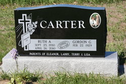
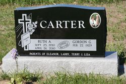
| Birth | : | 25 Sep 1930 Platte, Charles Mix County, South Dakota, USA |
| Death | : | 26 Apr 2010 Sioux Falls, Minnehaha County, South Dakota, USA |
| Burial | : | Saint James Lutheran Cemetery, Greenwich Township, Warren County, USA |
| Coordinate | : | 40.6814003, -75.1449966 |
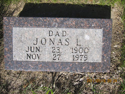
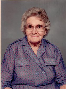
| Description | : | Ruth Ann (Paulson) Carter was born to parents, Jonas and Amber (Fotheringham) Paulson on Sept. 25, 1930 in Platte, SD. Ruth attended country school through the 8th grade and then went on to attend high school in Fergus Falls, MN at the Hillcrest Lutheran Academy. She was united in marriage to Gordon Carter on May 9, 1949 in Havre, MT. Together they farmed in Turner, MT until 1957 when they relocated their family to western Montana near Flathead Lake. They returned to Turner in 1963. In 1968 they purchased a farm in the Weme area near... Read More |
frequently asked questions (FAQ):
-
Where is Ruth A. Paulson Carter's memorial?
Ruth A. Paulson Carter's memorial is located at: Saint James Lutheran Cemetery, Greenwich Township, Warren County, USA.
-
When did Ruth A. Paulson Carter death?
Ruth A. Paulson Carter death on 26 Apr 2010 in Sioux Falls, Minnehaha County, South Dakota, USA
-
Where are the coordinates of the Ruth A. Paulson Carter's memorial?
Latitude: 40.6814003
Longitude: -75.1449966
Family Members:
Parent
Spouse
Siblings
Children
Flowers:
Nearby Cemetories:
1. Saint Philip and Saint James Cemetery
Greenwich Township, Warren County, USA
Coordinate: 40.6824989, -75.1457977
2. United Presbyterian Church Cemetery
Alpha, Warren County, USA
Coordinate: 40.6681200, -75.1562800
3. Saints Peter and Paul Byzantine Catholic Cemetery
Alpha, Warren County, USA
Coordinate: 40.6671982, -75.1556015
4. Saint Johns Russian Orthodox Cemetery
Alpha, Warren County, USA
Coordinate: 40.6670300, -75.1557700
5. Saint Marys Cemetery
Alpha, Warren County, USA
Coordinate: 40.6666700, -75.1554100
6. Stewartsville Cemetery
Stewartsville, Warren County, USA
Coordinate: 40.6907768, -75.1169128
7. Greenwich Cemetery
Greenwich Township, Warren County, USA
Coordinate: 40.6644440, -75.1168060
8. Stewartsville Lutheran Cemetery
Stewartsville, Warren County, USA
Coordinate: 40.6982384, -75.1051712
9. Saint Lukes Episcopal Church Chapel
Phillipsburg, Warren County, USA
Coordinate: 40.6965981, -75.1889267
10. Phillipsburg Cemetery
Phillipsburg, Warren County, USA
Coordinate: 40.6909409, -75.1918716
11. Old Saint Philip and Saint James Catholic Cemetery
Phillipsburg, Warren County, USA
Coordinate: 40.6907780, -75.1920170
12. Fairmount Cemetery
Phillipsburg, Warren County, USA
Coordinate: 40.6997032, -75.1925812
13. Old Phillipsburg Cemetery
Phillipsburg, Warren County, USA
Coordinate: 40.6892280, -75.1986280
14. Bnai Abraham Synagogue Cemetery #1
Easton, Northampton County, USA
Coordinate: 40.6810000, -75.2020000
15. Saint Anthony's Cemetery
Easton, Northampton County, USA
Coordinate: 40.6725006, -75.2022018
16. Bloomsbury Cemetery
Greenwich Township, Warren County, USA
Coordinate: 40.6552500, -75.0972200
17. Saint Mary Magdalen Cemetery
West Easton, Northampton County, USA
Coordinate: 40.6741982, -75.2086029
18. Trinity Episcopal Memorial Garden
Easton, Northampton County, USA
Coordinate: 40.6930730, -75.2083260
19. Saint John's Lutheran Church Cemetery
Easton, Northampton County, USA
Coordinate: 40.6890000, -75.2102500
20. Weller Free Church Cemetery
Willow Grove, Warren County, USA
Coordinate: 40.7042389, -75.0860367
21. Saint Bernard's Churchyard
Easton, Northampton County, USA
Coordinate: 40.6884000, -75.2126000
22. Saint Josephs New Cemetery
Williams Township, Northampton County, USA
Coordinate: 40.6731000, -75.2128000
23. Bloomsbury Presbyterian Cemetery
Bloomsbury, Hunterdon County, USA
Coordinate: 40.6539497, -75.0865173
24. Saint Josephs Catholic Church Cemetery
Easton, Northampton County, USA
Coordinate: 40.6826000, -75.2142000

