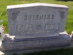
| Birth | : | 31 Mar 1917 Axtell, Kearney County, Nebraska, USA |
| Death | : | 18 Nov 2009 Gibbon, Buffalo County, Nebraska, USA |
| Burial | : | Canterbury Memorial Gardens and Crematorium, Bromley, Christchurch City, New Zealand |
| Coordinate | : | -43.5420790, 172.6893340 |
| Description | : | Ruth E. Lewis, of Shelton, Nebraska, departed this life and entered The Eternal Home on November 18, 2009, at Good Samaritan Society, Gibbon, Nebraska. Ruth was 92 years of age having been born on March 31, 1917, in Axtell, Nebraska to Guy and Anna (Rassmusen) Stienike. Ruth grew up in the Shelton, Nebraska area and received her education in Lexington, Nebraska graduating from Lexington (Nebraska) High School in The Class of 1935. She was united in marriage to Walter Lewis on August 11, 1940, in Minden, Nebraska. The couple resided in Shelton, Nebraska. Ruth was a member of... Read More |
frequently asked questions (FAQ):
-
Where is Ruth Elaine Stienike Lewis's memorial?
Ruth Elaine Stienike Lewis's memorial is located at: Canterbury Memorial Gardens and Crematorium, Bromley, Christchurch City, New Zealand.
-
When did Ruth Elaine Stienike Lewis death?
Ruth Elaine Stienike Lewis death on 18 Nov 2009 in Gibbon, Buffalo County, Nebraska, USA
-
Where are the coordinates of the Ruth Elaine Stienike Lewis's memorial?
Latitude: -43.5420790
Longitude: 172.6893340
Family Members:
Parent
Spouse
Siblings
Flowers:
Nearby Cemetories:
1. Canterbury Memorial Gardens and Crematorium
Bromley, Christchurch City, New Zealand
Coordinate: -43.5420790, 172.6893340
2. Bromley Cemetery
Bromley, Christchurch City, New Zealand
Coordinate: -43.5384980, 172.6862960
3. Canterbury Provincial Memorial
Bromley, Christchurch City, New Zealand
Coordinate: -43.5329620, 172.6896830
4. Ruru Lawn Cemetery
Bromley, Christchurch City, New Zealand
Coordinate: -43.5322470, 172.6918010
5. Memorial Park Cemetery
Bromley, Christchurch City, New Zealand
Coordinate: -43.5291840, 172.6877410
6. Linwood Cemetery
Linwood, Christchurch City, New Zealand
Coordinate: -43.5299220, 172.6828180
7. Woolston Cemetery
Woolston, Christchurch City, New Zealand
Coordinate: -43.5559770, 172.6825880
8. Avonside Anglican Cemetery
Avonside, Christchurch City, New Zealand
Coordinate: -43.5265780, 172.6585100
9. Blessed Sacrament Cathedral
Christchurch, Christchurch City, New Zealand
Coordinate: -43.5384250, 172.6458880
10. Barbadoes Street Cemetery
Christchurch, Christchurch City, New Zealand
Coordinate: -43.5230370, 172.6458760
11. All Saints Church Cemetery
Burwood, Christchurch City, New Zealand
Coordinate: -43.4999650, 172.6865820
12. Addington Cemetery
Addington, Christchurch City, New Zealand
Coordinate: -43.5434880, 172.6235790
13. Sydenham Cemetery
Sydenham, Christchurch City, New Zealand
Coordinate: -43.5582330, 172.6254900
14. Lyttelton Anglican Cemetery
Lyttelton, Christchurch City, New Zealand
Coordinate: -43.5985240, 172.7226520
15. Lyttelton Cemetery
Lyttelton, Christchurch City, New Zealand
Coordinate: -43.6018530, 172.7255220
16. St Paul's Anglican Church Cemetery
Papanui, Christchurch City, New Zealand
Coordinate: -43.4966540, 172.6067210
17. St Peter's Anglican Churchyard
Upper Riccarton, Christchurch City, New Zealand
Coordinate: -43.5317570, 172.5701330
18. Diamond Harbour Cemetery
Diamond Harbour, Christchurch City, New Zealand
Coordinate: -43.6237700, 172.7410400
19. Mount Magdala Cemetery
Halswell, Christchurch City, New Zealand
Coordinate: -43.5622700, 172.5672600
20. Waimairi Cemetery
Burnside, Christchurch City, New Zealand
Coordinate: -43.4997760, 172.5773860
21. St. Mary's Anglican Church Cemetery
Halswell, Christchurch City, New Zealand
Coordinate: -43.5794830, 172.5686440
22. Belfast Cemetery
Belfast, Christchurch City, New Zealand
Coordinate: -43.4532460, 172.6424400
23. St Cuthbert's Cemetery
Governors Bay, Christchurch City, New Zealand
Coordinate: -43.6326900, 172.6458000
24. Avonhead Memorial Cemetery
Avonhead, Christchurch City, New Zealand
Coordinate: -43.5095390, 172.5503920


