
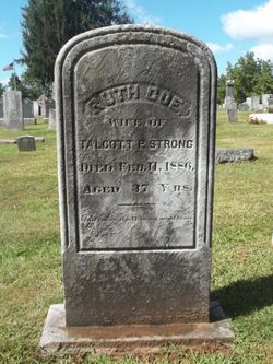
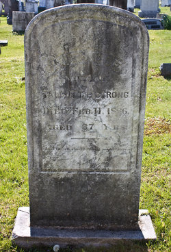
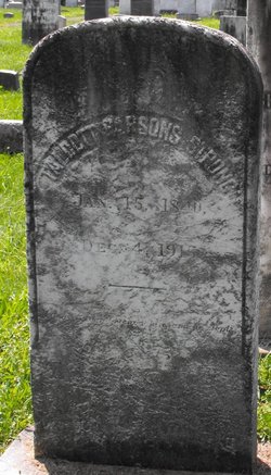
Ruth Ella Coe Tucker Strong
| Birth | : | 9 Jan 1849 Madison, New Haven County, Connecticut, USA |
| Death | : | 11 Feb 1886 Connecticut, USA |
| Burial | : | Terrace Park Cemetery, Kansas City, Clay County, USA |
| Coordinate | : | 39.2885017, -94.5888977 |
| Inscription | : | Wife of Talcott Parsons, age 37. |
| Description | : | Ruth Ella's maiden name was Tucker. Ruth and Talcott Strong had one daughter, Minnie. |
frequently asked questions (FAQ):
-
Where is Ruth Ella Coe Tucker Strong's memorial?
Ruth Ella Coe Tucker Strong's memorial is located at: Terrace Park Cemetery, Kansas City, Clay County, USA.
-
When did Ruth Ella Coe Tucker Strong death?
Ruth Ella Coe Tucker Strong death on 11 Feb 1886 in Connecticut, USA
-
Where are the coordinates of the Ruth Ella Coe Tucker Strong's memorial?
Latitude: 39.2885017
Longitude: -94.5888977
Family Members:
Parent


Spouse
Siblings
Flowers:


Nearby Cemetories:
1. Terrace Park Cemetery
Kansas City, Clay County, USA
Coordinate: 39.2885017, -94.5888977
2. Wilsons Cemetery
Barry, Clay County, USA
Coordinate: 39.2528800, -94.5982800
3. Second Creek Cemetery
Ferrelview, Platte County, USA
Coordinate: 39.3120995, -94.6287003
4. Gash Cemetery
Gashland, Clay County, USA
Coordinate: 39.2467613, -94.5848846
5. Barry Cemetery
Barry, Clay County, USA
Coordinate: 39.2444000, -94.5963974
6. Craig Cemetery
Clay County, USA
Coordinate: 39.2477112, -94.5638733
7. K.M. Woods Family Cemetery
Smithville, Clay County, USA
Coordinate: 39.3397300, -94.5906400
8. Corum-Judy Cemetery
Clay County, USA
Coordinate: 39.3343520, -94.5564480
9. Saint Anns Cemetery
Liberty, Clay County, USA
Coordinate: 39.3020401, -94.5231094
10. Resurrection Cemetery
Kansas City, Clay County, USA
Coordinate: 39.3013992, -94.5196991
11. Oak Grove Cemetery
Platte County, USA
Coordinate: 39.3396100, -94.6307800
12. Mount Olivet Christian Church Cemetery
Smithville, Clay County, USA
Coordinate: 39.3320150, -94.5286950
13. Faubion Cemetery
Gladstone, Clay County, USA
Coordinate: 39.2246017, -94.5617981
14. Pancake Cemetery
Platte County, USA
Coordinate: 39.3493996, -94.6299973
15. Mann-Vance-Young Burying Ground
Platte County, USA
Coordinate: 39.3544800, -94.6234900
16. Lynch Cemetery
Platte County, USA
Coordinate: 39.2591100, -94.6760100
17. Dixon Cemetery
Platte County, USA
Coordinate: 39.3542400, -94.6392200
18. Thatcher Cemetery
Smithville, Clay County, USA
Coordinate: 39.3662400, -94.5816800
19. Starks Cemetery
Clay County, USA
Coordinate: 39.2150210, -94.5464510
20. Church of the Redeemer
Kansas City, Platte County, USA
Coordinate: 39.2248800, -94.6603600
21. Line Creek Cemetery
Platte Woods, Platte County, USA
Coordinate: 39.2225990, -94.6584015
22. White Chapel Memorial Gardens
Gladstone, Clay County, USA
Coordinate: 39.2111015, -94.5372009
23. McEown Cemetery
Platte City, Platte County, USA
Coordinate: 39.3304100, -94.6888200
24. Brooks Cemetery
Smithville, Clay County, USA
Coordinate: 39.3753014, -94.5699997