
| Birth | : | 1 Sep 1918 Rutherford County, North Carolina, USA |
| Death | : | 5 Jul 2014 Greensboro, Guilford County, North Carolina, USA |
| Burial | : | Cedar Grove United Methodist Church Cemetery, Rutherford County, USA |
| Coordinate | : | 35.4506110, -81.8097540 |
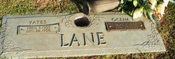
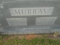
| Description | : | Ruth Lane Hardin Bost Ruth was the daughter of Clarence and Ella Lane. She was preceded in death by her husband Jack, and her parents; her brothers Howard, Yates, Rowell, Duard, Clarence, and Lewis; and sisters Foye Murray and Virle Earley. w/o Joseph R. Hardin, m. 12 Apr 1935, Bostic, Rutherford, North Carolina |
frequently asked questions (FAQ):
-
Where is Ruth Lane Bost's memorial?
Ruth Lane Bost's memorial is located at: Cedar Grove United Methodist Church Cemetery, Rutherford County, USA.
-
When did Ruth Lane Bost death?
Ruth Lane Bost death on 5 Jul 2014 in Greensboro, Guilford County, North Carolina, USA
-
Where are the coordinates of the Ruth Lane Bost's memorial?
Latitude: 35.4506110
Longitude: -81.8097540
Family Members:
Parent

Spouse
Siblings
Flowers:


Nearby Cemetories:
1. Mount Harmony Baptist Church Cemetery
Bostic, Rutherford County, USA
Coordinate: 35.4588380, -81.7996940
2. Ross Hill Baptist Church Cemetery
Bostic, Rutherford County, USA
Coordinate: 35.4575280, -81.7922220
3. Sunshine United Methodist Church Cemetery
Bostic, Rutherford County, USA
Coordinate: 35.4286930, -81.8132680
4. Mountain View Baptist Church Cemetery
Bostic, Rutherford County, USA
Coordinate: 35.4227630, -81.8080460
5. Hollifield Family Cemetery
Bostic, Rutherford County, USA
Coordinate: 35.4203956, -81.8117291
6. Mount Lebanon Cemetery
Rutherford County, USA
Coordinate: 35.4319000, -81.8414001
7. Cooper Springs Congregational Holiness Church Ceme
Rutherford County, USA
Coordinate: 35.4755700, -81.7844540
8. Sandy Level Baptist Cemetery
Bostic, Rutherford County, USA
Coordinate: 35.4591400, -81.8520440
9. Sweezy-Murray Family Cemetery
Rutherford County, USA
Coordinate: 35.4432090, -81.7671363
10. Wilson Baptist Cemetery
Forest City, Rutherford County, USA
Coordinate: 35.4257164, -81.8531723
11. Cansler Cemetery
Sunshine, Rutherford County, USA
Coordinate: 35.4082600, -81.8350400
12. Duggar Freeman Cemetery
Rutherford County, USA
Coordinate: 35.4247780, -81.8585810
13. Salem United Methodist Church Cemetery
Washburn, Rutherford County, USA
Coordinate: 35.4000015, -81.7985992
14. Golden Valley Missionary Methodist Church Cemetery
Bostic, Rutherford County, USA
Coordinate: 35.4961700, -81.7678800
15. Cherry Mountain Freewill Baptist Cemetery
Washburn, Rutherford County, USA
Coordinate: 35.3929060, -81.7902790
16. Brittain Cemetery
Rutherfordton, Rutherford County, USA
Coordinate: 35.4530983, -81.8861008
17. Pisgah United Methodist Church Cemetery
Rutherfordton, Rutherford County, USA
Coordinate: 35.4770130, -81.8799750
18. New Vernon Baptist Cemetery
Bostic, Rutherford County, USA
Coordinate: 35.3958320, -81.8497430
19. Robertson Creek Freewill Baptist Cemetery
Bostic, Rutherford County, USA
Coordinate: 35.3937840, -81.8465540
20. Westminister Baptist Church Cemetery
Rutherfordton, Rutherford County, USA
Coordinate: 35.4647750, -81.8927880
21. Fortune Cemetery
Rutherford County, USA
Coordinate: 35.5092010, -81.7647018
22. Duncans Creek Presbyterian Church Cemetery
Hollis, Rutherford County, USA
Coordinate: 35.4742680, -81.7276620
23. Golden Valley United Methodist Church Cemetery
Bostic, Rutherford County, USA
Coordinate: 35.5203018, -81.7900009
24. Walls Baptist Church Cemetery
Bostic, Rutherford County, USA
Coordinate: 35.3843141, -81.7757392