| Birth | : | 18 Nov 1919 Phelps County, Nebraska, USA |
| Death | : | 8 Oct 2011 Springfield, Greene County, Missouri, USA |
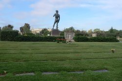
| Burial | : | Pine Grove Cemetery, Warren, Worcester County, USA |
| Coordinate | : | 42.2097015, -72.1971970 |
| Description | : | Ruth Laurbelle (Broberg) Johnson, 91 years of age, of Springfield, Missouri (formerly of Long Beach, California) passed away on Saturday, October 8, 2011 at her home in Springfield, MO. Ruth was born November 18, 1919 on the family farm in Phelps County, Nebraska, one of nine children born to John "J.G." and Hilma (Peterson) Broberg. On April 9, 1938, she was united in marriage to Paul Oscar Johnson in Oberlin, Kansas. In May 1947 after Paul returned from World War II, they bought a home in Long Beach and remained there until they moved to Springfield, Missouri in 1995. In 1947, her... Read More |
frequently asked questions (FAQ):
-
Where is Ruth Laurbelle Broberg Johnson's memorial?
Ruth Laurbelle Broberg Johnson's memorial is located at: Pine Grove Cemetery, Warren, Worcester County, USA.
-
When did Ruth Laurbelle Broberg Johnson death?
Ruth Laurbelle Broberg Johnson death on 8 Oct 2011 in Springfield, Greene County, Missouri, USA
-
Where are the coordinates of the Ruth Laurbelle Broberg Johnson's memorial?
Latitude: 42.2097015
Longitude: -72.1971970
Family Members:
Parent
Spouse
Siblings
Flowers:
Nearby Cemetories:
1. Pine Grove Cemetery
Warren, Worcester County, USA
Coordinate: 42.2097015, -72.1971970
2. Saint Pauls Cemetery
Warren, Worcester County, USA
Coordinate: 42.2069016, -72.1999969
3. Sacred Heart Cemetery
West Brookfield, Worcester County, USA
Coordinate: 42.2334900, -72.1517300
4. Old Indian Cemetery
West Brookfield, Worcester County, USA
Coordinate: 42.2372600, -72.1456500
5. Pine Grove Cemetery
West Brookfield, Worcester County, USA
Coordinate: 42.2382960, -72.1406610
6. Saint Marys Cemetery
Ware, Hampshire County, USA
Coordinate: 42.2472000, -72.2438965
7. Millbrook Road Cemetery
West Brimfield, Hampden County, USA
Coordinate: 42.1746470, -72.2581020
8. Walnut Grove Cemetery
Ware, Hampshire County, USA
Coordinate: 42.2623430, -72.2367810
9. Taylor Cemetery
West Brookfield, Worcester County, USA
Coordinate: 42.2695300, -72.1839700
10. Brookfield Cemetery
Brookfield, Worcester County, USA
Coordinate: 42.2181015, -72.1156006
11. Old Saint William Cemetery
Ware, Hampshire County, USA
Coordinate: 42.2582380, -72.2472420
12. West Street Burial Ground
Ware, Hampshire County, USA
Coordinate: 42.2533800, -72.2554700
13. South Warren Cemetery
Warren, Worcester County, USA
Coordinate: 42.1609300, -72.1461700
14. Holy Cross Polish National Catholic Cemetery
Ware, Hampshire County, USA
Coordinate: 42.2595300, -72.2508200
15. New Saint William Cemetery
Ware, Hampshire County, USA
Coordinate: 42.2597400, -72.2526400
16. Aspen Grove Cemetery
Ware, Hampshire County, USA
Coordinate: 42.2653008, -72.2450027
17. Mount Carmel Cemetery
Ware, Hampshire County, USA
Coordinate: 42.2694016, -72.2491989
18. Methodist Cemetery
West Brookfield, Worcester County, USA
Coordinate: 42.2833700, -72.2061400
19. Old West Brookfield Road Cemetery
North Brookfield, Worcester County, USA
Coordinate: 42.2545500, -72.1137600
20. West Brimfield Cemetery
Brimfield, Hampden County, USA
Coordinate: 42.1320526, -72.1984542
21. Ware Center Cemetery
Ware, Hampshire County, USA
Coordinate: 42.2641180, -72.2744130
22. Little Alum Pond Cemetery
Brimfield, Hampden County, USA
Coordinate: 42.1362750, -72.1537020
23. West Cemetery
Ware, Hampshire County, USA
Coordinate: 42.2651860, -72.2757270
24. Palmer Center Cemetery
Palmer, Hampden County, USA
Coordinate: 42.1819000, -72.3125000


