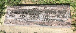
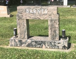
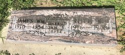
Ruth Marguerite Hanna Barnes
| Birth | : | 26 Jul 1916 Reynolds, White County, Indiana, USA |
| Death | : | 16 Apr 1990 Highland, Lake County, Indiana, USA |
| Burial | : | Lingwick Protestant Cemetery, Gould, Estrie Region, Canada |
| Coordinate | : | 45.5939200, -71.3728100 |
| Description | : | Ruth M. Barnes MONTICELLO — Ruth M. Barnes, 73, of 405 E. Cleveland St., died at 2 a.m. Monday in the home of her son. Born July 26, 1916, in Reynolds, she was the daughter of Fred and Nellie Snyder Hanna. On Jan. 3, 1934, in Michigan City, she was married to James W. "Jim" Barnes, who died June 24,1984. She had lived in Monticello since 1947, moving from Michigan City. She retired after 30 years of employment with Bryan Manufacturing Co. She was a member of Monticello United Methodist Church. Surviving are one son, Bill, Highland; three sisters, Helen Pliske, Alferetta Schepaneck, and Betty Ann... Read More |
frequently asked questions (FAQ):
-
Where is Ruth Marguerite Hanna Barnes's memorial?
Ruth Marguerite Hanna Barnes's memorial is located at: Lingwick Protestant Cemetery, Gould, Estrie Region, Canada.
-
When did Ruth Marguerite Hanna Barnes death?
Ruth Marguerite Hanna Barnes death on 16 Apr 1990 in Highland, Lake County, Indiana, USA
-
Where are the coordinates of the Ruth Marguerite Hanna Barnes's memorial?
Latitude: 45.5939200
Longitude: -71.3728100
Family Members:
Parent
Spouse
Siblings
Children
Flowers:
Nearby Cemetories:
1. Lingwick Protestant Cemetery
Gould, Estrie Region, Canada
Coordinate: 45.5939200, -71.3728100
2. St-Thomas Bown Anglican Cemetery
Bury, Estrie Region, Canada
Coordinate: 45.4802800, -71.4184700
3. Grace United Cemetery
Brookbury, Estrie Region, Canada
Coordinate: 45.5397500, -71.5393100
4. Dell Cemetery
Dell, Estrie Region, Canada
Coordinate: 45.5921200, -71.1730400
5. Saint John Cemetery
Brookbury, Estrie Region, Canada
Coordinate: 45.5092400, -71.5454850
6. Saint Paul Anglican Cemetery
Marbleton, Estrie Region, Canada
Coordinate: 45.6279800, -71.5830200
7. Marbleton Methodist Cemetery
Marbleton, Estrie Region, Canada
Coordinate: 45.6277600, -71.5838500
8. Bury Cemetery
Bury, Estrie Region, Canada
Coordinate: 45.4697100, -71.4971300
9. Cimetière Saint-Raphaël
Bury, Estrie Region, Canada
Coordinate: 45.4731590, -71.5071190
10. Cimetière Saint-Adolphe
Dudswell, Estrie Region, Canada
Coordinate: 45.6402330, -71.5855970
11. Lakeside Cemetery
Dudswell, Estrie Region, Canada
Coordinate: 45.5868000, -71.5955000
12. Cimetière Saint-Clément Bishopton
Dudswell, Estrie Region, Canada
Coordinate: 45.5850500, -71.5995400
13. Lothrop Cemetery
Bishopton, Estrie Region, Canada
Coordinate: 45.5843170, -71.6009770
14. Dudswell Center Cemetery
Bishopton, Estrie Region, Canada
Coordinate: 45.5845160, -71.6012720
15. McIver-Beaton Cemetery
Milan, Estrie Region, Canada
Coordinate: 45.5973600, -71.1414300
16. Gisla Cemetery
Milan, Estrie Region, Canada
Coordinate: 45.6342000, -71.1448000
17. Cimetière Saint-Ambroise
Milan, Estrie Region, Canada
Coordinate: 45.5902820, -71.1007630
18. Thompson Burial Ground Memorial
Ham-Sud, Estrie Region, Canada
Coordinate: 45.7285000, -71.5951640
19. Cimetière Saint-Pierre
La Patrie, Estrie Region, Canada
Coordinate: 45.4011740, -71.2623790
20. Cimetière Saint-Jacques le Mineur
Cookshire-Eaton, Estrie Region, Canada
Coordinate: 45.3912260, -71.4778960
21. Island Brook Cemetery
Cookshire-Eaton, Estrie Region, Canada
Coordinate: 45.3881000, -71.4744800
22. Cimetière Saint-Louis
East Angus, Estrie Region, Canada
Coordinate: 45.5046560, -71.6596360
23. Cimetière Saint-Joseph
Ham-Sud, Estrie Region, Canada
Coordinate: 45.7573120, -71.5994590
24. Cimetière Saint-Camille
Cookshire-Eaton, Estrie Region, Canada
Coordinate: 45.4221800, -71.6088700

