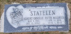
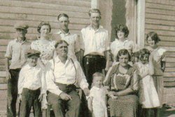
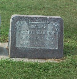
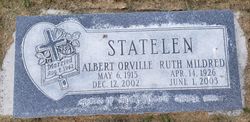
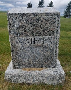
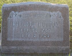
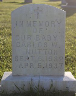
Ruth Mildred Hutton Statelen
| Birth | : | 14 Apr 1926 Turner, Blaine County, Montana, USA |
| Death | : | 1 Jun 2003 Lewistown, Fergus County, Montana, USA |
| Burial | : | Oak Grove Cemetery, Manistee, Manistee County, USA |
| Coordinate | : | 44.2655983, -86.3202972 |
| Description | : | Ruth Mildred Statelen, 77, a Havre resident, died Sunday, June 1, 2003, at a Lewistown medical center. Funeral services were held at the Fifth Avenue Christian Church. Interment at the Wing Cemetery. Ruth was born in Turner to William and Hazel Hutton on April 14, 1926. Ruth married Albert Orville Statelen on Aug. 7, 1942, and they enjoyed 60 years together. She worked hand in hand with her husband on the farm. In the late 1950s, Ruth and her sister, Esther, operated the Turner Cafè. After moving to Havre in 1960, she worked alongside Al in his massage therapy practice. Ruth loved... Read More |
frequently asked questions (FAQ):
-
Where is Ruth Mildred Hutton Statelen's memorial?
Ruth Mildred Hutton Statelen's memorial is located at: Oak Grove Cemetery, Manistee, Manistee County, USA.
-
When did Ruth Mildred Hutton Statelen death?
Ruth Mildred Hutton Statelen death on 1 Jun 2003 in Lewistown, Fergus County, Montana, USA
-
Where are the coordinates of the Ruth Mildred Hutton Statelen's memorial?
Latitude: 44.2655983
Longitude: -86.3202972
Family Members:
Parent
Spouse
Siblings
Children
Flowers:
Nearby Cemetories:
1. Oak Grove Cemetery
Manistee, Manistee County, USA
Coordinate: 44.2655983, -86.3202972
2. Mount Carmel Cemetery
Manistee, Manistee County, USA
Coordinate: 44.2297220, -86.3258330
3. Trinity Cemetery
Manistee, Manistee County, USA
Coordinate: 44.2257996, -86.3264008
4. Old Stronach Cemetery
Stronach Township, Manistee County, USA
Coordinate: 44.2071991, -86.2433014
5. Miller Cemetery
Brown Township, Manistee County, USA
Coordinate: 44.2943993, -86.1766968
6. Long Lake Cemetery
Grant Township, Mason County, USA
Coordinate: 44.1567001, -86.3003006
7. Norwalk Lutheran Church Cemetery
Brown Township, Manistee County, USA
Coordinate: 44.3247220, -86.1800000
8. Old School House Cemetery
Brown Township, Manistee County, USA
Coordinate: 44.3316994, -86.1564026
9. Onekama Village Cemetery
Onekama Township, Manistee County, USA
Coordinate: 44.3731003, -86.2016983
10. Saint Joseph Cemetery
Onekama Township, Manistee County, USA
Coordinate: 44.3739014, -86.2018967
11. Riverview Cemetery
Brown Township, Manistee County, USA
Coordinate: 44.2980995, -86.1307983
12. Grant Township Cemetery
Grant Township, Mason County, USA
Coordinate: 44.1088982, -86.2902985
13. Maple Grove Cemetery
Free Soil, Mason County, USA
Coordinate: 44.1091995, -86.2517014
14. Onekama Village Cemetery #2
Onekama Township, Manistee County, USA
Coordinate: 44.4102730, -86.2026770
15. Bertelson Cemetery
Onekama Township, Manistee County, USA
Coordinate: 44.4110718, -86.2020264
16. Bear Lake Township Cemetery
Bear Lake Township, Manistee County, USA
Coordinate: 44.3885750, -86.1427250
17. Saint John Cantius Cemetery
Free Soil, Mason County, USA
Coordinate: 44.1061310, -86.2090090
18. Pleasant View Cemetery
Brown Township, Manistee County, USA
Coordinate: 44.3279810, -86.0803110
19. North Victory Cemetery
Victory Township, Mason County, USA
Coordinate: 44.0802900, -86.3559000
20. Fairview Cemetery
Bear Lake Township, Manistee County, USA
Coordinate: 44.4180572, -86.1609210
21. Fairview Cemetery South Annex
Bear Lake Township, Manistee County, USA
Coordinate: 44.4172830, -86.1593240
22. Meade Cemetery
Free Soil, Mason County, USA
Coordinate: 44.1122017, -86.1466980
23. Corfu Cemetery
Brethren, Manistee County, USA
Coordinate: 44.2756004, -86.0417023
24. Conway Cemetery
Arcadia Township, Manistee County, USA
Coordinate: 44.4575005, -86.2230988

