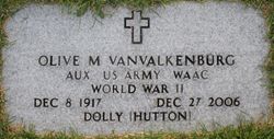
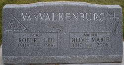
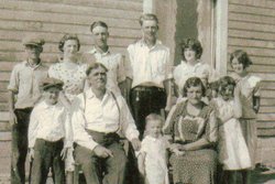
Olive Marie “Dolly” Hutton VanValkenburg
| Birth | : | 8 Dec 1917 Alameda, Estevan Census Division, Saskatchewan, Canada |
| Death | : | 27 Dec 2006 Havre, Hill County, Montana, USA |
| Burial | : | Turner Cemetery, Turner, Blaine County, USA |
| Coordinate | : | 48.8610001, -108.4120026 |
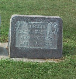
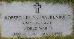
| Description | : | Olive Marie "Dolly" VanValkenburg, 89, died Wednesday, Dec. 27, 2006, at Northern Montana Care Center of natural causes. Her funeral service will be held Saturday at 11 a.m. in the Fifth Avenue Christian Church with burial following in the Turner Cemetery at 3 p.m. with military honors. Dolly was born in Alameda, Saskatchewan, Canada, on Dec. 8, 1917, to William Denny and Hazel (Pierson) Hutton. The family homesteaded north of Turner and in 1920 Olive became a naturalized United States citizen. She attended the Petrie School and graduated in 1935 from Turner High School. She worked as a waitress in... Read More |
frequently asked questions (FAQ):
-
Where is Olive Marie “Dolly” Hutton VanValkenburg's memorial?
Olive Marie “Dolly” Hutton VanValkenburg's memorial is located at: Turner Cemetery, Turner, Blaine County, USA.
-
When did Olive Marie “Dolly” Hutton VanValkenburg death?
Olive Marie “Dolly” Hutton VanValkenburg death on 27 Dec 2006 in Havre, Hill County, Montana, USA
-
Where are the coordinates of the Olive Marie “Dolly” Hutton VanValkenburg's memorial?
Latitude: 48.8610001
Longitude: -108.4120026
Family Members:
Parent
Spouse
Siblings
Flowers:
Nearby Cemetories:
1. Turner Cemetery
Turner, Blaine County, USA
Coordinate: 48.8610001, -108.4120026
2. Turner Colony Cemetery
Turner Colony, Blaine County, USA
Coordinate: 48.7595000, -108.4369000
3. Wing Cemetery
Hogeland, Blaine County, USA
Coordinate: 48.8125000, -108.5860000
4. Silver Bow Cemetery
Hogeland, Blaine County, USA
Coordinate: 48.8870000, -108.7160000
5. Loring Colony Cemetery
Loring, Phillips County, USA
Coordinate: 48.7879148, -107.9747077
6. Bethel Lutheran Cemetery
Frontier, Maple Creek Census Division, Canada
Coordinate: 49.1447730, -108.5891890
7. North Harlem Colony Cemetery
North Harlem Colony, Blaine County, USA
Coordinate: 48.5855560, -108.7558330
8. Climax Cemetery
Climax, Maple Creek Census Division, Canada
Coordinate: 49.2177000, -108.3832600
9. Bracken Cemetery
Bracken, Maple Creek Census Division, Canada
Coordinate: 49.1751700, -108.1147000
10. Frontier Municipal Cemetery
Frontier, Maple Creek Census Division, Canada
Coordinate: 49.2038040, -108.6506010
11. Harlem Cemetery
Harlem, Blaine County, USA
Coordinate: 48.5444700, -108.7817200
12. Waldville Cemetery
Climax, Maple Creek Census Division, Canada
Coordinate: 49.2617900, -108.2928800
13. Fort Belknap Cemetery
Harlem, Blaine County, USA
Coordinate: 48.4347210, -108.5595860
14. Sacred Heart Catholic Cemetery
Fort Belknap Agency, Blaine County, USA
Coordinate: 48.4489000, -108.6582000
15. Agency Cemetery
Fort Belknap Agency, Blaine County, USA
Coordinate: 48.4767000, -108.7702000
16. Hillside Cemetery
Dodson, Phillips County, USA
Coordinate: 48.4122009, -108.2352982
17. Orkney Cemetery
Orkney, Maple Creek Census Division, Canada
Coordinate: 49.1457130, -107.8533630
18. Ridgley Cemetery
Frontier, Maple Creek Census Division, Canada
Coordinate: 49.3202760, -108.5628280
19. Graveyard Hill Cemetery
Phillips County, USA
Coordinate: 48.3847008, -108.3638992
20. Bethel Bruderthaler Mennonite Church Cemetery
Chinook, Blaine County, USA
Coordinate: 48.7552000, -109.1345000
21. Masefield Cemetery
Val Marie, Maple Creek Census Division, Canada
Coordinate: 49.1519450, -107.8100840
22. Zurich Cemetery
Zurich, Blaine County, USA
Coordinate: 48.5900000, -109.0459000
23. Divide Cemetery
Divide, Maple Creek Census Division, Canada
Coordinate: 49.1455840, -109.0491690
24. Hollandville Cemetery
Chinook, Blaine County, USA
Coordinate: 48.6960310, -109.1557200

