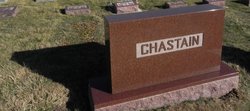
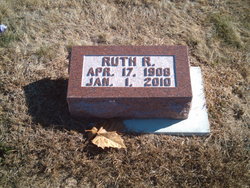
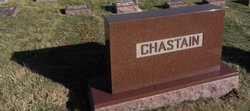
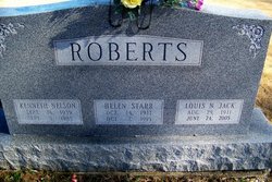
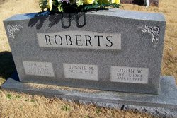
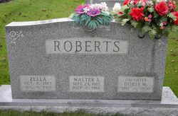
Ruth Roberts Chastain
| Birth | : | 17 Apr 1908 Lawrence County, Indiana, USA |
| Death | : | 1 Jan 2010 Bedford, Lawrence County, Indiana, USA |
| Burial | : | Ryhope Cemetery, Ryhope, Metropolitan Borough of Sunderland, England |
| Coordinate | : | 54.8681320, -1.3708760 |
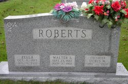
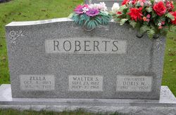
| Description | : | Daughter of Lewis Walter Stuart Roberts & Zella Ann Orpha Shroyer. Ruth Roberts married Clarence Cleo Chastain on 13 Aug 1927 in Lawrenceport, Lawrence, Indiana. This union was blessed with one daughter and 2 sons. Perhaps one of the kindest people I have had the privilege to meet. |
frequently asked questions (FAQ):
-
Where is Ruth Roberts Chastain's memorial?
Ruth Roberts Chastain's memorial is located at: Ryhope Cemetery, Ryhope, Metropolitan Borough of Sunderland, England.
-
When did Ruth Roberts Chastain death?
Ruth Roberts Chastain death on 1 Jan 2010 in Bedford, Lawrence County, Indiana, USA
-
Where are the coordinates of the Ruth Roberts Chastain's memorial?
Latitude: 54.8681320
Longitude: -1.3708760
Family Members:
Parent
Spouse
Siblings
Children
Flowers:

I will always remember our time together. How you spoke so kindly of Grandpa Jean and how willing you were to share your Roberts linage. Yours was a life well lived. Will love ...
Left by Anonymous on 02 Nov 2010

Left by Anonymous on 31 Dec 2010

thinking of you ....
Left by Anonymous on 05 Jan 2011

For a wonderful lady .... with love.
Left by Anonymous on 19 Jan 2011

Left by Anonymous on 20 Jan 2011
Left by Anonymous on 07 Sep 2011
Nearby Cemetories:
1. Ryhope Cemetery
Ryhope, Metropolitan Borough of Sunderland, England
Coordinate: 54.8681320, -1.3708760
2. Sunderland Cemetery
Sunderland, Metropolitan Borough of Sunderland, England
Coordinate: 54.8833700, -1.3660100
3. St Leonard RC
Silksworth, Metropolitan Borough of Sunderland, England
Coordinate: 54.8736400, -1.3971900
4. St Matthew's Churchyard
Silksworth, Metropolitan Borough of Sunderland, England
Coordinate: 54.8707006, -1.4090075
5. Seaham Cemetery
Seaham, Durham Unitary Authority, England
Coordinate: 54.8493205, -1.3414431
6. St Mary's Churchyard
Seaham, Durham Unitary Authority, England
Coordinate: 54.8475590, -1.3435800
7. Christchurch Graveyard
Seaham, Durham Unitary Authority, England
Coordinate: 54.8414660, -1.3614550
8. St. John the Evangelist Churchyard
Seaham, Durham Unitary Authority, England
Coordinate: 54.8362792, -1.3363791
9. Sunderland Friends Burial Ground
Sunderland, Metropolitan Borough of Sunderland, England
Coordinate: 54.9059650, -1.3768230
10. St. Thomas' Church
Sunderland, Metropolitan Borough of Sunderland, England
Coordinate: 54.9066294, -1.3804475
11. Princess Road Cemetery
Seaham, Durham Unitary Authority, England
Coordinate: 54.8334800, -1.3394080
12. St Michael's Minster Church
Sunderland, Metropolitan Borough of Sunderland, England
Coordinate: 54.9059555, -1.3887787
13. Holy Trinity Church Burial
Sunderland, Metropolitan Borough of Sunderland, England
Coordinate: 54.9077830, -1.3688030
14. Sunderland Crematorium
Sunderland, Metropolitan Borough of Sunderland, England
Coordinate: 54.8970430, -1.4216890
15. Galley's Gill Cemetery
Sunderland, Metropolitan Borough of Sunderland, England
Coordinate: 54.9082914, -1.3913108
16. Bishopwearmouth Cemetery
Bishopwearmouth, Metropolitan Borough of Sunderland, England
Coordinate: 54.8996124, -1.4206740
17. St Andrew's Church
Dalton-le-Dale, Durham Unitary Authority, England
Coordinate: 54.8255000, -1.3665000
18. Jewish Burial Ground
Ayre's Quay, Metropolitan Borough of Sunderland, England
Coordinate: 54.9115200, -1.3960100
19. St Cuthbert's Churchyard
New Herrington, Metropolitan Borough of Sunderland, England
Coordinate: 54.8708720, -1.4579010
20. Holy Trinity Churchyard
Murton, Durham Unitary Authority, England
Coordinate: 54.8159880, -1.3899430
21. St Joseph's Roman Catholic Churchyard
Murton, Durham Unitary Authority, England
Coordinate: 54.8155960, -1.3888230
22. Murton Cemetery
Murton, Durham Unitary Authority, England
Coordinate: 54.8153330, -1.3916320
23. St Aidan Churchyard
New Herrington, Metropolitan Borough of Sunderland, England
Coordinate: 54.8693700, -1.4680430
24. Holy Trinity Churchyard
Southwick, Metropolitan Borough of Sunderland, England
Coordinate: 54.9203120, -1.4060260

