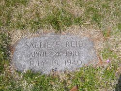
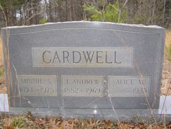
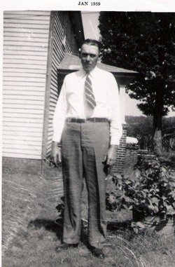
Sallie E. Cardwell Reid
| Birth | : | 4 Apr 1910 Rockingham County, North Carolina, USA |
| Death | : | 19 Jul 1940 Rockingham County, North Carolina, USA |
| Burial | : | Shady Grove Cemetery, Portola, Plumas County, USA |
| Coordinate | : | 39.8072014, -120.4593964 |
frequently asked questions (FAQ):
-
Where is Sallie E. Cardwell Reid's memorial?
Sallie E. Cardwell Reid's memorial is located at: Shady Grove Cemetery, Portola, Plumas County, USA.
-
When did Sallie E. Cardwell Reid death?
Sallie E. Cardwell Reid death on 19 Jul 1940 in Rockingham County, North Carolina, USA
-
Where are the coordinates of the Sallie E. Cardwell Reid's memorial?
Latitude: 39.8072014
Longitude: -120.4593964
Family Members:
Parent
Spouse
Children
Flowers:
Nearby Cemetories:
1. Shady Grove Cemetery
Portola, Plumas County, USA
Coordinate: 39.8072014, -120.4593964
2. Whispering Pines Cemetery
Beckworth, Plumas County, USA
Coordinate: 39.8252983, -120.4180984
3. Westside-Sharkey Cemetery
Beckworth, Plumas County, USA
Coordinate: 39.7378006, -120.3867035
4. Summers Family Cemetery
Calpine, Sierra County, USA
Coordinate: 39.6861940, -120.4355350
5. Mohawk Cemetery
Mohawk, Plumas County, USA
Coordinate: 39.7791060, -120.6384200
6. Johnsville Cemetery
Johnsville, Plumas County, USA
Coordinate: 39.7627983, -120.6913986
7. Cromberg Cemetery
Cromberg, Plumas County, USA
Coordinate: 39.8535995, -120.6947021
8. Sattley Cemetery
Sattley, Sierra County, USA
Coordinate: 39.6214000, -120.4225500
9. Mountain View Cemetery
Loyalton, Sierra County, USA
Coordinate: 39.6718490, -120.2496190
10. Vinton Cemetery
Vinton, Plumas County, USA
Coordinate: 39.8011017, -120.1592026
11. Sierraville Cemetery
Sierraville, Sierra County, USA
Coordinate: 39.5842018, -120.3786011
12. Chilcoot Cemetery
Chilcoot, Plumas County, USA
Coordinate: 39.7966800, -120.1254400
13. Sierra City Cemetery
Sierra City, Sierra County, USA
Coordinate: 39.5663900, -120.6408300
14. Andrew J Brineger Gravesite
Quincy, Plumas County, USA
Coordinate: 39.8380230, -120.8486450
15. Davis Family Cemetery
Genesee, Plumas County, USA
Coordinate: 40.0648010, -120.6877290
16. Whiskey Diggings Cemetery
Sierra County, USA
Coordinate: 39.7504200, -120.8868700
17. Howland Flat Cemetery
Howland Flat, Sierra County, USA
Coordinate: 39.7152500, -120.8821900
18. Shims Flat Indian Burial Ground
Taylorsville, Plumas County, USA
Coordinate: 40.0499992, -120.7780991
19. Long Valley Cemetery
Doyle, Lassen County, USA
Coordinate: 40.0268400, -120.1087300
20. Pine Grove Cemetery
Sierra County, USA
Coordinate: 39.7174988, -120.8983002
21. Gibsonville Cemetery
Gibsonville, Sierra County, USA
Coordinate: 39.7448700, -120.9097100
22. East Lawn Cemetery
Quincy, Plumas County, USA
Coordinate: 39.9336014, -120.9088974
23. Milford Cemetery
Milford, Lassen County, USA
Coordinate: 40.1712500, -120.3758500
24. Downieville Cemetery
Downieville, Sierra County, USA
Coordinate: 39.5676700, -120.8252390


