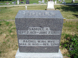
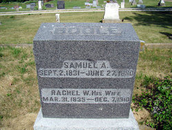
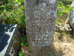
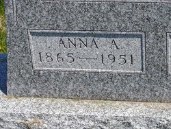
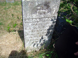
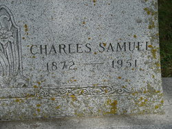
Samuel A Bogle
| Birth | : | 2 Sep 1831 Perry County, Ohio, USA |
| Death | : | 27 Jun 1890 Birmingham, Van Buren County, Iowa, USA |
| Burial | : | Maple Hill Cemetery, Birmingham, Van Buren County, USA |
| Coordinate | : | 40.8778020, -91.9354496 |
| Plot | : | Section 4 Row 14 |
| Description | : | Husband of Rachel Wilson Bogle. ----------- From the History of Jefferson County - 1912, Volume II, Pages 41-43. "....Samuel and Rachel (Wilson) Bogle, both of whom were natives of Perry county, Ohio; the former was born in 1832 (sic. 1831) and the latter in 1835. In 1856 they came to Iowa, locating in Lee county. The following year witnessed their removal to Van Buren county, where they continued to reside throughout the remainder of their lives. Samuel Bogle followed farming until 1867, when he took up his abode in Birmingham, Iowa, there living retired until called to his final rest on the... Read More |
frequently asked questions (FAQ):
-
Where is Samuel A Bogle's memorial?
Samuel A Bogle's memorial is located at: Maple Hill Cemetery, Birmingham, Van Buren County, USA.
-
When did Samuel A Bogle death?
Samuel A Bogle death on 27 Jun 1890 in Birmingham, Van Buren County, Iowa, USA
-
Where are the coordinates of the Samuel A Bogle's memorial?
Latitude: 40.8778020
Longitude: -91.9354496
Family Members:
Spouse
Children
Flowers:
Nearby Cemetories:
1. Maple Hill Cemetery
Birmingham, Van Buren County, USA
Coordinate: 40.8778020, -91.9354496
2. Methodist Episcopal Cemetery
Birmingham, Van Buren County, USA
Coordinate: 40.8788000, -91.9427000
3. United Presbyterian Cemetery
Birmingham, Van Buren County, USA
Coordinate: 40.8796000, -91.9438000
4. Parkerville Cemetery
Birmingham, Van Buren County, USA
Coordinate: 40.8666920, -91.9001710
5. Smith Cemetery
Birmingham, Van Buren County, USA
Coordinate: 40.8807983, -91.8964005
6. Clinkinbeard Family Cemetery
Libertyville, Jefferson County, USA
Coordinate: 40.9083300, -91.9583300
7. Winchester Cemetery
Winchester, Van Buren County, USA
Coordinate: 40.8499985, -91.9047012
8. Topping Cemetery
Stockport, Van Buren County, USA
Coordinate: 40.8500000, -91.8879670
9. Thompson Cemetery
Jefferson County, USA
Coordinate: 40.9155998, -91.9772034
10. Bethel Cemetery
Birmingham, Van Buren County, USA
Coordinate: 40.8967018, -92.0056000
11. Cumberland Cemetery
Jefferson County, USA
Coordinate: 40.9248000, -91.9903000
12. Pattison Cemetery
Fairfield, Jefferson County, USA
Coordinate: 40.9444008, -91.9049988
13. Fordyce Cemetery
Stockport, Van Buren County, USA
Coordinate: 40.8388000, -91.8556000
14. White Chapel Cemetery
Birmingham, Van Buren County, USA
Coordinate: 40.8417015, -92.0203018
15. Wiley Pioneer Cemetery
Jefferson County, USA
Coordinate: 40.9087000, -91.8457000
16. Kilbourne Cemetery
Van Buren County, USA
Coordinate: 40.8045000, -91.9705000
17. Jefferson County Poor Farm Cemetery
Libertyville, Jefferson County, USA
Coordinate: 40.9416900, -91.9996200
18. Miller Chapel Cemetery
Mount Zion, Van Buren County, USA
Coordinate: 40.8045000, -91.8905000
19. Roth Cemetery
Fairfield, Jefferson County, USA
Coordinate: 40.9589005, -91.9574966
20. Wilson Family Cemetery
Van Buren County, USA
Coordinate: 40.7951500, -91.9681000
21. Wright Cemetery
Fairfield, Jefferson County, USA
Coordinate: 40.9524000, -91.8728000
22. Gilbert Cemetery
Kilbourn, Van Buren County, USA
Coordinate: 40.7916926, -91.9779510
23. Rogers Cemetery
Mount Zion, Van Buren County, USA
Coordinate: 40.7916800, -91.8890600
24. Trumbo Cemetery
Stockport, Van Buren County, USA
Coordinate: 40.8166943, -91.8418354

