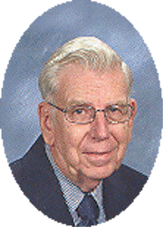
Samuel Gloor
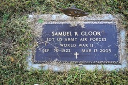
| Birth | : | 30 Sep 1922 Polk County, Nebraska, USA |
| Death | : | 13 Mar 2005 Columbus, Platte County, Nebraska, USA |
| Burial | : | White Plains Friends Meeting Cemetery, White Plains, Surry County, USA |
| Coordinate | : | 36.4478607, -80.6326141 |
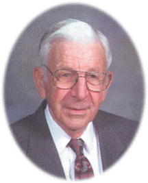
| Description | : | Son of Rudolph & Bertha (Mueller) Gloor. He graduated from Kramer High School in Columbus, Nebraska in 1940. Sam entered the U.S. Army Air Corp. on February 19, 1943. He served with the 11th Air Force unit and attained the rank of Sergeant while serving in the Aluetian Islands. He was honorably discharged on November 21, 1945. Sam farmed near Columbus all his life until his retirement in 2003 when he moved to the Heritage House. Sam enjoyed bowling and playing cards. Sam is survived by: Brother - Dan (Marilyn) Gloor of Columbus, NE Niece - Sandra Gloor of Omaha, NE Nephew - Gary... Read More |
frequently asked questions (FAQ):
-
Where is Samuel Gloor's memorial?
Samuel Gloor's memorial is located at: White Plains Friends Meeting Cemetery, White Plains, Surry County, USA.
-
When did Samuel Gloor death?
Samuel Gloor death on 13 Mar 2005 in Columbus, Platte County, Nebraska, USA
-
Where are the coordinates of the Samuel Gloor's memorial?
Latitude: 36.4478607
Longitude: -80.6326141
Family Members:
Parent
Siblings
Flowers:
Nearby Cemetories:
1. White Plains Friends Meeting Cemetery
White Plains, Surry County, USA
Coordinate: 36.4478607, -80.6326141
2. White Plains Baptist Church Cemetery
White Plains, Surry County, USA
Coordinate: 36.4534820, -80.6296600
3. Dover Baptist Church Cemetery
White Plains, Surry County, USA
Coordinate: 36.4376678, -80.6373901
4. Doss Cemetery
Mount Airy, Surry County, USA
Coordinate: 36.4553337, -80.6131363
5. Hutchens-Venable Family Cemetery
Mount Airy, Surry County, USA
Coordinate: 36.4309170, -80.6131390
6. Dunbar Cemetery
Mount Airy, Surry County, USA
Coordinate: 36.4690010, -80.6567720
7. Little Mountain Baptist Church Cemetery
Ararat, Surry County, USA
Coordinate: 36.4213066, -80.6090012
8. Whitlock Family Cemetery
Mount Airy, Surry County, USA
Coordinate: 36.4813056, -80.6422222
9. Mosley Family Cemetery
Mount Airy, Surry County, USA
Coordinate: 36.4670770, -80.6681230
10. Harrell-Lewis Family Cemetery
Mount Airy, Surry County, USA
Coordinate: 36.4148120, -80.6607750
11. Norman Family Cemetery
Mount Airy, Surry County, USA
Coordinate: 36.4867516, -80.6183090
12. W.C. Hiatt Cemetery
Mount Airy, Surry County, USA
Coordinate: 36.4484329, -80.5796204
13. Westside Baptist Church Cemetery
Toast, Surry County, USA
Coordinate: 36.4859720, -80.6574720
14. Venable Family Cemetery
Surry County, USA
Coordinate: 36.4045315, -80.6444179
15. Marion Family Cemetery
Dobson, Surry County, USA
Coordinate: 36.4101530, -80.6633480
16. Creed Family Cemetery
Mount Airy, Surry County, USA
Coordinate: 36.4905280, -80.6525830
17. Blackwater Community Church Cemetery
Black Water, Surry County, USA
Coordinate: 36.4019720, -80.6393330
18. Skyline Memory Gardens
Mount Airy, Surry County, USA
Coordinate: 36.4745610, -80.5856500
19. Watson Cemetery
Ararat, Surry County, USA
Coordinate: 36.4254140, -80.5822060
20. Charles Beck Family Cemetery
Ararat, Surry County, USA
Coordinate: 36.4147800, -80.5909700
21. Piney Grove Baptist Church Cemetery
White Plains, Surry County, USA
Coordinate: 36.4138080, -80.6742100
22. Critz Family Cemetery
Surry County, USA
Coordinate: 36.4960000, -80.6339170
23. The Community Church Cemetery
Mount Airy, Surry County, USA
Coordinate: 36.3986860, -80.6312360
24. Community Church Cemetery
Black Water, Surry County, USA
Coordinate: 36.3986300, -80.6312750

