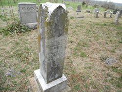
| Birth | : | 9 Feb 1840 High Point, Moniteau County, Missouri, USA |
| Death | : | 23 Jan 1927 High Point, Moniteau County, Missouri, USA |
| Burial | : | High Point Cemetery, High Point, Moniteau County, USA |
| Coordinate | : | 38.4817009, -92.5757980 |
| Description | : | California Democrat Sam Simpson passes. Lived for 87 years in Southern Moniteau County Sam Simpson, 87 years old, who lived in Southern Moniteau County perhaps longer than anyone now residing there, died at the home of his sons, George A. and O. W. Simpson, west of High Point at 7;30 o'clock Sunday evening. Mr. Simpson was born on what is now known as the Young place, near where he died, on Feb. 9, 1840, a son of Mr. and Mrs. Hugh and Sarah Miller Simpson, who immigrated from Kentucky and settled near High Point in 1835. He spent his entire life in... Read More |
frequently asked questions (FAQ):
-
Where is Samuel M. Simpson's memorial?
Samuel M. Simpson's memorial is located at: High Point Cemetery, High Point, Moniteau County, USA.
-
When did Samuel M. Simpson death?
Samuel M. Simpson death on 23 Jan 1927 in High Point, Moniteau County, Missouri, USA
-
Where are the coordinates of the Samuel M. Simpson's memorial?
Latitude: 38.4817009
Longitude: -92.5757980
Family Members:
Parent
Spouse
Siblings
Children
Flowers:
Nearby Cemetories:
1. High Point Cemetery
High Point, Moniteau County, USA
Coordinate: 38.4817009, -92.5757980
2. Depp Cemetery
High Point, Moniteau County, USA
Coordinate: 38.4776400, -92.5818500
3. United Baptist Church Cemetery
High Point, Moniteau County, USA
Coordinate: 38.4962200, -92.5856800
4. Gray Cemetery
Moniteau County, USA
Coordinate: 38.4536018, -92.5456009
5. Yarnell Cemetery
California, Moniteau County, USA
Coordinate: 38.5189018, -92.5708008
6. Union Christian Church Cemetery
High Point, Moniteau County, USA
Coordinate: 38.5196390, -92.5994260
7. Phillips Cemetery
High Point, Moniteau County, USA
Coordinate: 38.4430300, -92.6125300
8. Bruce-Lewis-McGahan Cemetery
Enon, Moniteau County, USA
Coordinate: 38.4667500, -92.5172100
9. Rock Enon Cemetery
Miller County, USA
Coordinate: 38.4668400, -92.5170700
10. Karnes Cemetery
Corticelli, Moniteau County, USA
Coordinate: 38.5099700, -92.5247900
11. Walker Cemetery
Moniteau County, USA
Coordinate: 38.4338989, -92.5522003
12. Etter-Walker Cemetery
Burris Fork, Moniteau County, USA
Coordinate: 38.4333700, -92.5525400
13. Jackson Chapel Methodist Church Cemetery
California, Moniteau County, USA
Coordinate: 38.4447900, -92.5286500
14. Farris Cemetery
Moniteau County, USA
Coordinate: 38.4369900, -92.5380000
15. Marney Family Cemetery
High Point, Moniteau County, USA
Coordinate: 38.5357900, -92.5614500
16. Gamble Cemetery
California, Moniteau County, USA
Coordinate: 38.5393982, -92.5757980
17. Karnes-Carney-Henderson Cemetery
Burris Fork, Moniteau County, USA
Coordinate: 38.4992100, -92.5007510
18. Old Latham Cemetery
Latham, Moniteau County, USA
Coordinate: 38.5466400, -92.5891100
19. Elliott Cemetery
Moniteau County, USA
Coordinate: 38.5244500, -92.6408700
20. Colburn Cemetery
Eldon, Miller County, USA
Coordinate: 38.4246300, -92.6275500
21. Green Ridge Baptist Church Cemetery
Eldon, Miller County, USA
Coordinate: 38.4116200, -92.5645700
22. DeFoe Cemetery
California, Moniteau County, USA
Coordinate: 38.5416985, -92.5250015
23. Olean Cemetery
Olean, Miller County, USA
Coordinate: 38.4131012, -92.5413971
24. Phillips Cemetery
Barnett, Morgan County, USA
Coordinate: 38.4227982, -92.6367035


