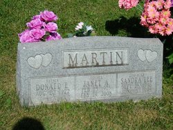
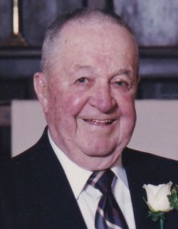
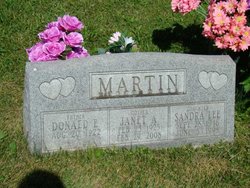
Sandra Lee Martin DeSmit
| Birth | : | 28 Sep 1946 Milwaukee, Milwaukee County, Wisconsin, USA |
| Death | : | 5 Jun 1998 Bear Lake, Manistee County, Michigan, USA |
| Burial | : | Chestnut Mound Missionary Baptist Church Cemetery, Chestnut Mound, Smith County, USA |
| Coordinate | : | 36.2034730, -85.8169980 |
| Plot | : | Old.P.105 |
| Description | : | Fairfield Ledger Thursday, June 11, 1998 Sandra Lee MARTIN DeSMIT Sandra Lee MARTIN DeSMIT, 51, of Bear Lake, Mich., died at her home Friday, June 5, 1998. The body has been cremated. A memorial service will be at 1:30 p.m. Friday at First Lutheran Church in Fairfield with the Rev. Peter Drever Jr. officiating. Burial of cremains will be at a later date. In leu of flowers, memorials can be made to the family or the donor's choice. Behner Funeral Home is in charge of arrangements. Mrs. DeSMIT was born Sept. 28, 1946, in Milwaukee, Wis., the daughter of Donald... Read More |
frequently asked questions (FAQ):
-
Where is Sandra Lee Martin DeSmit's memorial?
Sandra Lee Martin DeSmit's memorial is located at: Chestnut Mound Missionary Baptist Church Cemetery, Chestnut Mound, Smith County, USA.
-
When did Sandra Lee Martin DeSmit death?
Sandra Lee Martin DeSmit death on 5 Jun 1998 in Bear Lake, Manistee County, Michigan, USA
-
Where are the coordinates of the Sandra Lee Martin DeSmit's memorial?
Latitude: 36.2034730
Longitude: -85.8169980
Family Members:
Parent
Flowers:
Nearby Cemetories:
1. Chestnut Mound Missionary Baptist Church Cemetery
Chestnut Mound, Smith County, USA
Coordinate: 36.2034730, -85.8169980
2. Blair Cemetery
Chestnut Mound, Smith County, USA
Coordinate: 36.2058296, -85.8167038
3. Chestnut Mound United Methodist Church Cemetery
Chestnut Mound, Smith County, USA
Coordinate: 36.2034210, -85.8220200
4. Knight Cemetery
Chestnut Mound, Smith County, USA
Coordinate: 36.2053080, -85.8222990
5. Wyatt Cemetery
Chestnut Mound, Smith County, USA
Coordinate: 36.2036920, -85.8258930
6. Harris Cemetery
Chestnut Mound, Smith County, USA
Coordinate: 36.2119400, -85.8083500
7. Old Church Cemetery
Chestnut Mound, Smith County, USA
Coordinate: 36.2041660, -85.8314390
8. Gross Cemetery
Chestnut Mound, Smith County, USA
Coordinate: 36.2084380, -85.8332100
9. Bennett Cemetery
Smith County, USA
Coordinate: 36.1897700, -85.8104400
10. Brown Cemetery
Chestnut Mound, Smith County, USA
Coordinate: 36.2025300, -85.8358900
11. Winfrey Cemetery
Chestnut Mound, Smith County, USA
Coordinate: 36.2025800, -85.8360600
12. Robinson Cemetery
Chestnut Mound, Smith County, USA
Coordinate: 36.1887290, -85.8109240
13. Confederate Soldiers Gravesite
Smith County, USA
Coordinate: 36.1874730, -85.8154110
14. Glover Cemetery
Chestnut Mound, Smith County, USA
Coordinate: 36.2196870, -85.8278670
15. Draper Cemetery
Chestnut Mound, Smith County, USA
Coordinate: 36.2219610, -85.8237250
16. John Watts Cemetery
Chestnut Mound, Smith County, USA
Coordinate: 36.1895420, -85.7992740
17. Fitzpatrick Cemetery
Chestnut Mound, Smith County, USA
Coordinate: 36.1855300, -85.8287710
18. Young-McDonald Cemetery
Cookeville, Putnam County, USA
Coordinate: 36.2081840, -85.7919060
19. Fitzpatrick Cemetery
Smith County, USA
Coordinate: 36.1827060, -85.8201630
20. McKinney Cemetery
Chestnut Mound, Smith County, USA
Coordinate: 36.2166800, -85.8378000
21. Brown Cemetery
Smith County, USA
Coordinate: 36.2159600, -85.7928400
22. High Cemetery
Chestnut Mound, Smith County, USA
Coordinate: 36.2097800, -85.8452900
23. Apple-Ditty-Madewell Family Cemetery
Buffalo Valley, Putnam County, USA
Coordinate: 36.1808740, -85.8041080
24. Vaden Cemetery
Chestnut Mound, Smith County, USA
Coordinate: 36.2096020, -85.8484130


