
| Birth | : | 1787 |
| Death | : | 1869 |
| Burial | : | Gnadenfrei Lutheran Cemetery, Marananga, Light Regional Council, Australia |
| Coordinate | : | -34.4824300, 138.9336200 |
| Description | : | Father: Joseph Hays Mother: Jemima Hays INFORMATION PROVIDED BY CONTRIBUTOR MILLHAVEN 1818 --- Marriage Record: Sandy June Hill Married Sarah Hays -- Date: March 11, 1818 - By Ralph Petty -- Consent: Isaecck Hill - Witnesses: James Hill and Frederick Atkinson --- MARRIAGE RECORDS OF BARREN COUNTY, KENTUCKY 1799-1849, by Martha Reneau, PAGE: 128. 1850 --- District #58, Moniteau County, Missouri -- Dwelling Number: 350 - Page: 26 - Microfilm Roll: 407 ----- Sandy Hill 51 (head) -- Sarah 51 (wife) -- Mariah 20 (daughter) -- Eliza 17 (daughter) -- Henry 16 (son) -- Washington 14 (son) -- Calvin 9 (son). --- Source... Read More |
frequently asked questions (FAQ):
-
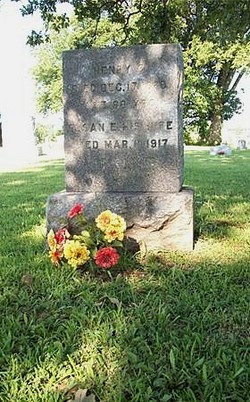
Where is Sarah Ann Hays Hill's memorial?
Sarah Ann Hays Hill's memorial is located at: Gnadenfrei Lutheran Cemetery, Marananga, Light Regional Council, Australia.
-
When did Sarah Ann Hays Hill death?
Sarah Ann Hays Hill death on 1869 in
-
Where are the coordinates of the Sarah Ann Hays Hill's memorial?
Latitude: -34.4824300
Longitude: 138.9336200
Family Members:
Spouse

Children
Flowers:


Nearby Cemetories:
1. Gnadenfrei Lutheran Cemetery
Marananga, Light Regional Council, Australia
Coordinate: -34.4824300, 138.9336200
2. Greenock Public Cemetery
Greenock, Light Regional Council, Australia
Coordinate: -34.4541700, 138.9284000
3. Zum Schmalen Weg Lutheran Cemetery
Nain, Light Regional Council, Australia
Coordinate: -34.4519000, 138.9034000
4. Nain Lutheran Cemetery
Nain, Light Regional Council, Australia
Coordinate: -34.4505600, 138.9000300
5. Siegersdorf Cemetery
Dorrien, Barossa Council, Australia
Coordinate: -34.4976200, 138.9844600
6. Nuriootpa Cemetery
Nuriootpa, Barossa Council, Australia
Coordinate: -34.4660790, 138.9841150
7. Tabor Lutheran Cemetery
Tanunda, Barossa Council, Australia
Coordinate: -34.5219890, 138.9630260
8. Langmeil Lutheran Churchyard
Tanunda, Barossa Council, Australia
Coordinate: -34.5265900, 138.9551600
9. Tabor Old Lutheran Church Cemetery
Tanunda, Barossa Council, Australia
Coordinate: -34.5253900, 138.9587660
10. St. John's Lutheran Cemetery
Tanunda, Barossa Council, Australia
Coordinate: -34.5325870, 138.9510190
11. Bethany New Lutheran Cemetery
Bethany, Barossa Council, Australia
Coordinate: -34.5312110, 138.9743280
12. Gomersal Schoenborn Lutheran Cemetery
Gomersal, Light Regional Council, Australia
Coordinate: -34.5401200, 138.9014600
13. Bethany Pioneer Cemetery
Bethany, Barossa Council, Australia
Coordinate: -34.5380780, 138.9717450
14. Gomersal Good Shepherd Lutheran Cemetery
Gomersal, Light Regional Council, Australia
Coordinate: -34.5240570, 138.8715950
15. Angaston Cemetery
Angaston, Barossa Council, Australia
Coordinate: -34.4925700, 139.0201900
16. Strait Gate Lutheran Cemetery
Light Pass, Barossa Council, Australia
Coordinate: -34.4703300, 139.0223100
17. Habermann and Mengler Cemetery
Bethany, Barossa Council, Australia
Coordinate: -34.5389310, 138.9937420
18. Light Pass Immanuel Lutheran Cemetery
Light Pass, Barossa Council, Australia
Coordinate: -34.4700750, 139.0262580
19. Krondorf Cemetery
Krondorf, Barossa Council, Australia
Coordinate: -34.5610650, 138.9712520
20. Angaston Old Pioneer Cemetery
Angaston, Barossa Council, Australia
Coordinate: -34.4999740, 139.0471820
21. Freeling General Cemetery
Freeling, Light Regional Council, Australia
Coordinate: -34.4506860, 138.8227030
22. Neukirch New Lutheran Cemetery
Ebenezer, Light Regional Council, Australia
Coordinate: -34.4017400, 138.9993300
23. Neukirch Pilgrim Pioneer Cemetery
Ebenezer, Light Regional Council, Australia
Coordinate: -34.4047840, 139.0114220
24. St. Johns Lutheran Cemetery
Ebenezer, Light Regional Council, Australia
Coordinate: -34.4219800, 139.0321700