| Birth | : | 25 Nov 1657 Roxbury, Suffolk County, Massachusetts, USA |
| Death | : | 15 Nov 1710 Roxbury, Suffolk County, Massachusetts, USA |
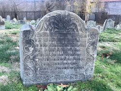
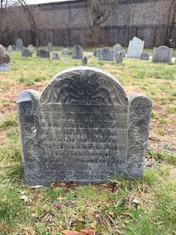
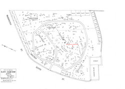
| Burial | : | Eliot Burying Ground, Roxbury, Suffolk County, USA |
| Coordinate | : | 42.3318890, -71.0811970 |
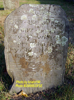
| Description | : | Sarah Denison, dau. of Edward Denison and Elizabeth Weld, b. of record Nov. 25 (bapt. Dec. 6), 1657 at Roxbury, Mass. where she d. of record Nov. 15, 1710. Sarah is assumed to be interred at Roxbury's Eustice Street Cemetery, formerly known as the Eliot Cemetery, which served as Roxbury's primary burying place from soon after Roxbury's beginning in 1630. In 1846 the Town of Roxbury was dissolved and absorbed by the City of Boston. If Sarah once had a gravestone it has long since decayed away. On an unrecorded date by early 1677, Sarah m. Thomas Robinson, Jr., s. of... Read More |
frequently asked questions (FAQ):
-
Where is Sarah Denison Robinson's memorial?
Sarah Denison Robinson's memorial is located at: Eliot Burying Ground, Roxbury, Suffolk County, USA.
-
When did Sarah Denison Robinson death?
Sarah Denison Robinson death on 15 Nov 1710 in Roxbury, Suffolk County, Massachusetts, USA
-
Where are the coordinates of the Sarah Denison Robinson's memorial?
Latitude: 42.3318890
Longitude: -71.0811970
Family Members:
Parent
Siblings
Children
Flowers:
Nearby Cemetories:
1. Eliot Burying Ground
Roxbury, Suffolk County, USA
Coordinate: 42.3318890, -71.0811970
2. Warren Cemetery (Defunct)
Boston, Suffolk County, USA
Coordinate: 42.3269700, -71.0825500
3. South Burying Ground
Boston, Suffolk County, USA
Coordinate: 42.3382600, -71.0741000
4. Saint Margaret's Convent Columbarium
Roxbury, Suffolk County, USA
Coordinate: 42.3260000, -71.0940700
5. Cathedral of the Holy Cross Crypt
Boston, Suffolk County, USA
Coordinate: 42.3408200, -71.0697400
6. Warren Anatomical Museum
Boston, Suffolk County, USA
Coordinate: 42.3351300, -71.1036100
7. Old South Church
Boston, Suffolk County, USA
Coordinate: 42.3500500, -71.0779000
8. Dorchester North Burying Ground
Dorchester, Suffolk County, USA
Coordinate: 42.3170013, -71.0645828
9. Cocoanut Grove Fire Memorial
Boston, Suffolk County, USA
Coordinate: 42.3499600, -71.0681900
10. Central Burying Ground
Boston, Suffolk County, USA
Coordinate: 42.3526300, -71.0659500
11. Saint Augustine Cemetery
South Boston, Suffolk County, USA
Coordinate: 42.3339900, -71.0491800
12. Christ's Church
Brookline, Norfolk County, USA
Coordinate: 42.3421500, -71.1104200
13. Saint Matthews Cemetery (Defunct)
South Boston, Suffolk County, USA
Coordinate: 42.3379940, -71.0497180
14. Trinity Church Tombs (Defunct)
Boston, Suffolk County, USA
Coordinate: 42.3549300, -71.0597500
15. Granary Burying Ground
Boston, Suffolk County, USA
Coordinate: 42.3572400, -71.0613500
16. Kings Chapel Burying Ground
Boston, Suffolk County, USA
Coordinate: 42.3583340, -71.0600370
17. First Church in Jamaica Plain Cemetery
Jamaica Plain, Suffolk County, USA
Coordinate: 42.3097600, -71.1159400
18. Hawes Burying Ground
South Boston, Suffolk County, USA
Coordinate: 42.3340607, -71.0345078
19. Union Cemetery
South Boston, Suffolk County, USA
Coordinate: 42.3340440, -71.0344730
20. Walnut Street Cemetery
Brookline, Norfolk County, USA
Coordinate: 42.3275795, -71.1284103
21. South Boston Farm Cemetery (Defunct)
South Boston, Suffolk County, USA
Coordinate: 42.3388510, -71.0326710
22. Holy Cross Greek Orthodox School Of Theology
Brookline, Norfolk County, USA
Coordinate: 42.3183600, -71.1299300
23. Saint Clare Monastery
Jamaica Plain, Suffolk County, USA
Coordinate: 42.3078890, -71.1221000
24. Forest Hills Cemetery and Crematory
Jamaica Plain, Suffolk County, USA
Coordinate: 42.2982000, -71.1077400


