


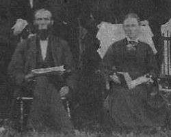
Sarah Doddridge McMullen
| Birth | : | 3 Jul 1829 |
| Death | : | 8 Sep 1862 |
| Burial | : | Mangere Lawn Cemetery, Mangere, Auckland Council, New Zealand |
| Coordinate | : | -36.9626150, 174.7857000 |
| Plot | : | 2-241-1 |
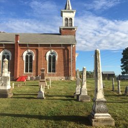
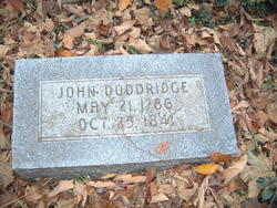
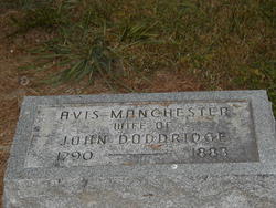
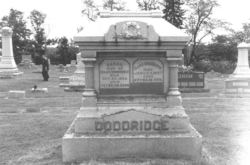
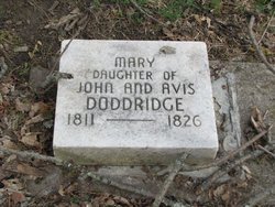
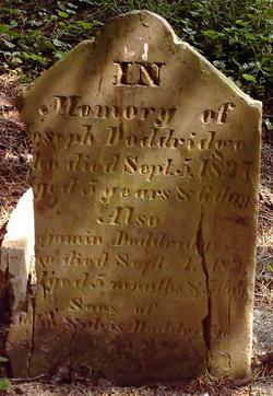
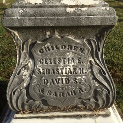
| Description | : | Info from Doddridge Chapel Cemetery Records. Original records compiled by unknown. Revised 1n 1945 to 1964 by Doris Clevenger. Revised in 1994 to 1998 by Reid Doddridge. 2-241-1 McMullen, Sarah Doddridge - Daughter of Avis & John Doddridge. Wife of Reverend J. W. McMullen. Her Children were Wilbur, James, Carrie. No decendents from these. The names of the side of her stone are Sarah McMullen and 3 childrens names. Celestia E, Sebastion H. & David S. I am going to list them as infants that died. It is a big stone & the names would not be there unless they were... Read More |
frequently asked questions (FAQ):
-
Where is Sarah Doddridge McMullen's memorial?
Sarah Doddridge McMullen's memorial is located at: Mangere Lawn Cemetery, Mangere, Auckland Council, New Zealand.
-
When did Sarah Doddridge McMullen death?
Sarah Doddridge McMullen death on 8 Sep 1862 in
-
Where are the coordinates of the Sarah Doddridge McMullen's memorial?
Latitude: -36.9626150
Longitude: 174.7857000
Family Members:
Parent
Spouse
Siblings


Children


Flowers:


Nearby Cemetories:
1. Mangere Lawn Cemetery
Mangere, Auckland Council, New Zealand
Coordinate: -36.9626150, 174.7857000
2. Mangere Presbyterian Cemetery
Mangere, Auckland Council, New Zealand
Coordinate: -36.9750197, 174.7924783
3. Mangere Piriti Urupā St. James Churchyard
Mangere, Auckland Council, New Zealand
Coordinate: -36.9418970, 174.7835260
4. Waikaraka Cemetery
Ōnehunga, Auckland Council, New Zealand
Coordinate: -36.9297140, 174.7967170
5. St. Peter's Anglican Cemetery
Ōnehunga, Auckland Council, New Zealand
Coordinate: -36.9227113, 174.7847550
6. Onehunga Catholic Cemetery
Ōnehunga, Auckland Council, New Zealand
Coordinate: -36.9224360, 174.7884560
7. Our Lady of the Assumption Catholic Church
Ōnehunga, Auckland Council, New Zealand
Coordinate: -36.9223690, 174.7884530
8. Hillsborough Cemetery
Hillsborough, Auckland Council, New Zealand
Coordinate: -36.9246600, 174.7524030
9. Nixon Memorial
Ōtāhūhū, Auckland Council, New Zealand
Coordinate: -36.9499366, 174.8449909
10. Papatoetoe Cemetery
Papatoetoe, Auckland Council, New Zealand
Coordinate: -36.9893110, 174.8373530
11. Otahuhu Public Cemetery
Ōtāhūhū, Auckland Council, New Zealand
Coordinate: -36.9377500, 174.8432390
12. Holy Trinity Memorial Park
Ōtāhūhū, Auckland Council, New Zealand
Coordinate: -36.9374510, 174.8448580
13. Manukau Memorial Gardens
Manukau, Auckland Council, New Zealand
Coordinate: -36.9944380, 174.8397300
14. St. Joseph and St. Joachim Catholic Cemetery
Ōtāhūhū, Auckland Council, New Zealand
Coordinate: -36.9436100, 174.8490100
15. St. John's Presbyterian Church Cemetery
Papatoetoe, Auckland Council, New Zealand
Coordinate: -36.9674185, 174.8598178
16. Saint Andrew's Churchyard
Epsom, Auckland Council, New Zealand
Coordinate: -36.8937200, 174.7654100
17. St Matthias Churchyard
Panmure, Auckland Council, New Zealand
Coordinate: -36.9053300, 174.8577200
18. St. Patrick's Roman Catholic Church Cemetery
Panmure, Auckland Council, New Zealand
Coordinate: -36.9029680, 174.8564960
19. Woodside Methodist Cemetery
Manukau, Auckland Council, New Zealand
Coordinate: -36.9929680, 174.8837860
20. St. John's Church Cemetery
East Tamaki, Auckland Council, New Zealand
Coordinate: -36.9522250, 174.8964540
21. St Mark's Anglican Church Cemetery
Remuera, Auckland Council, New Zealand
Coordinate: -36.8729300, 174.7801600
22. St. David's Anglican Churchyard
Wiri, Auckland Council, New Zealand
Coordinate: -37.0025400, 174.8886150
23. Saint Ninians Churchyard
Avondale, Auckland Council, New Zealand
Coordinate: -36.8994510, 174.6966690
24. St. Luke's Anglican Church Cemetery
Mount Albert, Auckland Council, New Zealand
Coordinate: -36.8785540, 174.7290400