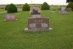
| Birth | : | 13 Jul 1868 Liverpool, Perry County, Pennsylvania, USA |
| Death | : | 7 Apr 1893 Dickinson County, Kansas, USA |
| Burial | : | Bethel Cemetery, Moonlight, Dickinson County, USA |
| Coordinate | : | 39.0022011, -97.1110535 |
| Description | : | Sarah "Sally" Edna Gish is the daughter of John L Gish and Catherine Moyer. She married as his first wife Seth H Ginder. They married 21 Oct 1890 in Dickinson Co, Ks. Children Naomi and Aaron. She died when Aaron was born |
frequently asked questions (FAQ):
-
Where is Sarah Edna Gish Ginder's memorial?
Sarah Edna Gish Ginder's memorial is located at: Bethel Cemetery, Moonlight, Dickinson County, USA.
-
When did Sarah Edna Gish Ginder death?
Sarah Edna Gish Ginder death on 7 Apr 1893 in Dickinson County, Kansas, USA
-
Where are the coordinates of the Sarah Edna Gish Ginder's memorial?
Latitude: 39.0022011
Longitude: -97.1110535
Family Members:
Parent
Spouse
Siblings
Children
Flowers:
Nearby Cemetories:
1. Bethel Cemetery
Moonlight, Dickinson County, USA
Coordinate: 39.0022011, -97.1110535
2. Detroit Cemetery
Detroit, Dickinson County, USA
Coordinate: 38.9439300, -97.1255100
3. Buckeye Cemetery
Buckeye, Dickinson County, USA
Coordinate: 39.0463070, -97.1665840
4. Union Cemetery
Buckeye, Dickinson County, USA
Coordinate: 39.0243988, -97.1856003
5. Sutphen Mill Cemetery
Chapman, Dickinson County, USA
Coordinate: 39.0330190, -97.0368770
6. Indian Hill Cemetery
Chapman, Dickinson County, USA
Coordinate: 38.9714012, -97.0327988
7. Jones Cemetery
Dickinson County, USA
Coordinate: 39.0703011, -97.0860977
8. Zion Cemetery
Abilene, Dickinson County, USA
Coordinate: 39.0319240, -97.2045850
9. Saint Patricks Cemetery
Chapman, Dickinson County, USA
Coordinate: 38.9803330, -97.0062850
10. Good Hope Cemetery
Chapman, Dickinson County, USA
Coordinate: 39.0388985, -96.9991989
11. Henry Cemetery
Buckeye, Dickinson County, USA
Coordinate: 39.0828018, -97.1857986
12. Mount Saint Joseph Cemetery
Abilene, Dickinson County, USA
Coordinate: 38.9442170, -97.2218690
13. Lutheran Cemetery #17
Enterprise, Dickinson County, USA
Coordinate: 38.9009209, -97.0734787
14. Liberty Cemetery
Upland, Dickinson County, USA
Coordinate: 39.0896988, -97.0278015
15. Abilene Cemetery
Abilene, Dickinson County, USA
Coordinate: 38.9322014, -97.2217026
16. Saint John's Episcopal Church Memorial Garden
Abilene, Dickinson County, USA
Coordinate: 38.9202700, -97.2137300
17. Mount Hope Cemetery
Enterprise, Dickinson County, USA
Coordinate: 38.8869019, -97.1121979
18. Dwight D. Eisenhower Municipal Building
Abilene, Dickinson County, USA
Coordinate: 38.9191100, -97.2155700
19. Pleasant Hill Cemetery
Enterprise, Dickinson County, USA
Coordinate: 38.8885150, -97.0749560
20. Eisenhower Presidential Library and Museum Chapel
Abilene, Dickinson County, USA
Coordinate: 38.9118450, -97.2129410
21. Greenridge Cemetery
Dickinson County, USA
Coordinate: 39.1199989, -97.1433029
22. Prairiedale Cemetery
Talmage, Dickinson County, USA
Coordinate: 39.0471992, -97.2652969
23. Alida Zion Evangelical Cemetery
Upland, Dickinson County, USA
Coordinate: 39.0750008, -96.9721985
24. Scheiller Cemetery
Enterprise, Dickinson County, USA
Coordinate: 38.8669014, -97.1106033


