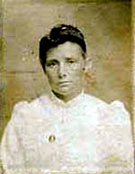
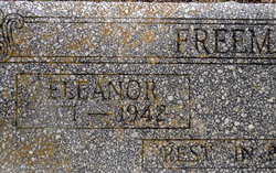
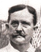
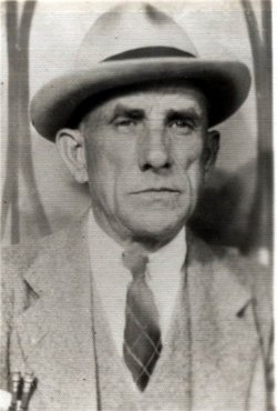
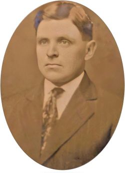
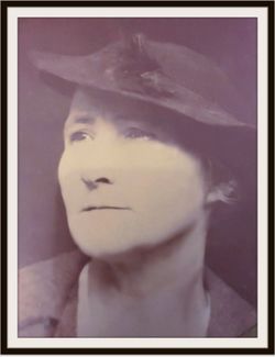
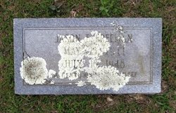
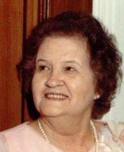
Sarah Eleanor “Lena” Hodge Freeman
| Birth | : | 16 Jun 1871 Ramer, Montgomery County, Alabama, USA |
| Death | : | 31 Dec 1942 Huttig, Union County, Arkansas, USA |
| Burial | : | Harper Springs Cemetery, Huttig, Union County, USA |
| Coordinate | : | 33.0397300, -92.2211300 |
| Description | : | OBITUARY FOR SARAH ELEANOR HODGE FREEMAN El Dorado, Arkansas – Mrs. Sarah Eleanor Freeman, 71, died at her home in Huttig Thursday (December 31, 1942) after an illness of three weeks. Mrs. Freeman is survived by four sons, Joe A. Freeman of Marion, Louisiana, John Goodwyn Freeman of San Francisco, James Sidney Freeman of Shreveport, and Jason Elliott "Jake" Freeman of Jonesboro, Louisiana; seven daughters, Mrs. A. L. Dollar (Effie) of Rayville, Louisiana, Mrs. J. W. (Betty) Stinson, Mrs. John (Maybelle) Harrison, Mrs. Henry (Florence) Thurman, all of Huttig, Arkansas, Mrs. Walter (Louella) Bozeman of Winnsboro, Louisiana, Mrs.... Read More |
frequently asked questions (FAQ):
-
Where is Sarah Eleanor “Lena” Hodge Freeman's memorial?
Sarah Eleanor “Lena” Hodge Freeman's memorial is located at: Harper Springs Cemetery, Huttig, Union County, USA.
-
When did Sarah Eleanor “Lena” Hodge Freeman death?
Sarah Eleanor “Lena” Hodge Freeman death on 31 Dec 1942 in Huttig, Union County, Arkansas, USA
-
Where are the coordinates of the Sarah Eleanor “Lena” Hodge Freeman's memorial?
Latitude: 33.0397300
Longitude: -92.2211300
Family Members:
Parent
Spouse
Siblings
Children
Nearby Cemetories:
1. Harper Springs Cemetery
Huttig, Union County, USA
Coordinate: 33.0397300, -92.2211300
2. Simms Cemetery
Huttig, Union County, USA
Coordinate: 33.0358000, -92.1899800
3. Huttig Cemetery
Huttig, Union County, USA
Coordinate: 33.0489000, -92.1889400
4. Old Lapile Cemetery
Lapile, Union County, USA
Coordinate: 33.0656000, -92.2445600
5. Union Cemetery
Marion, Union Parish, USA
Coordinate: 33.0031345, -92.2576905
6. Union Cemetery
Sadie, Union Parish, USA
Coordinate: 33.0032997, -92.2583008
7. Batts Chapel Cemetery
Huttig, Union County, USA
Coordinate: 33.0722008, -92.2632980
8. Litroe-Smedley Cemetery
Litroe, Union Parish, USA
Coordinate: 32.9941100, -92.1783100
9. Saint Pauls Cemetery No. 1
Union Parish, USA
Coordinate: 32.9538994, -92.2117004
10. Saint Paul Cemetery #2
Litroe, Union Parish, USA
Coordinate: 32.9538500, -92.2111100
11. Teel Cemetery
Strong, Union County, USA
Coordinate: 33.0760000, -92.3172000
12. Sweet Home Cemetery
Strong, Union County, USA
Coordinate: 33.0572400, -92.3387000
13. Ward Chapel Cemetery
Strong, Union County, USA
Coordinate: 33.1377000, -92.2697000
14. Good Hope Primitive Baptist Church Cemetery
Strong, Union County, USA
Coordinate: 33.0129000, -92.3448000
15. Pratt-Dobbs Cemetery
Strong, Union County, USA
Coordinate: 33.0856800, -92.3494500
16. Mount Union Memorial Gardens
Marion, Union Parish, USA
Coordinate: 32.9315240, -92.2775130
17. Reppond Cemetery
Union Parish, USA
Coordinate: 32.9263992, -92.1785965
18. Spring Hill Cemetery
Union Parish, USA
Coordinate: 33.0050011, -92.3653030
19. Springhill African American Cemetery
Oakland, Union Parish, USA
Coordinate: 33.0052940, -92.3658390
20. Strong Cemetery
Strong, Union County, USA
Coordinate: 33.0964012, -92.3589020
21. Ebenezer Presbyterian Cemetery
Strong, Union County, USA
Coordinate: 33.1612000, -92.2803000
22. Hughes Cemetery
Strong, Union County, USA
Coordinate: 33.0777500, -92.3722000
23. Forest Hill Cemetery
Aurelle, Union County, USA
Coordinate: 33.0619011, -92.3771973
24. Poole Cemetery
Strong, Union County, USA
Coordinate: 33.1729000, -92.2739000

