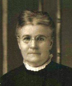
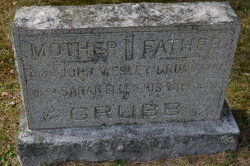
Sarah Ellen Hollenback Grubb
| Birth | : | 30 Nov 1854 Washburn, Woodford County, Illinois, USA |
| Death | : | 22 Nov 1923 Granger, Yakima County, Washington, USA |
| Burial | : | General Lutheran Cemetery, South Saint Paul, Dakota County, USA |
| Coordinate | : | 44.8917007, -93.0516968 |
| Plot | : | Section 60, Grave 2 |
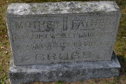
| Inscription | : | His Wife |
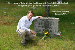
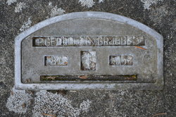
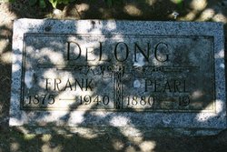
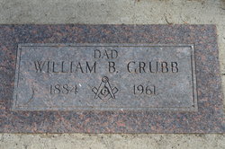
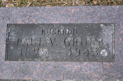
| Description | : | Sarah was a daughter of George and Jane Patton Hollenback. She married John Wesley Grubb in Linn, Woodford County, Illinois 30 Mar 1875. They had nine children together: George Emerson, Rose, Della Pearl, Lena, William, Frank, Hattie, Arthur and Paul Vivian. Bayview Cemetery, West Section, is located at the junction of Bayview Road and Howard Road, near Washington Route 525, between Freeland and Clinton on Whidbey Island. |
frequently asked questions (FAQ):
-
Where is Sarah Ellen Hollenback Grubb's memorial?
Sarah Ellen Hollenback Grubb's memorial is located at: General Lutheran Cemetery, South Saint Paul, Dakota County, USA.
-
When did Sarah Ellen Hollenback Grubb death?
Sarah Ellen Hollenback Grubb death on 22 Nov 1923 in Granger, Yakima County, Washington, USA
-
Where are the coordinates of the Sarah Ellen Hollenback Grubb's memorial?
Latitude: 44.8917007
Longitude: -93.0516968
Family Members:
Parent
Spouse
Siblings
Children
Flowers:
Nearby Cemetories:
1. General Lutheran Cemetery
South Saint Paul, Dakota County, USA
Coordinate: 44.8917007, -93.0516968
2. Oak Hill Cemetery
South Saint Paul, Dakota County, USA
Coordinate: 44.8922005, -93.0532990
3. First Presbyterian Church Memorial Garden
South Saint Paul, Dakota County, USA
Coordinate: 44.8990300, -93.0589000
4. Memorial Park and Native American Burial Grounds
South Saint Paul, Dakota County, USA
Coordinate: 44.9033910, -93.0483790
5. Kaposia Village Burial Grounds
South Saint Paul, Dakota County, USA
Coordinate: 44.8927803, -93.0347214
6. Augustana Lutheran Church Columbarium
West Saint Paul, Dakota County, USA
Coordinate: 44.9042659, -93.0797811
7. Salem United Methodist Church Cemetery
Inver Grove Heights, Dakota County, USA
Coordinate: 44.8678741, -93.0656433
8. Old Salem Evangelical Church Cemetery
Inver Grove Heights, Dakota County, USA
Coordinate: 44.8693100, -93.0752300
9. Riverview Cemetery
Saint Paul, Ramsey County, USA
Coordinate: 44.9196660, -93.0699010
10. Union Cemetery
Inver Grove Heights, Dakota County, USA
Coordinate: 44.8622017, -93.0258026
11. Saint Annes Columbarium
Saint Paul, Ramsey County, USA
Coordinate: 44.8822710, -93.1008710
12. Red Rock Cemetery
Newport, Washington County, USA
Coordinate: 44.8837900, -93.0013300
13. Old Emanuel Lutheran Church Cemetery
Inver Grove Heights, Dakota County, USA
Coordinate: 44.8478800, -93.0648600
14. Indian Mounds Park
Saint Paul, Ramsey County, USA
Coordinate: 44.9460060, -93.0547060
15. Newport Cemetery
Newport, Washington County, USA
Coordinate: 44.8560982, -92.9922028
16. Trinity Lone Oak Cemetery
Eagan, Dakota County, USA
Coordinate: 44.8503600, -93.1270750
17. Old Peoples Home Cemetery
Cottage Grove, Washington County, USA
Coordinate: 44.8478400, -92.9750800
18. Inver Hills Memorial Cemetery
Inver Grove Heights, Dakota County, USA
Coordinate: 44.8317540, -93.1028230
19. Saint Thomas Aquinas Cemetery
Saint Paul Park, Washington County, USA
Coordinate: 44.8425000, -92.9806600
20. Saint John the Evangelist Episcopal Columbarium
Saint Paul, Ramsey County, USA
Coordinate: 44.9428200, -93.1236700
21. Resurrection Cemetery
Mendota Heights, Dakota County, USA
Coordinate: 44.8767014, -93.1513977
22. Woodbury Methodist Cemetery
Woodbury, Washington County, USA
Coordinate: 44.9187400, -92.9533970
23. House of Hope Presbyterian Church Memorial Garden
Saint Paul, Ramsey County, USA
Coordinate: 44.9418400, -93.1329500
24. Church of Saint Peter Historic Cemetery
Mendota, Dakota County, USA
Coordinate: 44.8839417, -93.1671906

