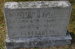
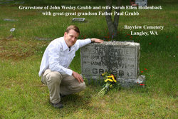
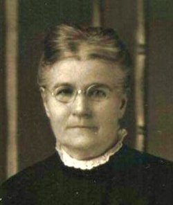
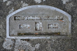
John Wesley Grubb
| Birth | : | 11 May 1849 Jerome, Union County, Ohio, USA |
| Death | : | 4 Jul 1910 Maxwelton, Island County, Washington, USA |
| Burial | : | Canton Cemetery, Canton, Blaine County, USA |
| Coordinate | : | 36.0293999, -98.5813980 |
| Plot | : | Section 60, Grave 3 |
| Description | : | John was the second of three sons of Benjamin C. and Cynthia Ann Gregg Grubb. He married Sarah Ellen Hollenback in Linn, Woodford County, Illinois 30 Mar 1875. They had 9 children together and lived in Illinois, Kansas and finally Washington. Bayview Cemetery, West Section, is located at the junction of Bayview Road and Howard Road, near Washington Route 525, between Freeland and Clinton on Whidbey Island. |
frequently asked questions (FAQ):
-
Where is John Wesley Grubb's memorial?
John Wesley Grubb's memorial is located at: Canton Cemetery, Canton, Blaine County, USA.
-
When did John Wesley Grubb death?
John Wesley Grubb death on 4 Jul 1910 in Maxwelton, Island County, Washington, USA
-
Where are the coordinates of the John Wesley Grubb's memorial?
Latitude: 36.0293999
Longitude: -98.5813980
Family Members:
Parent
Spouse
Siblings
Children
Flowers:
Nearby Cemetories:
1. Zion Mennonite Indian Cemetery
Canton, Blaine County, USA
Coordinate: 36.0279999, -98.5812683
2. Canton Reinterment Cemetery
Canton, Blaine County, USA
Coordinate: 36.0775810, -98.6083890
3. Cherryvale Cemetery
Blaine County, USA
Coordinate: 36.0553017, -98.5108032
4. Unnamed Relocated Cemetery #6
Longdale, Blaine County, USA
Coordinate: 36.0936380, -98.5901930
5. Unnamed Relocated Cemetery #4
Longdale, Blaine County, USA
Coordinate: 36.1059820, -98.5859870
6. Unnamed Relocated Cemetery #3
Longdale, Blaine County, USA
Coordinate: 36.1069530, -98.5844420
7. Indian Mennonite Cemetery
Canton, Blaine County, USA
Coordinate: 36.1010500, -98.6197800
8. Unnamed Relocated Cemetery #2
Canton, Blaine County, USA
Coordinate: 36.1079240, -98.5897640
9. Flyingout Cemetery
Longdale, Blaine County, USA
Coordinate: 36.1234550, -98.6127660
10. Longdale Cemetery
Cantonment Township, Blaine County, USA
Coordinate: 36.1300850, -98.5561450
11. Eagle City Cemetery
Eagle City, Blaine County, USA
Coordinate: 35.9199982, -98.5997009
12. Fountain Cemetery
Seiling, Dewey County, USA
Coordinate: 36.0297012, -98.7244034
13. Unnamed Relocated Cemetery #5
Longdale, Blaine County, USA
Coordinate: 36.1488260, -98.6160280
14. Oakwood Cemetery
Oakwood, Dewey County, USA
Coordinate: 35.9272000, -98.6861000
15. Chain Family Cemetery
Dewey County, USA
Coordinate: 36.0583800, -98.7633700
16. Midlin Cemetery
Blaine County, USA
Coordinate: 36.0361100, -98.3886100
17. New Bell Cemetery
Watonga, Blaine County, USA
Coordinate: 36.0361100, -98.3886100
18. Oakwood Memorial Cemetery
Oakwood, Dewey County, USA
Coordinate: 35.8991620, -98.7148350
19. Evergreen Cemetery
Oakwood, Dewey County, USA
Coordinate: 35.9706001, -98.7778015
20. Plymouth Cemetery
Fairview, Major County, USA
Coordinate: 36.1727982, -98.4672012
21. Rising Sun Cemetery
Blaine County, USA
Coordinate: 35.8558006, -98.5919037
22. Bethel Cemetery
Major County, USA
Coordinate: 36.2030983, -98.6102982
23. Mount Hope Cemetery
Fay, Dewey County, USA
Coordinate: 35.8553009, -98.6433029
24. Munice Cemetery
Seiling, Dewey County, USA
Coordinate: 36.0574989, -98.8043976

