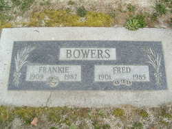
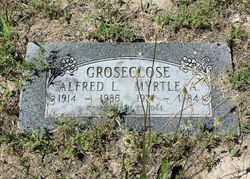
Sarah Frances “Frankie” Groseclose Bowers
| Birth | : | 6 Aug 1909 Bridgeport, Douglas County, Washington, USA |
| Death | : | 16 Apr 1987 Wenatchee, Chelan County, Washington, USA |
| Burial | : | Bethlehem Cemetery, Thomasville, Oregon County, USA |
| Coordinate | : | 36.8861389, -91.5680008 |
| Plot | : | Row 10, Block 39, Lot 1 |
| Inscription | : | Fred Bowers |
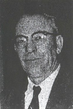
| Description | : | Frankie Bowers, 77, of Wenatchee, died Thursday, April 16, 1987, at Central Washington Hospital following a brief illness. She was born Francis Groseclose on Aug. 6, 1909, at the family homestead in Bridgeport. She attended Green Valley and Bridgeport schools. On Dec. 31, 1926, she married Fred A. Bowers at Waterville and they made their first home in Tacoma. In 1936, they moved to Grand Coulee where Mr. Bowers was employed in the construction of Grand Coulee Dam. In 1941, they moved to Chelan. During their time there, Mrs. Bowers worked as a packer for Beebe Orchards and Blue Chelan. She... Read More |
frequently asked questions (FAQ):
-
Where is Sarah Frances “Frankie” Groseclose Bowers's memorial?
Sarah Frances “Frankie” Groseclose Bowers's memorial is located at: Bethlehem Cemetery, Thomasville, Oregon County, USA.
-
When did Sarah Frances “Frankie” Groseclose Bowers death?
Sarah Frances “Frankie” Groseclose Bowers death on 16 Apr 1987 in Wenatchee, Chelan County, Washington, USA
-
Where are the coordinates of the Sarah Frances “Frankie” Groseclose Bowers's memorial?
Latitude: 36.8861389
Longitude: -91.5680008
Family Members:
Parent
Spouse
Siblings
Flowers:
Nearby Cemetories:
1. Bethlehem Cemetery
Thomasville, Oregon County, USA
Coordinate: 36.8861389, -91.5680008
2. Corinth Cemetery
Birch Tree, Shannon County, USA
Coordinate: 36.9169998, -91.5661011
3. Ledbetter Cemetery
Spring Creek, Oregon County, USA
Coordinate: 36.8566080, -91.5501210
4. New Salem Cemetery
Teresita, Shannon County, USA
Coordinate: 36.9239006, -91.6027985
5. Miller Cemetery
Thomasville, Oregon County, USA
Coordinate: 36.8089410, -91.4992900
6. Pleasant Grove Cemetery
Teresita, Shannon County, USA
Coordinate: 36.9742012, -91.6206970
7. Woodside Cemetery
Thomasville, Oregon County, USA
Coordinate: 36.7927017, -91.5317993
8. Brown-DePriest Cemetery
Birch Tree, Shannon County, USA
Coordinate: 36.9674988, -91.5000000
9. Montier Cemetery
Montier, Shannon County, USA
Coordinate: 36.9847984, -91.5754013
10. Lane Cemetery
Oregon County, USA
Coordinate: 36.7881012, -91.5410995
11. Bellah Cemetery
Thomasville, Oregon County, USA
Coordinate: 36.7881012, -91.5406036
12. Old Baptist Cemetery
Birch Tree, Shannon County, USA
Coordinate: 36.9798775, -91.5186768
13. Warm Corners Cemetery
Birch Tree, Shannon County, USA
Coordinate: 36.9653015, -91.4880981
14. Chapel Hill Cemetery
Chapel, Howell County, USA
Coordinate: 36.9358290, -91.6826140
15. Thomasville Civil War Cemetery #2
Thomasville, Oregon County, USA
Coordinate: 36.7814100, -91.5606600
16. Thomasville Civil War Cemetery
Thomasville, Oregon County, USA
Coordinate: 36.7845800, -91.5301100
17. Oak Forest Cemetery
Birch Tree, Shannon County, USA
Coordinate: 36.9818993, -91.4847031
18. Shaw Family Cemetery
Thomasville, Oregon County, USA
Coordinate: 36.7850790, -91.4799380
19. Oak Grove Cemetery
Birch Tree, Shannon County, USA
Coordinate: 36.9632111, -91.4445267
20. Turkey Oak Cemetery
Montier, Shannon County, USA
Coordinate: 37.0203018, -91.5768967
21. Dunkard Cemetery
Montier, Shannon County, USA
Coordinate: 37.0208015, -91.5580978
22. Union Hill Cemetery
Thomasville, Oregon County, USA
Coordinate: 36.7468987, -91.5346985
23. Spring Creek Cemetery
Spring Creek, Oregon County, USA
Coordinate: 36.8175011, -91.4107971
24. Jolliff Cemetery
Rover, Oregon County, USA
Coordinate: 36.7430992, -91.5892029


