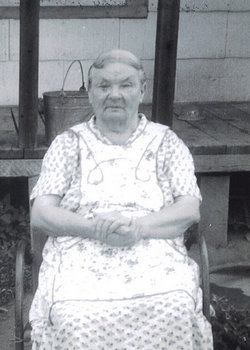
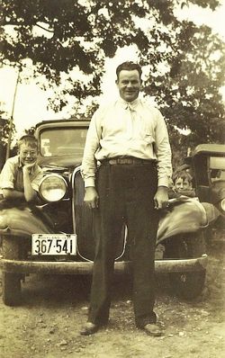
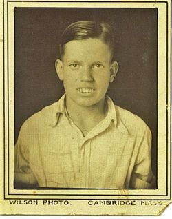
Shirley Randolph Beach
| Birth | : | 10 Aug 1884 |
| Death | : | 1957 |
| Burial | : | St. Stephen's Churchyard, North Meols, West Lancashire District, England |
| Coordinate | : | 53.6813720, -2.9248140 |
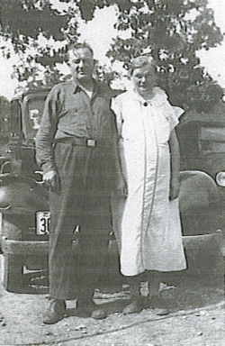
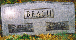
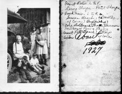
| Description | : | Shirley Randolph Beach was the son of Cornelius Vernon Beach and Susannah Mathers. He married Bertha W. Bettis. They are buried together in Union Cemetery in Leesburg Va. Shirley was my great great uncle. |
frequently asked questions (FAQ):
-
Where is Shirley Randolph Beach's memorial?
Shirley Randolph Beach's memorial is located at: St. Stephen's Churchyard, North Meols, West Lancashire District, England.
-
When did Shirley Randolph Beach death?
Shirley Randolph Beach death on 1957 in
-
Where are the coordinates of the Shirley Randolph Beach's memorial?
Latitude: 53.6813720
Longitude: -2.9248140
Family Members:
Parent
Spouse
Siblings
Children
Flowers:
Nearby Cemetories:
1. St. Stephen's Churchyard
North Meols, West Lancashire District, England
Coordinate: 53.6813720, -2.9248140
2. Saint John Crossens Churchyard
Crossens, Metropolitan Borough of Sefton, England
Coordinate: 53.6733410, -2.9478740
3. St Cuthberts Churchyard
Southport, Metropolitan Borough of Sefton, England
Coordinate: 53.6603230, -2.9620310
4. Emmanuel Parish Church
Southport, Metropolitan Borough of Sefton, England
Coordinate: 53.6604534, -2.9748117
5. Emmanuel Church Garden of Remembrance
North Meols, West Lancashire District, England
Coordinate: 53.6607130, -2.9753420
6. Holy Trinity Church
Southport, Metropolitan Borough of Sefton, England
Coordinate: 53.6503800, -2.9969150
7. St. Marie on the Sands
Southport, Metropolitan Borough of Sefton, England
Coordinate: 53.6524320, -3.0023440
8. All Saints Churchyard
Hesketh with Becconsall, West Lancashire District, England
Coordinate: 53.7028189, -2.8400142
9. St John the Divine
Lytham Saint Annes, Fylde Borough, England
Coordinate: 53.7367060, -2.9548070
10. Becconsall Old Church Churchyard
Hesketh with Becconsall, West Lancashire District, England
Coordinate: 53.7023610, -2.8314810
11. St. Mary's Churchyard
Tarleton, West Lancashire District, England
Coordinate: 53.6746100, -2.8239200
12. Southport Crematorium
Scarisbrick, West Lancashire District, England
Coordinate: 53.6235810, -2.9600210
13. St. Cuthbert Churchyard
Lytham Saint Annes, Fylde Borough, England
Coordinate: 53.7376560, -2.9761270
14. Ardwick Cemetery
Ardwick, Metropolitan Borough of Manchester, England
Coordinate: 53.6302778, -2.9900000
15. Christ Church Churchyard
Southport, Metropolitan Borough of Sefton, England
Coordinate: 53.6327778, -2.9953770
16. Duke Street Cemetery
Southport, Metropolitan Borough of Sefton, England
Coordinate: 53.6343536, -2.9993131
17. Saltcoates Roman Catholic Cemetery
Lytham Saint Annes, Fylde Borough, England
Coordinate: 53.7463000, -2.9448940
18. St. Michael and All Angel Churchyard
Much Hoole, South Ribble Borough, England
Coordinate: 53.6942950, -2.8143830
19. St. Mark Churchyard
Scarisbrick, West Lancashire District, England
Coordinate: 53.6134600, -2.9403800
20. St. Elizabeth's Churchyard
Scarisbrick, West Lancashire District, England
Coordinate: 53.6124460, -2.9206340
21. Parish Church of St. Paul
Warton, Fylde Borough, England
Coordinate: 53.7502621, -2.8932641
22. Congregational Church
Bretherton, Chorley Borough, England
Coordinate: 53.6780260, -2.7986920
23. St. John the Baptist Churchyard
Bretherton, Chorley Borough, England
Coordinate: 53.6776300, -2.7952200
24. Woodland Burial Ground
Much Hoole, South Ribble Borough, England
Coordinate: 53.6986390, -2.7974440

