

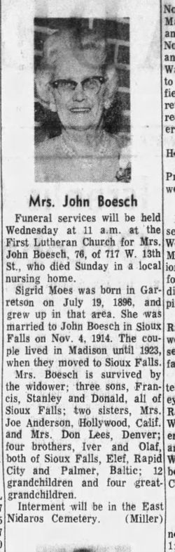
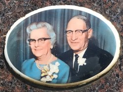
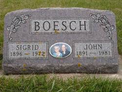
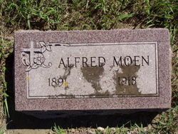
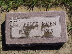
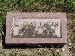
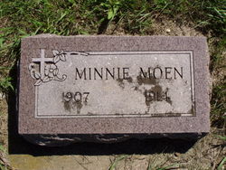
Sigrid Moen Boesch
| Birth | : | 19 Jul 1896 Garretson, Minnehaha County, South Dakota, USA |
| Death | : | 17 Sep 1972 Minnehaha County, South Dakota, USA |
| Burial | : | Port Clyde Cemetery, Port Clyde, Shelburne County, Canada |
| Coordinate | : | 43.5944429, -65.4657523 |
frequently asked questions (FAQ):
-
Where is Sigrid Moen Boesch's memorial?
Sigrid Moen Boesch's memorial is located at: Port Clyde Cemetery, Port Clyde, Shelburne County, Canada.
-
When did Sigrid Moen Boesch death?
Sigrid Moen Boesch death on 17 Sep 1972 in Minnehaha County, South Dakota, USA
-
Where are the coordinates of the Sigrid Moen Boesch's memorial?
Latitude: 43.5944429
Longitude: -65.4657523
Family Members:
Parent

Spouse
Siblings
Children

Flowers:


Nearby Cemetories:
1. Port Clyde Cemetery
Port Clyde, Shelburne County, Canada
Coordinate: 43.5944429, -65.4657523
2. Harbour View Cemetery
Port Saxon, Shelburne County, Canada
Coordinate: 43.5866700, -65.4284730
3. Saint Matthews Cemetery
Clyde River, Shelburne County, Canada
Coordinate: 43.6319900, -65.4779200
4. Hillside Cemetery
Cape Negro, Shelburne County, Canada
Coordinate: 43.5563700, -65.4534960
5. Seaview Cemetery
Cape Negro, Shelburne County, Canada
Coordinate: 43.5540850, -65.4438020
6. Pleasant Plain Cemetery
North West Harbour, Shelburne County, Canada
Coordinate: 43.5496673, -65.3979585
7. Old Kirk Cemetery
North East Point, Shelburne County, Canada
Coordinate: 43.5491240, -65.3982850
8. Parkdale Cemetery
Upper Port La Tour, Shelburne County, Canada
Coordinate: 43.5156570, -65.4655722
9. Ingomar Community Cemetery
Ingomar, Shelburne County, Canada
Coordinate: 43.5730968, -65.3581679
10. Villagedale Cemetery
Villagedale, Shelburne County, Canada
Coordinate: 43.5379720, -65.5476840
11. Barrington River Cemetery
Barrington, Shelburne County, Canada
Coordinate: 43.5667700, -65.5797000
12. Roseway Cemetery
Roseway, Shelburne County, Canada
Coordinate: 43.6239909, -65.3501101
13. River Dale Cemetery
Riverhead, Shelburne County, Canada
Coordinate: 43.5709930, -65.5878290
14. Camp Hill Cemetery
Port La Tour, Shelburne County, Canada
Coordinate: 43.5033050, -65.4845240
15. Ponds Cemetery
Port La Tour, Shelburne County, Canada
Coordinate: 43.4977020, -65.5054660
16. Hillside Cemetery
Barrington, Shelburne County, Canada
Coordinate: 43.5520000, -65.6014667
17. Smithsville Union Cemetery
Smithsville, Shelburne County, Canada
Coordinate: 43.4791670, -65.4738890
18. Forest Hill Cemetery
Barrington Passage, Shelburne County, Canada
Coordinate: 43.5275000, -65.6091670
19. United Baptist Church Cemetery
Barrington Passage, Shelburne County, Canada
Coordinate: 43.5192870, -65.6316240
20. Anglican Cemetery
Churchover, Shelburne County, Canada
Coordinate: 43.7142400, -65.3595400
21. Atlantic Cemetery
Stoney Island, Shelburne County, Canada
Coordinate: 43.4681600, -65.5755600
22. Dall Cemetery
Lower Sandy Point, Shelburne County, Canada
Coordinate: 43.6730720, -65.2881470
23. Centreville Cemetery
Centreville, Shelburne County, Canada
Coordinate: 43.4842510, -65.6117500
24. Mizpah Cemetery
Birchtown, Shelburne County, Canada
Coordinate: 43.7382800, -65.3892000