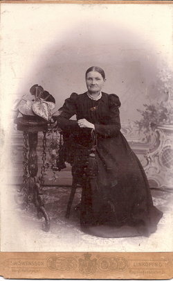
Sophia Danielson Johnson
| Birth | : | 12 Sep 1833 Sweden |
| Death | : | 14 Aug 1882 Sac County, Iowa, USA |
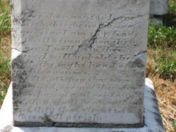
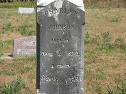
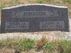
| Burial | : | Rock Creek Cemetery, Meroa, Mitchell County, USA |
| Coordinate | : | 43.2352791, -92.9225006 |
| Plot | : | lot 32 |
| Description | : | Sophia was from the Vardnas Church, near Kogenas Wardnas, Socken Ostergotland, Sweden. She married Charley Johan Johnson in Sweden. She immigrated to America at age 24 and went to Illinois, later they moved to Wall Lake, Iowa. She and Charley had 12 children, seven sons and five daughters (two sets of twins). They lost 2 daughters, Clara at age 5 and Lorena at 11 months old. |
frequently asked questions (FAQ):
-
Where is Sophia Danielson Johnson's memorial?
Sophia Danielson Johnson's memorial is located at: Rock Creek Cemetery, Meroa, Mitchell County, USA.
-
When did Sophia Danielson Johnson death?
Sophia Danielson Johnson death on 14 Aug 1882 in Sac County, Iowa, USA
-
Where are the coordinates of the Sophia Danielson Johnson's memorial?
Latitude: 43.2352791
Longitude: -92.9225006
Family Members:
Spouse
Children
Flowers:
Nearby Cemetories:
1. Rock Creek Cemetery
Meroa, Mitchell County, USA
Coordinate: 43.2352791, -92.9225006
2. West End Cemetery
Meroa, Mitchell County, USA
Coordinate: 43.2216682, -92.9250031
3. Eden Presbyterian Cemetery
Meroa, Mitchell County, USA
Coordinate: 43.2131004, -92.9103012
4. Dudley Cemetery
Dudley (historical), Mitchell County, USA
Coordinate: 43.2252998, -92.8743973
5. Tucker Cemetery
Osage, Mitchell County, USA
Coordinate: 43.2494011, -92.8319016
6. Calvary Cemetery
Osage, Mitchell County, USA
Coordinate: 43.2238998, -92.8300018
7. Oak Grove Cemetery
Mitchell, Mitchell County, USA
Coordinate: 43.3156013, -92.8707962
8. Osage Cemetery
Osage, Mitchell County, USA
Coordinate: 43.2916700, -92.8201700
9. Rudd Evergreen Cemetery
Rudd, Floyd County, USA
Coordinate: 43.1417007, -92.9214020
10. South Osage Mennonite Church Cemetery
Osage, Mitchell County, USA
Coordinate: 43.2544556, -92.7915573
11. Orchard Cemetery
Orchard, Mitchell County, USA
Coordinate: 43.2249985, -92.7838898
12. Spring Grove Cemetery
Nora Springs, Floyd County, USA
Coordinate: 43.1631012, -93.0211029
13. Sacred Heart Cemetery
Osage, Mitchell County, USA
Coordinate: 43.2742004, -92.7917023
14. Saint Johns Lutheran Cemetery
Rock Creek, Mitchell County, USA
Coordinate: 43.3295560, -92.9849770
15. Park Cemetery
Nora Springs, Floyd County, USA
Coordinate: 43.1444016, -92.9982986
16. Riverview Cemetery
Saint Ansgar, Mitchell County, USA
Coordinate: 43.3430328, -92.9220200
17. Saint Johns Lutheran Old Cemetery
Rock Creek, Mitchell County, USA
Coordinate: 43.3313904, -92.9897232
18. Rock Falls Cemetery
Rock Falls, Cerro Gordo County, USA
Coordinate: 43.2122192, -93.0858307
19. Rock Grove Township Cemetery
Nora Springs, Floyd County, USA
Coordinate: 43.1227989, -92.9880981
20. Grafton Cemetery
Grafton, Worth County, USA
Coordinate: 43.3252983, -93.0631027
21. Blakestad Cemetery
Saint Ansgar, Mitchell County, USA
Coordinate: 43.3711014, -92.9400024
22. Immanuel Lutheran Cemetery
Saint Ansgar, Mitchell County, USA
Coordinate: 43.3717003, -92.9257965
23. Emmanuel Lutheran Cemetery
Grafton, Worth County, USA
Coordinate: 43.3300018, -93.0691681
24. Saint Ansgar Cemetery
Saint Ansgar, Mitchell County, USA
Coordinate: 43.3777809, -92.9094391

