
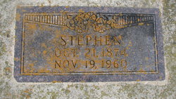
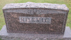
Stephen Emil Rorvig
| Birth | : | 21 Oct 1874 Norway |
| Death | : | 19 Nov 1960 McVille, Nelson County, North Dakota, USA |
| Burial | : | Blessed Virgin Mary Churchyard, Woolavington, Sedgemoor District, England |
| Coordinate | : | 51.1704000, -2.9341000 |
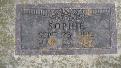
| Description | : | Stephen Emil Rorvig died Saturday evening at the McVille Hospital. He was 86 years old. Funeral services were in Trinity Lutheran Church at Binford Wednesday afternoon. He was born October 21, 1874 in Norway, the son of Peter and Julia Rorvig. He emigrated from Norway with his parents in 1883, going to Polk County, Minnesota. In 1886 the family moved to North Dakota. He married Sophia Smogard September 26, 1904. In September 1954 they celebrated their fiftieth wedding anniversary. She died March 23, 1957. In Binford he was a partner in one of the early general stores. For over thirty... Read More |
frequently asked questions (FAQ):
-
Where is Stephen Emil Rorvig's memorial?
Stephen Emil Rorvig's memorial is located at: Blessed Virgin Mary Churchyard, Woolavington, Sedgemoor District, England.
-
When did Stephen Emil Rorvig death?
Stephen Emil Rorvig death on 19 Nov 1960 in McVille, Nelson County, North Dakota, USA
-
Where are the coordinates of the Stephen Emil Rorvig's memorial?
Latitude: 51.1704000
Longitude: -2.9341000
Family Members:
Parent
Spouse
Siblings
Children
Flowers:


Nearby Cemetories:
1. Blessed Virgin Mary Churchyard
Woolavington, Sedgemoor District, England
Coordinate: 51.1704000, -2.9341000
2. Blessed Virgin Mary Extension Cemetery
Woolavington, Sedgemoor District, England
Coordinate: 51.1705660, -2.9329110
3. St. Mary's Churchyard
Cossington, Sedgemoor District, England
Coordinate: 51.1580085, -2.9213149
4. Saint Michael & All Angels Churchyard
Bawdrip, Sedgemoor District, England
Coordinate: 51.1517260, -2.9429330
5. Saint Michael and All Angels Churchyard
Puriton, Sedgemoor District, England
Coordinate: 51.1706000, -2.9735000
6. St Edwards Churchyard
Chilton Polden, Sedgemoor District, England
Coordinate: 51.1554490, -2.8972091
7. All Saints Churchyard
East Huntspill, Sedgemoor District, England
Coordinate: 51.2015000, -2.9405700
8. St. Francis Churchyard
Stawell, Sedgemoor District, England
Coordinate: 51.1404200, -2.9046660
9. Church of the Blessed Virgin Mary Churchyard
Chedzoy, Sedgemoor District, England
Coordinate: 51.1344600, -2.9429400
10. Saint George Churchyard
Edington, Sedgemoor District, England
Coordinate: 51.1540010, -2.8778350
11. St. John The Baptist Churchyard
Pawlett, Sedgemoor District, England
Coordinate: 51.1789100, -3.0012650
12. St. Philip and St. James Churchyard
Burtle, Sedgemoor District, England
Coordinate: 51.1856232, -2.8665409
13. Sedgemoor Crematorium
Sedgemoor District, England
Coordinate: 51.1909300, -3.0005180
14. Saint Peter Churchyard
Catcott, Sedgemoor District, England
Coordinate: 51.1494920, -2.8671220
15. St. John Bristol Road Cemetery
Bridgwater, Sedgemoor District, England
Coordinate: 51.1391470, -2.9901660
16. Sutton Mallet Churchyard
Sutton Mallet, Sedgemoor District, England
Coordinate: 51.1282540, -2.8974536
17. Pawlett Methodist (Carter Memorial Wesleyan)
Pawlett, Sedgemoor District, England
Coordinate: 51.1845660, -3.0126480
18. Holy Trinity Churchyard
Chilton Trinity, Sedgemoor District, England
Coordinate: 51.1474390, -3.0072360
19. Saint Peter and All Hallows Churchyard
West Huntspill, Sedgemoor District, England
Coordinate: 51.2041900, -2.9966370
20. St John The Baptist Churchyard
Bridgwater, Sedgemoor District, England
Coordinate: 51.1311160, -2.9969910
21. Highbridge Cemetery
Highbridge, Sedgemoor District, England
Coordinate: 51.2249430, -2.9741730
22. Westonzoyland Cemetery New
Westonzoyland, Sedgemoor District, England
Coordinate: 51.1096271, -2.9349336
23. Former Holy Trinity Churchyard
Bridgwater, Sedgemoor District, England
Coordinate: 51.1261850, -3.0021850
24. St. Mary's Churchyard
Bridgwater, Sedgemoor District, England
Coordinate: 51.1277430, -3.0050330