
| Birth | : | 8 Jul 1908 Red Lodge, Carbon County, Montana, USA |
| Death | : | 6 Nov 1969 Osmond, Pierce County, Nebraska, USA |
| Burial | : | Bath Abbey Cemetery, Widcombe, Bath and North East Somerset Unitary Authority, England |
| Coordinate | : | 51.3712850, -2.3483060 |
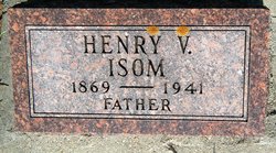
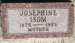
| Description | : | Stirl H. Isom, 61, passed away Thursday morning at the Osmond General Hospital after a lingering illness. Funeral services were held Saturay, November 8, at the First United Methodist church. Rev. Harold Onwiler officiating. Mrs. Neil Lackas, organist, accmpanied Jana Buchanan and Mrs. Otis Gartner. Internment was in the Hillcrest cemetery at Norfolk under the direction of Johnson Funeral Home. Pallbearers wer Dwayne Granfield, Roley Isom, Marvin Isom, Charley Junck, Harold Burns, Donald Coulter. Stirl Hardy, son of Henry (Vic) and Josie Barnes Isom was born at Red Lodge, Mont. July 8, 1906. He came to the Randolph vicinity... Read More |
frequently asked questions (FAQ):
-
Where is Stirling Hardy Isom's memorial?
Stirling Hardy Isom's memorial is located at: Bath Abbey Cemetery, Widcombe, Bath and North East Somerset Unitary Authority, England.
-
When did Stirling Hardy Isom death?
Stirling Hardy Isom death on 6 Nov 1969 in Osmond, Pierce County, Nebraska, USA
-
Where are the coordinates of the Stirling Hardy Isom's memorial?
Latitude: 51.3712850
Longitude: -2.3483060
Family Members:
Parent
Spouse

Siblings
Children
Flowers:


Nearby Cemetories:
1. Bath Abbey Cemetery
Widcombe, Bath and North East Somerset Unitary Authority, England
Coordinate: 51.3712850, -2.3483060
2. St John the Evangelist Cemetery
Bath, Bath and North East Somerset Unitary Authority, England
Coordinate: 51.3696700, -2.3487400
3. St Thomas à Becket's Church
Widcombe, Bath and North East Somerset Unitary Authority, England
Coordinate: 51.3734250, -2.3465560
4. Quaker Burial Ground
Widcombe, Bath and North East Somerset Unitary Authority, England
Coordinate: 51.3744350, -2.3498460
5. Unitarian Chapel Burial Ground
Widcombe, Bath and North East Somerset Unitary Authority, England
Coordinate: 51.3704650, -2.3539270
6. Smallcombe Vale Cemetery
Bathwick, Bath and North East Somerset Unitary Authority, England
Coordinate: 51.3757400, -2.3429400
7. Abbey & St James' Graveyard for the Poor
Widcombe, Bath and North East Somerset Unitary Authority, England
Coordinate: 51.3753550, -2.3545640
8. Old Baptist Burial Ground
Walcot, Bath and North East Somerset Unitary Authority, England
Coordinate: 51.3755070, -2.3544360
9. St. Mary The Virgin Churchyard
Bathwick, Bath and North East Somerset Unitary Authority, England
Coordinate: 51.3759930, -2.3411930
10. Baptist Burial Ground
Widcombe, Bath and North East Somerset Unitary Authority, England
Coordinate: 51.3764216, -2.3556947
11. Prior Park College
Bath, Bath and North East Somerset Unitary Authority, England
Coordinate: 51.3645990, -2.3442400
12. Saint Mark's Churchyard
Widcombe, Bath and North East Somerset Unitary Authority, England
Coordinate: 51.3766660, -2.3588010
13. Old Orchard Street Catholic Burial Vault
Bath, Bath and North East Somerset Unitary Authority, England
Coordinate: 51.3800370, -2.3579910
14. St Mary Magdalen Chapel
Widcombe, Bath and North East Somerset Unitary Authority, England
Coordinate: 51.3760486, -2.3643405
15. St James Old Burial Ground
Bath, Bath and North East Somerset Unitary Authority, England
Coordinate: 51.3798600, -2.3610100
16. Jewish Burial Ground
Combe Down, Bath and North East Somerset Unitary Authority, England
Coordinate: 51.3599170, -2.3534670
17. Union Chapel
Combe Down, Bath and North East Somerset Unitary Authority, England
Coordinate: 51.3594751, -2.3443662
18. Bath Abbey
Bath, Bath and North East Somerset Unitary Authority, England
Coordinate: 51.3815310, -2.3586640
19. St. Mary de Stall Churchyard (Defunct)
Bath, Bath and North East Somerset Unitary Authority, England
Coordinate: 51.3813350, -2.3600353
20. Quaker Meeting House
Bath, Bath and North East Somerset Unitary Authority, England
Coordinate: 51.3823280, -2.3604380
21. Bath General Hospital Burial Ground
Bath and North East Somerset Unitary Authority, England
Coordinate: 51.3824715, -2.3614742
22. Ss Michael & Paul Churchyard
Bath, Bath and North East Somerset Unitary Authority, England
Coordinate: 51.3834970, -2.3596980
23. St. Michael's Burial Ground
Bath, Bath and North East Somerset Unitary Authority, England
Coordinate: 51.3838810, -2.3594090
24. St Mary's Chapel, Queens Square
Bath, Bath and North East Somerset Unitary Authority, England
Coordinate: 51.3827790, -2.3649790