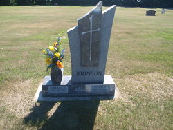
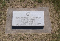
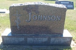
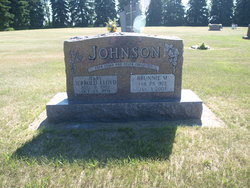
Stuart K. Johnson
| Birth | : | 26 Nov 1930 Kenmare, Ward County, North Dakota, USA |
| Death | : | 4 Apr 2003 Minot, Ward County, North Dakota, USA |
| Burial | : | St Paul Churchyard, Walkden, Metropolitan Borough of Salford, England |
| Coordinate | : | 53.5231133, -2.3947620 |
| Description | : | Stuart K. Johnson, 72, 5715 97th St. NW, Kenmare, died Friday, April 04, 2003 in a Minot hospital. Stuart was born on November 26, 1930 in Kenmare, ND, to Johannes and Ida (Edwardsen) Johnson. He was raised and educated near his parents' farm in Rockford Township, Norma, ND. Following his education, he helped on the farm and worked for several years at the Farmers Union in Tolley and Flaxton, ND. He also worked for a time for Allen Chevrolet in Mohall, ND. He married Lorraine Jessen in Kenmare on November 26, 1950. They moved to Coos Bay, OR, and lived and... Read More |
frequently asked questions (FAQ):
-
Where is Stuart K. Johnson's memorial?
Stuart K. Johnson's memorial is located at: St Paul Churchyard, Walkden, Metropolitan Borough of Salford, England.
-
When did Stuart K. Johnson death?
Stuart K. Johnson death on 4 Apr 2003 in Minot, Ward County, North Dakota, USA
-
Where are the coordinates of the Stuart K. Johnson's memorial?
Latitude: 53.5231133
Longitude: -2.3947620
Family Members:
Parent
Spouse
Siblings
Children
Flowers:
Nearby Cemetories:
1. St Paul Churchyard
Walkden, Metropolitan Borough of Salford, England
Coordinate: 53.5231133, -2.3947620
2. Woodland Cemetery
Worsley, Metropolitan Borough of Salford, England
Coordinate: 53.5125570, -2.4198280
3. St Mary's Catholic Cemetery
Wardley, Metropolitan Borough of Salford, England
Coordinate: 53.5163700, -2.3645900
4. St. Paul's Churchyard
Little Hulton, Metropolitan Borough of Salford, England
Coordinate: 53.5309270, -2.4260100
5. St Stephen churchyard
Kearsley, Metropolitan Borough of Bolton, England
Coordinate: 53.5381650, -2.3717160
6. Kearsley New Church Burial Ground
Farnworth, Metropolitan Borough of Bolton, England
Coordinate: 53.5435500, -2.3879200
7. New Jerusalem Church Churchyard
Kearsley, Metropolitan Borough of Bolton, England
Coordinate: 53.5435770, -2.3877380
8. St James Churchyard
Farnworth, Metropolitan Borough of Bolton, England
Coordinate: 53.5423730, -2.4117570
9. St Mark Churchyard
Worsley, Metropolitan Borough of Salford, England
Coordinate: 53.5024361, -2.3833430
10. Market Street Congregational Churchyard
Farnworth, Metropolitan Borough of Bolton, England
Coordinate: 53.5475620, -2.3911703
11. St John the Evangelist Churchyard
Farnworth, Metropolitan Borough of Bolton, England
Coordinate: 53.5491930, -2.4043350
12. Swinton Cemetery
Swinton, Metropolitan Borough of Salford, England
Coordinate: 53.5183372, -2.3457739
13. St Saviour churchyard
Ringley, Metropolitan Borough of Bolton, England
Coordinate: 53.5439030, -2.3576830
14. Farnworth Cemetery
Farnworth, Metropolitan Borough of Bolton, England
Coordinate: 53.5548590, -2.3843000
15. Tyldesley Cemetery
Tyldesley, Metropolitan Borough of Wigan, England
Coordinate: 53.5115190, -2.4462820
16. St Anne Churchyard
Clifton, Metropolitan Borough of Salford, England
Coordinate: 53.5277070, -2.3391650
17. St. Peter's Churchyard
Swinton, Metropolitan Borough of Salford, England
Coordinate: 53.5119130, -2.3413860
18. St. Paul's Wesleyan Methodist Churchyard
Swinton, Metropolitan Borough of Salford, England
Coordinate: 53.5133900, -2.3397500
19. St. Michael Churchyard
Great Lever, Metropolitan Borough of Bolton, England
Coordinate: 53.5603730, -2.4082370
20. Christ Church Churchyard
Little Lever, Metropolitan Borough of Bolton, England
Coordinate: 53.5598101, -2.3692188
21. St. Matthew Churchyard
Little Lever, Metropolitan Borough of Bolton, England
Coordinate: 53.5626144, -2.3732190
22. King's Church Chapelyard
Little Lever, Metropolitan Borough of Bolton, England
Coordinate: 53.5625122, -2.3716833
23. St. Stephen Church
Astley, Metropolitan Borough of Wigan, England
Coordinate: 53.5016780, -2.4579610
24. Saint Augustine's Churchyard
Pendlebury, Metropolitan Borough of Salford, England
Coordinate: 53.5107070, -2.3223960

