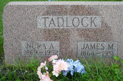
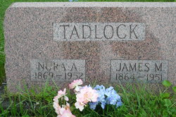
Susan Ann Norah Miller Tadlock
| Birth | : | 21 Oct 1869 Van Buren County, Iowa, USA |
| Death | : | 24 Oct 1952 Lancaster, Schuyler County, Missouri, USA |
| Burial | : | McIntyre Cemetery, Monroe, Monroe County, USA |
| Coordinate | : | 41.9900017, -83.4569016 |
| Description | : | widowed, daughter of Luke Miller and unknown Webster, wife of James M. Tadlock d. cert 37346 Susan appears to have been the daughter of Susan (Webster) Miller who died in 1869 at the age of 22. She was subsequently raised by her grandparents. U.S. Federal Census Mortality Schedules, 1850-1885 Name: Susan Miller Gender: Female Race: White Marital status: Married Estimated birth year: abt 1847 Birth Place: Missouri Age: 22 Death Date: Dec 1869 Cause of Death: Typhoid Fever Census Year: 1870 Census Place: Chequest, Van Buren, Iowa Line: 5 ------------ 1870 Iowa census, Van Buren... Read More |
frequently asked questions (FAQ):
-
Where is Susan Ann Norah Miller Tadlock's memorial?
Susan Ann Norah Miller Tadlock's memorial is located at: McIntyre Cemetery, Monroe, Monroe County, USA.
-
When did Susan Ann Norah Miller Tadlock death?
Susan Ann Norah Miller Tadlock death on 24 Oct 1952 in Lancaster, Schuyler County, Missouri, USA
-
Where are the coordinates of the Susan Ann Norah Miller Tadlock's memorial?
Latitude: 41.9900017
Longitude: -83.4569016
Family Members:
Parent
Spouse
Children
Flowers:
Nearby Cemetories:
1. McIntyre Cemetery
Monroe, Monroe County, USA
Coordinate: 41.9900017, -83.4569016
2. Holy Ghost Evangelical Lutheran Cemetery
Raisinville Township, Monroe County, USA
Coordinate: 41.9916077, -83.4294968
3. Gethsemane Cemetery
Monroe, Monroe County, USA
Coordinate: 41.9925650, -83.4274120
4. Saint Patricks Cemetery
Carleton, Monroe County, USA
Coordinate: 42.0224991, -83.4188995
5. Saint Patricks Cemetery #2
Carleton, Monroe County, USA
Coordinate: 42.0226620, -83.4190390
6. Saint Patricks Cemetery #1
Carleton, Monroe County, USA
Coordinate: 42.0252360, -83.4197690
7. Saint Joseph Cemetery
Maybee, Monroe County, USA
Coordinate: 42.0088997, -83.5121994
8. Northside Cemetery
Maybee, Monroe County, USA
Coordinate: 42.0093994, -83.5132980
9. Calkins Cemetery
Frenchtown Township, Monroe County, USA
Coordinate: 41.9972700, -83.3907800
10. Saint Pauls Cemetery
Maybee, Monroe County, USA
Coordinate: 42.0066986, -83.5338974
11. Doty Cemetery
Monroe, Monroe County, USA
Coordinate: 41.9538994, -83.5252991
12. King Cemetery
Monroe, Monroe County, USA
Coordinate: 41.9411011, -83.5100021
13. Saint Antoine Cemetery
Monroe, Monroe County, USA
Coordinate: 41.9263800, -83.4304550
14. Grafton Cemetery
Grafton, Monroe County, USA
Coordinate: 42.0341988, -83.3869019
15. Potters Field Cemetery
Monroe, Monroe County, USA
Coordinate: 41.9180500, -83.4711100
16. Sandy Hill Cemetery
Scofield, Monroe County, USA
Coordinate: 42.0525017, -83.5089035
17. Saint Joseph Cemetery
Monroe, Monroe County, USA
Coordinate: 41.9289017, -83.3921967
18. Saint Joseph Cemetery
London, Monroe County, USA
Coordinate: 42.0286111, -83.5502778
19. Old Burial Ground
Monroe, Monroe County, USA
Coordinate: 41.9259370, -83.3927540
20. Immaculate Heart of Mary Cemetery
Monroe, Monroe County, USA
Coordinate: 41.9206090, -83.4036330
21. Rath Cemetery
Grape, Monroe County, USA
Coordinate: 41.9558460, -83.5543990
22. Saint Matthews Cemetery
Monroe, Monroe County, USA
Coordinate: 41.9551220, -83.5550310
23. Old Immanuel Lutheran Cemetery
Raisinville Township, Monroe County, USA
Coordinate: 41.9116550, -83.5015280
24. Memorial Place Cemetery
Monroe, Monroe County, USA
Coordinate: 41.9108370, -83.4025760

