
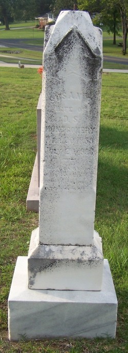
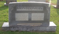
Susan E “Susie” Laney Montgomery
| Birth | : | 20 Mar 1859 |
| Death | : | 20 Jul 1906 |
| Burial | : | Maryvale Homestead Cemetery, Warwick, Southern Downs Region, Australia |
| Coordinate | : | -28.0669430, 152.2405230 |
| Inscription | : | Wife of D.S. Montgomery |
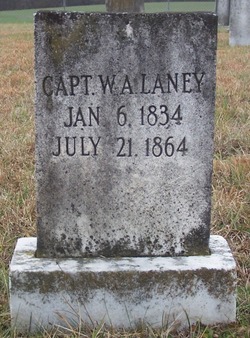
| Description | : | Mrs. Susan Montgomery, wife of Mr. D. S. Montgomery of Buford township, died on the 19th inst. of dropsy of the heart, after an illness of about two weeks. She was 47 years old and a most devoted member of the Methodist church. She was a good woman. Mrs. Montgomery was a daughter of the late Capt. William Laney. She leaves two brothers, Messrs. Robert and John Laney, and three sisters, Mesdames W. A. Eubanks and A. W. Funderburk and Miss Lula Laney. The Monroe Journal Monroe, NC Tuesday, July 31, 1906 Page 3 |
frequently asked questions (FAQ):
-
Where is Susan E “Susie” Laney Montgomery's memorial?
Susan E “Susie” Laney Montgomery's memorial is located at: Maryvale Homestead Cemetery, Warwick, Southern Downs Region, Australia.
-
When did Susan E “Susie” Laney Montgomery death?
Susan E “Susie” Laney Montgomery death on 20 Jul 1906 in
-
Where are the coordinates of the Susan E “Susie” Laney Montgomery's memorial?
Latitude: -28.0669430
Longitude: 152.2405230
Family Members:
Parent
Spouse
Siblings

Children
Flowers:


Nearby Cemetories:
1. Maryvale Homestead Cemetery
Warwick, Southern Downs Region, Australia
Coordinate: -28.0669430, 152.2405230
2. Maryvale Cemetery
Maryvale, Southern Downs Region, Australia
Coordinate: -28.0607800, 152.2474610
3. Yangan Presbyterian Church Cemetery
Yangan, Southern Downs Region, Australia
Coordinate: -28.1972310, 152.2142130
4. Yangan General and Anglican Cemetery
Emu Vale, Southern Downs Region, Australia
Coordinate: -28.2059990, 152.2207110
5. Swan Creek Anglican Cemetery
Swan Creek, Southern Downs Region, Australia
Coordinate: -28.1974400, 152.1364830
6. Spicers Gap
Boonah, Scenic Rim Region, Australia
Coordinate: -28.0733318, 152.4255524
7. Glengallan Station
Warwick, Southern Downs Region, Australia
Coordinate: -28.1027016, 152.0585067
8. Warwick-Conway Family Homestead Cemetery
Warwick, Southern Downs Region, Australia
Coordinate: -28.1258400, 152.0395700
9. St Marks Anglican Church Columbarium Wall
Warwick, Southern Downs Region, Australia
Coordinate: -28.2161000, 152.0347600
10. Allora Cemetery
Allora, Southern Downs Region, Australia
Coordinate: -28.0199230, 151.9750720
11. Warwick General Cemetery
Warwick, Southern Downs Region, Australia
Coordinate: -28.2100890, 152.0044080
12. Warwick War Cemetery
Warwick, Southern Downs Region, Australia
Coordinate: -28.2089620, 152.0033530
13. Warwick General Lawn Cemetery
Warwick, Southern Downs Region, Australia
Coordinate: -28.2106310, 152.0039087
14. Eden Gardens Memorial Park
Warwick, Southern Downs Region, Australia
Coordinate: -28.2229690, 152.0031130
15. Headington Hill Lutheran Cemetery
Allora, Southern Downs Region, Australia
Coordinate: -27.9037210, 152.0020290
16. Aratula Lutheran Cemetery
Aratula, Scenic Rim Region, Australia
Coordinate: -27.9813240, 152.5425210
17. Lone Grave Warwick
Warwick, Southern Downs Region, Australia
Coordinate: -28.2316590, 151.9833180
18. Killarney Lawn Cemetery
Killarney, Southern Downs Region, Australia
Coordinate: -28.3475760, 152.2742790
19. Rosevale Lutheran Cemetery
Rosevale, Scenic Rim Region, Australia
Coordinate: -27.8644230, 152.4758150
20. Old Kerwitz Property
Rosevale, Scenic Rim Region, Australia
Coordinate: -27.8641190, 152.4761580
21. Rosevale Church of Christ Cemetery
Rosevale, Scenic Rim Region, Australia
Coordinate: -27.8708920, 152.4900461
22. Mount Alford Church Cemetery
Mount Alford, Scenic Rim Region, Australia
Coordinate: -28.0656790, 152.5952250
23. Clifton General Cemetery
Clifton, Toowoomba Region, Australia
Coordinate: -27.9389150, 151.9120790
24. Fassifern Pioneer Cemetery
Fassifern Valley, Scenic Rim Region, Australia
Coordinate: -27.9568800, 152.5816230