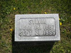
Sylvia Esther Badgley Fisher
| Birth | : | 14 Jul 1887 Douds, Van Buren County, Iowa, USA |
| Death | : | 2 Sep 1955 Keosauqua, Van Buren County, Iowa, USA |
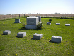
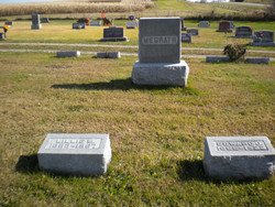
| Burial | : | Coral Cemetery, Coral, Montcalm County, USA |
| Coordinate | : | 43.3671989, -85.4060974 |
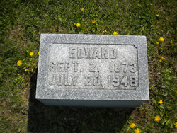
| Description | : | Sylvia Esther Fisher, daughter of William and Mary Badgley, was born on a farm near Douds, Ia., July 14,1887 and departed this life on Sept. 2,1955 at 3:30 a.m. at the Van Buren county hospital in Keosauqua at the age of 68 years, after an illness of two days. She spent her entire life in Van Buren county. She was united in marriage to Edward C. Fisher on Sept. 22,1909. To this union two sons was born, Charles W. of Chenoa, Ill. and Lawrence B. at home. Shortly after her marriage she became a member of the Lebanon Presbyterian church.... Read More |
frequently asked questions (FAQ):
-
Where is Sylvia Esther Badgley Fisher's memorial?
Sylvia Esther Badgley Fisher's memorial is located at: Coral Cemetery, Coral, Montcalm County, USA.
-
When did Sylvia Esther Badgley Fisher death?
Sylvia Esther Badgley Fisher death on 2 Sep 1955 in Keosauqua, Van Buren County, Iowa, USA
-
Where are the coordinates of the Sylvia Esther Badgley Fisher's memorial?
Latitude: 43.3671989
Longitude: -85.4060974
Family Members:
Parent
Spouse
Siblings
Children
Flowers:
Nearby Cemetories:
1. Coral Cemetery
Coral, Montcalm County, USA
Coordinate: 43.3671989, -85.4060974
2. Coady Cemetery
Maple Valley Township, Montcalm County, USA
Coordinate: 43.3540520, -85.3825890
3. Maple Valley Cemetery
Maple Valley Township, Montcalm County, USA
Coordinate: 43.3358002, -85.3724976
4. West Pine Cemetery
Coral, Montcalm County, USA
Coordinate: 43.3669014, -85.3227997
5. Trufant Cemetery
Maple Valley Township, Montcalm County, USA
Coordinate: 43.3083000, -85.3653030
6. Reynolds Township Cemetery
Howard City, Montcalm County, USA
Coordinate: 43.4101300, -85.4767100
7. Amble Cemetery
Amble, Montcalm County, USA
Coordinate: 43.4352989, -85.4024963
8. Pierson Township Cemetery
Pierson, Montcalm County, USA
Coordinate: 43.3381004, -85.5006027
9. Dickerson-Whitsell Cemetery
Lakeview, Montcalm County, USA
Coordinate: 43.4533005, -85.3227997
10. Boyd Cemetery
Morley, Mecosta County, USA
Coordinate: 43.4796982, -85.3818970
11. Saint Mary's Cemetery
Sand Lake, Kent County, USA
Coordinate: 43.2717018, -85.4969025
12. Sand Lake Cemetery
Sand Lake, Kent County, USA
Coordinate: 43.2861480, -85.5313380
13. Saint Apollonia Cemetery
Morley, Mecosta County, USA
Coordinate: 43.4907990, -85.4278030
14. Lakeview Cemetery
Lakeview, Montcalm County, USA
Coordinate: 43.4467010, -85.2739029
15. Bouton Family Farm Burial Site
Reynolds Township, Montcalm County, USA
Coordinate: 43.4294960, -85.5555570
16. Little Denmark Cemetery
Gowen, Montcalm County, USA
Coordinate: 43.2677994, -85.3013992
17. Cato Cemetery
Lakeview, Montcalm County, USA
Coordinate: 43.4171982, -85.2472000
18. Aetna Township Cemetery
Morley, Mecosta County, USA
Coordinate: 43.4906006, -85.4597015
19. Riverside Cemetery
Langston, Montcalm County, USA
Coordinate: 43.3136400, -85.2400300
20. North Ensley Cemetery
Ensley Center, Newaygo County, USA
Coordinate: 43.3671989, -85.5935974
21. East Nelson Cemetery
Cedar Springs, Kent County, USA
Coordinate: 43.2355995, -85.4561005
22. Rustford Cemetery
Morley, Mecosta County, USA
Coordinate: 43.4972916, -85.3432999
23. Saint Johns Catholic Cemetery
Ensley Center, Newaygo County, USA
Coordinate: 43.3664017, -85.5969009
24. Amish Greenville Church District Cemetery
Stanton, Montcalm County, USA
Coordinate: 43.3060570, -85.2311130


